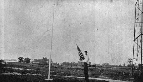
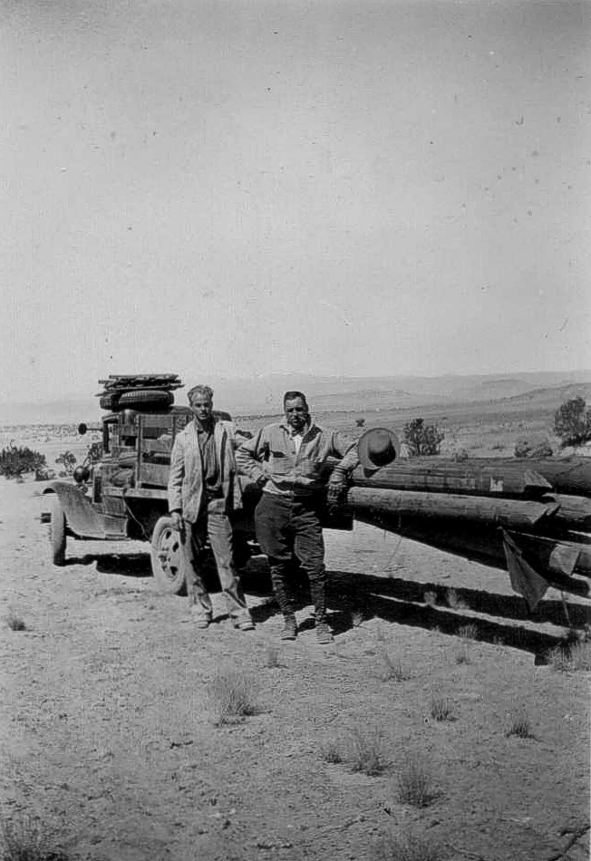
Photo submitted by Brian Fortier
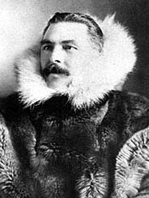
Gordon Bettles, Bettles, Alaska
Gordon Bettles built the store at Bettles Village in the 1890’s and brought supplies up the Koyukuk River to supply the gold rush miners.
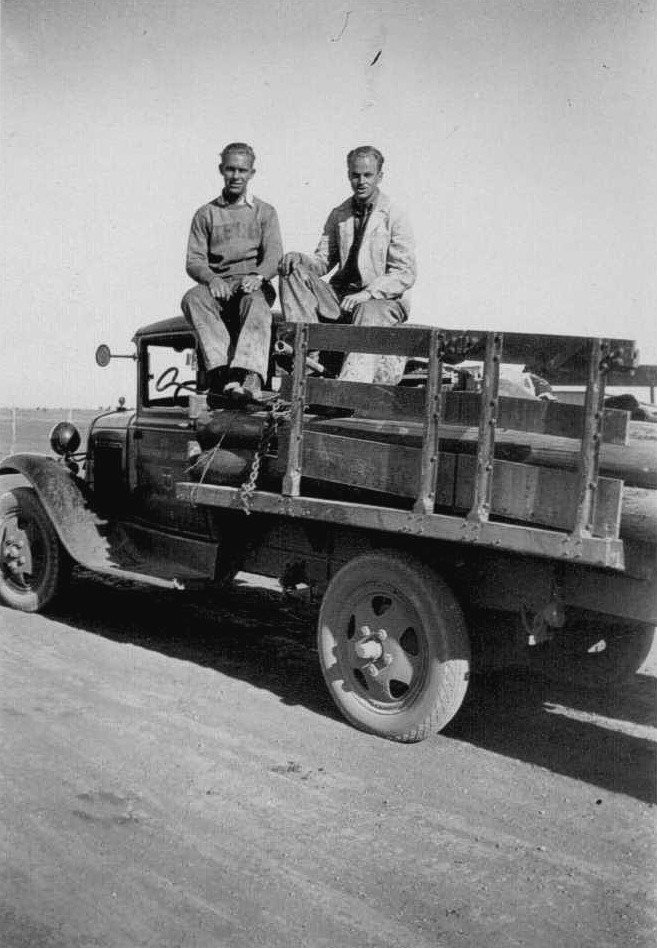
Photo submitted by Brian Fortier
Gordon Bettles, Bettles, Alaska
Gordon Bettles built the store at Bettles Village in the 1890’s and brought supplies up the Koyukuk River to supply the gold rush miners.
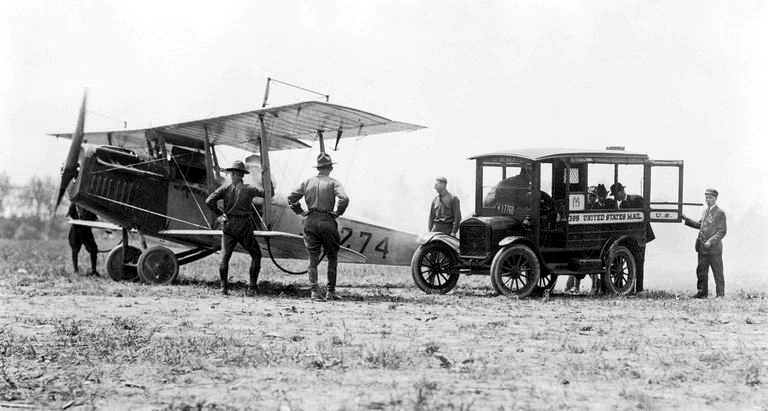
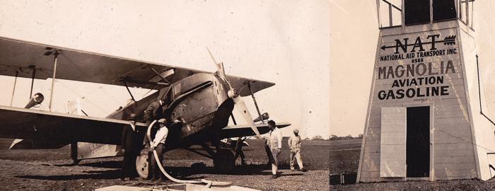
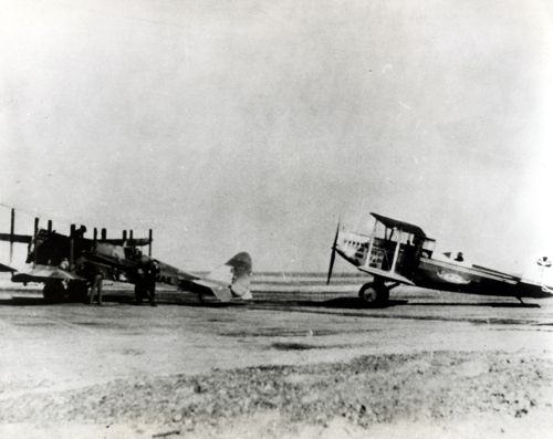
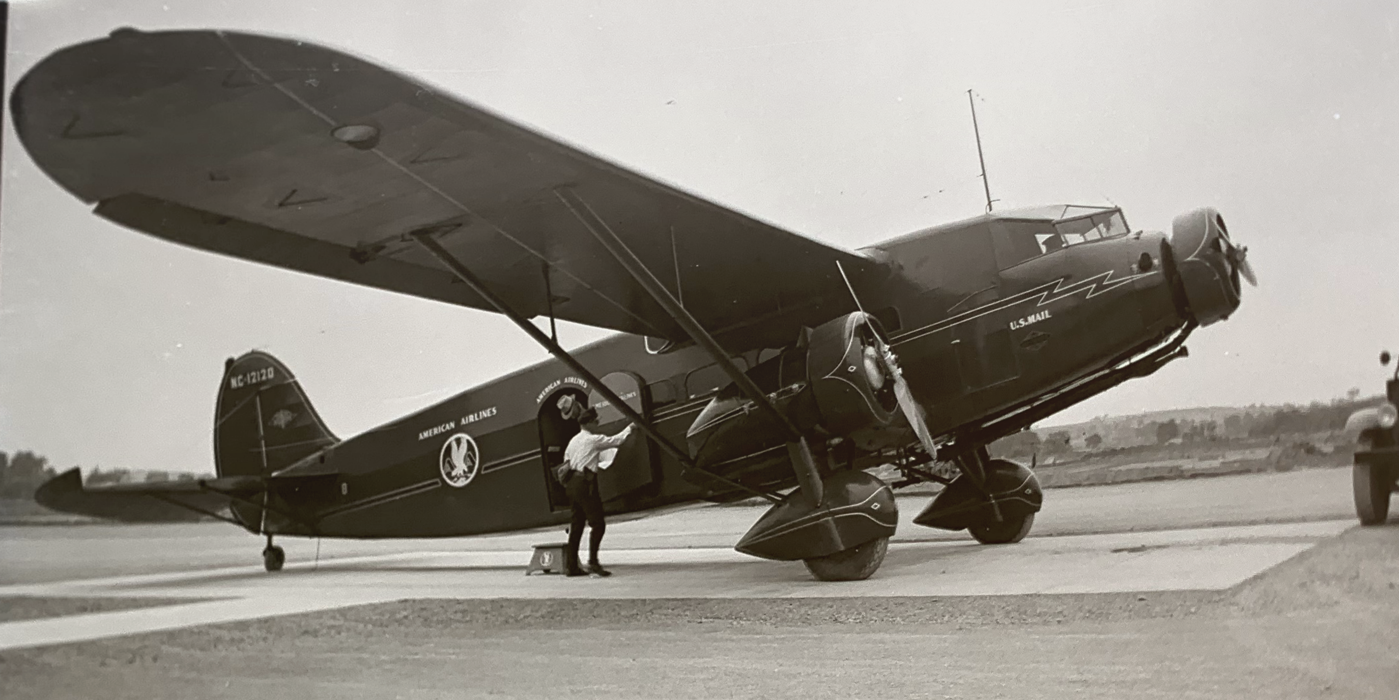
Philadelphia (PHL), Pennsylvania, 1918
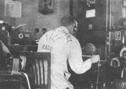
Mail being transferred in Philadelphia, Pennsylvania to a New York bound plane.
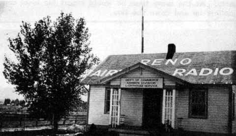
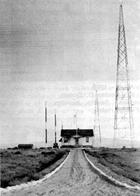
Reno Airway Radio Station (KDEK-KLK), Nevada, 1920
Former employees stationed at Reno Radio:
Lucian D. Coman
Lindsay
Cordano
Beedle
Jennings
Breniman
Fielder
Hulen
The facility was decommissioned April 3, 2007.
![]()
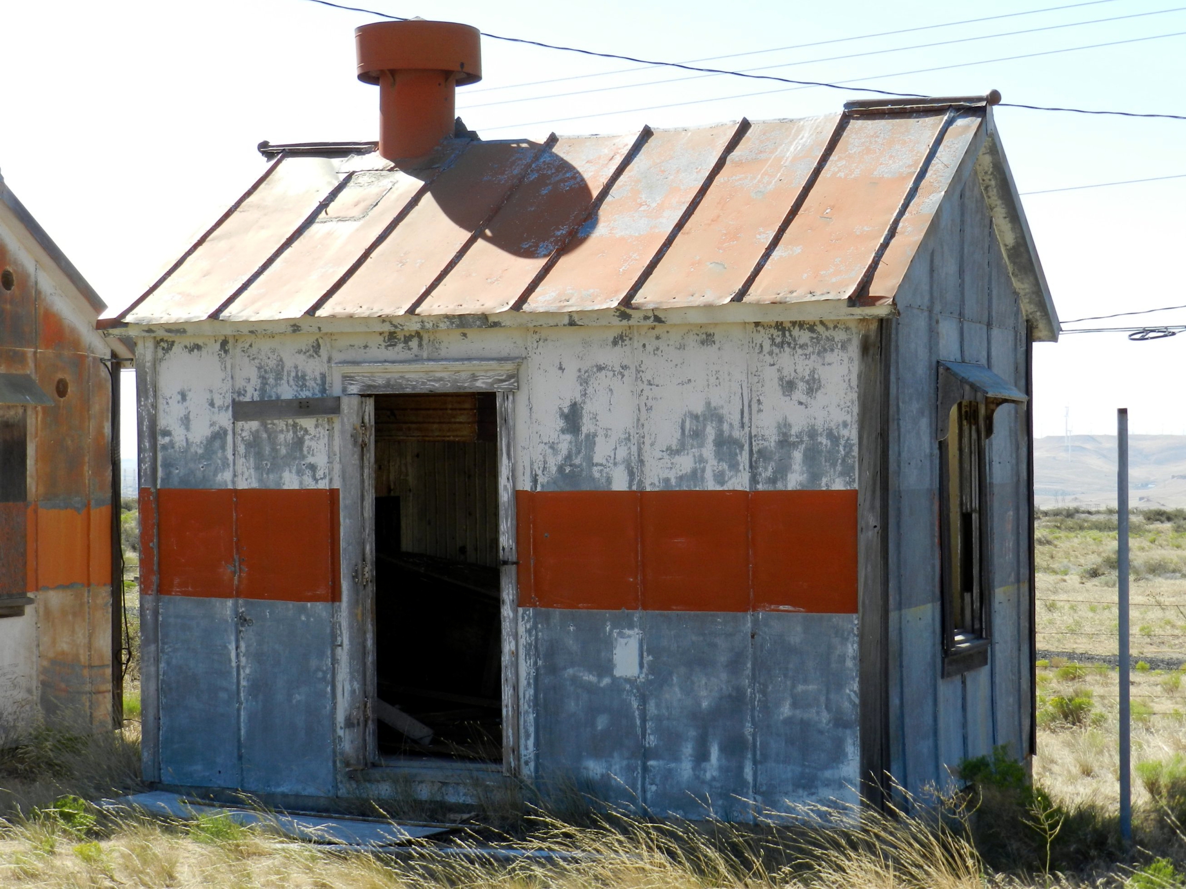
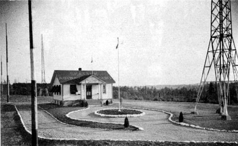
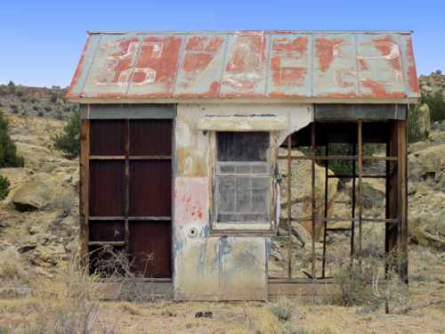
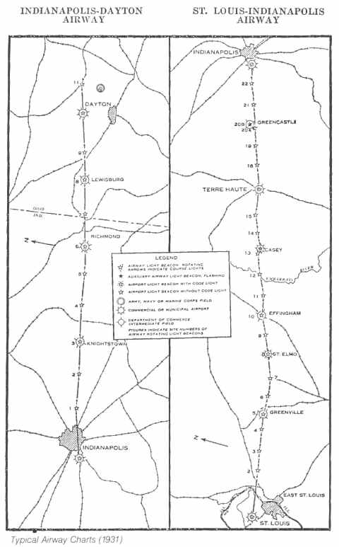
Cassoday Airway Beacon Site, #41, Kansas
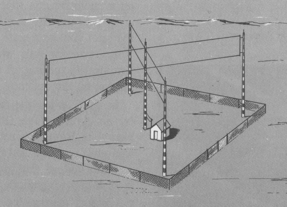
An aeronautical bulletin was published about the Cassoday airfield which identified it as Site #41 along the airway. The bulletin further detailed the field as being operated by the Department of Commerce & having 2 grass runways in an ‘L’ formation, 2,600 feet long (see airport diagram).
In the northwest corner of the airfield was a 2-million candlepower 24 inch rotating beacon, which rotated at 6 RPM. The newly-built field had few amenities (no fuel, repairs, or telegraph) but did have nighttime lights around the boundary of the airfield.
By 1931, the starting point of the airway had been changed from Dallas to Amarillo, and this resulted in a renumbering of the airfields & beacons. Cassoday was changed from Site #41 to Site #34 and, according to the 1931 Bulletin #2 this beacon site was upgraded to a Flight Service Station (FSS), commissioned February 1931, and included course lights and a weather teletype.
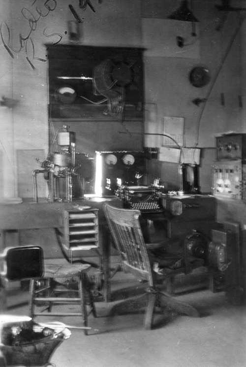
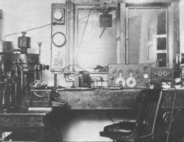
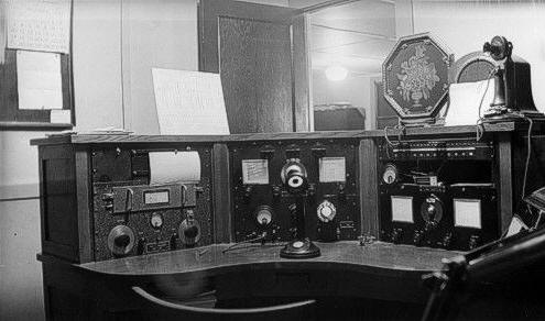
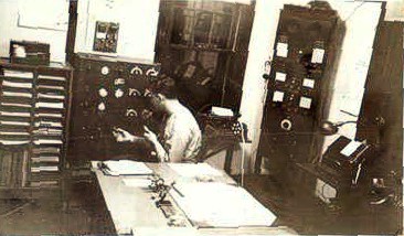
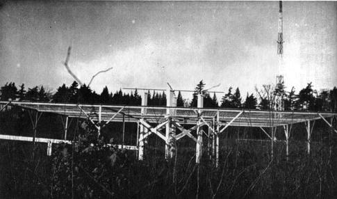
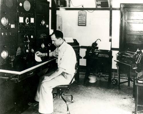
Rock Springs FSS (RKS), Wyoming, 1920’s
Interior photo of Rock Springs Radio.
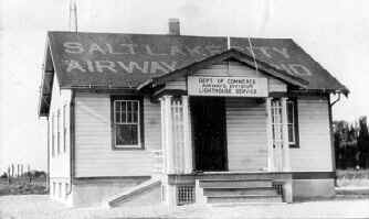
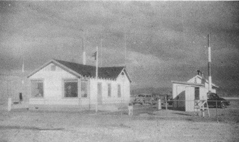
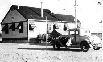
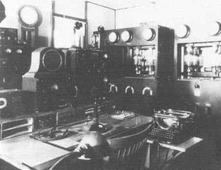
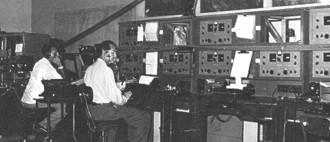
Salt Lake City Air Mail Radio Station (SLC), Utah, 1920
______________
 Salt Lake City Air Mail Radio Station (KSWH-KGO), Utah, October 1920
Former employees stationed at Salt Lake City Radio:
Art Johnson
Phil Coupland
Dan Cordano
J. Petrison
Ralp Baker
William C. Hill,
Art Fielder
Ray Tripp
Submitted by Steve Wolff
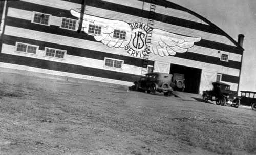
Rock Springs FSS (RKS), Wyoming, 1920’s
Rock Springs US Air Mail Hanger
Submitted by Steve Wolff
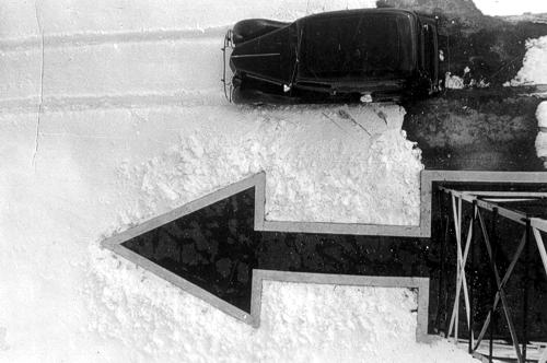
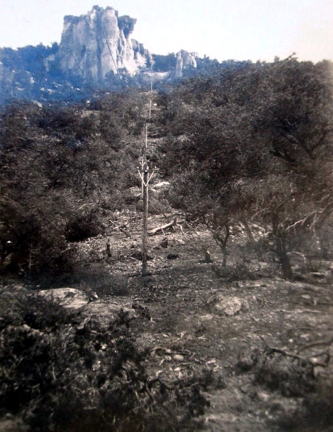
Day marker, location possibly in Wyoming? Year unknown.
![]() Historical summary and photo submitted by Mel Duncan of Wyoming
Historical summary and photo submitted by Mel Duncan of Wyoming
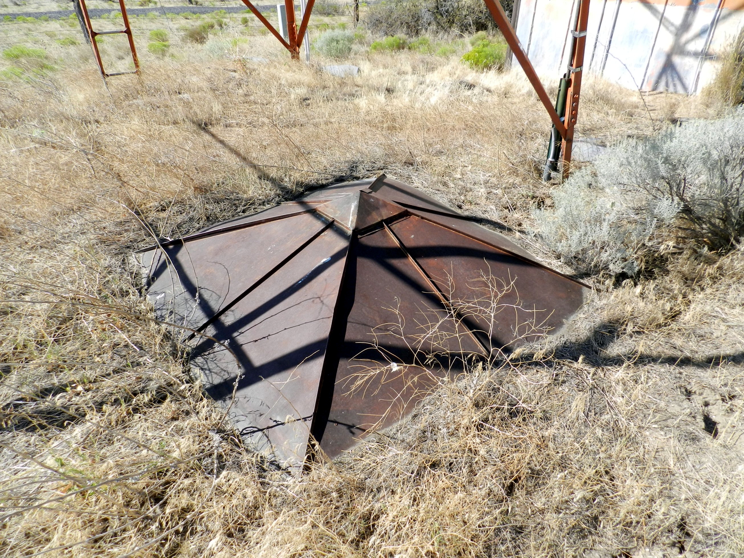
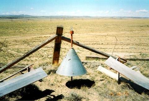
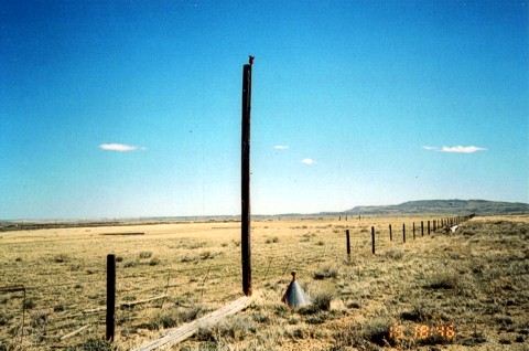
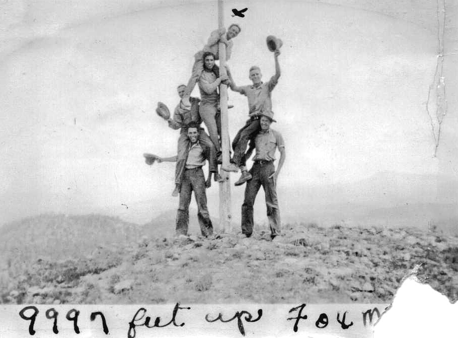
A concrete arrow is all that remains of the old Section 33 beacon site. This site is located about 3/4 mile north of McIntyre’s, WY. Elevation 7,528 feet, coordinates 41° 13″ 34″ N, 105° 14′ 36″ W.
![]() Submitted by Mel Duncan of Wyoming
Submitted by Mel Duncan of Wyoming
![]() Submitted by Mel Duncan of Wyoming
Submitted by Mel Duncan of Wyoming
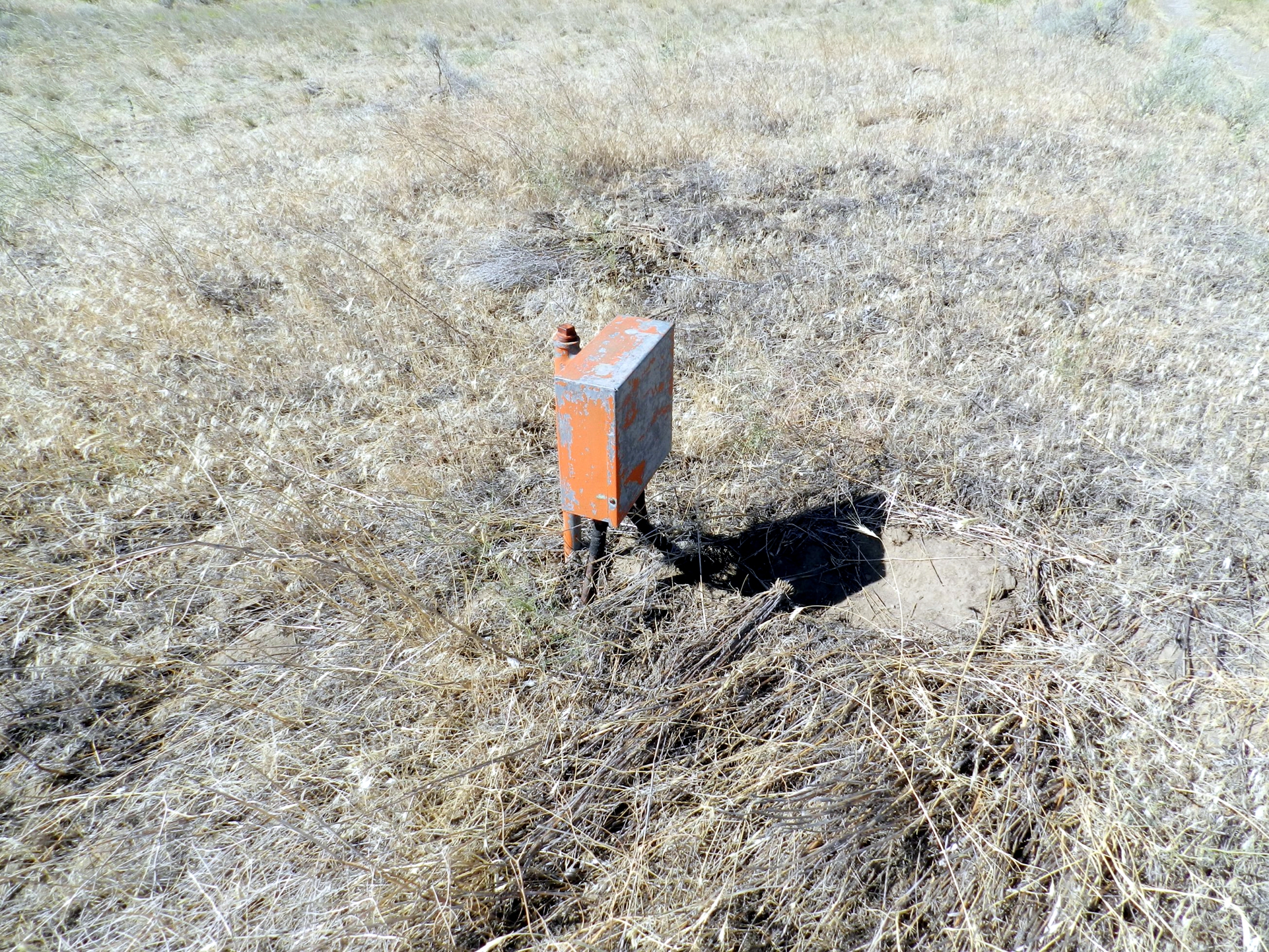
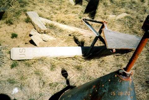
Some old parts found at the site
![]() Submitted by Mel Duncan of Wyoming
Submitted by Mel Duncan of Wyoming
![]() Submitted by Mel Duncan of Wyoming
Submitted by Mel Duncan of Wyoming
![]() Submitted by Mel Duncan of Wyoming
Submitted by Mel Duncan of Wyoming
![]()
Photo submitted by Mick Batt
This concrete arrow is located in Washington City (St. George) on top of the 3,300 foot Shinob Kibe Plateau (37° 7’2.76″N 113°29’15.91″W). Contract Air Mail Route (CAM) #4 Los Angeles, California to Salt Lake City, Utah. Looking WSW.
![]()
Photo submitted by Mick Batt
Looking ENE. There is no arrow on the west end.
![]()
Submitted by Carl Schott
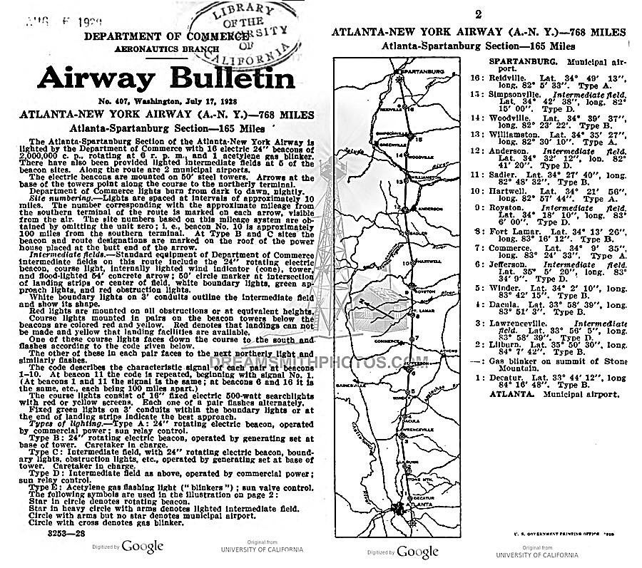
Possibly the last surviving concrete arrow in South Carolina, as well as on the Atlanta-New York airway route,
is located near Reidville, South Carolina. The arrow has been repainted, and a new sign has been posted.
The arrow and beacon #16 is located on the Atlanta-New York airway, shown in the 1928 bulletin below.
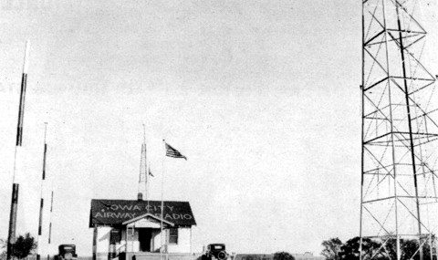
Iowa City Radio, Iowa, 1920’s
Former employees stationed at Iowa City Radio were:
P.E. White
Tony Gearhart
Silas F. Clark
Claude M. Smith.
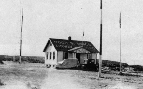
Rock Springs Airway Radio Station, Wyoming, 1921
Former employees stationed at Rock Springs:
L.D. Bates
L.D. Coman
E.C. Butler
Julius Petrison
Samuel F. Kelly
Tom Bostic
A.D. Hulen
Orville Hammond.
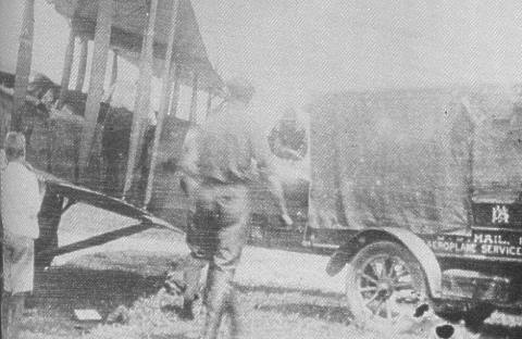
Mail Plane Operator, 1923
The scene is circa 1923 as a possible future air mail pilot watches an Airway Radio Station operator on the wing help load the mail in the front cockpit of a DH-4.
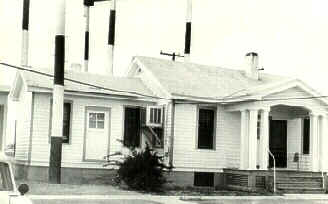
Bellfonte Radio (R/BF), Pennsylvania
This radio station at Bellfonte, PA., was one of the nation’s first, a critical stop on the New York to Cleveland run. A housing development now sits on this pioneer site.
Submitted by Steve Wolff
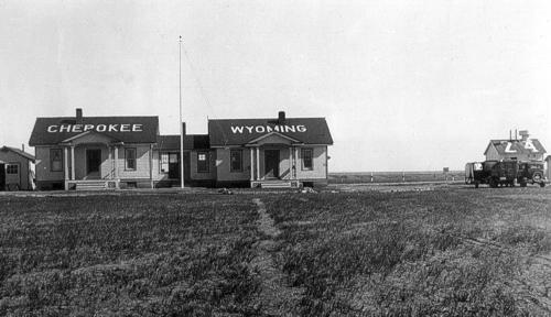
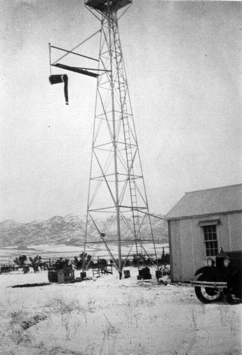
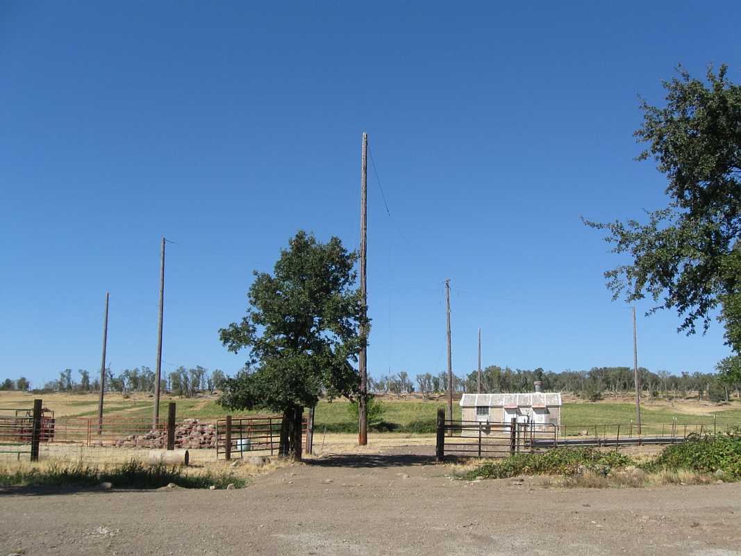
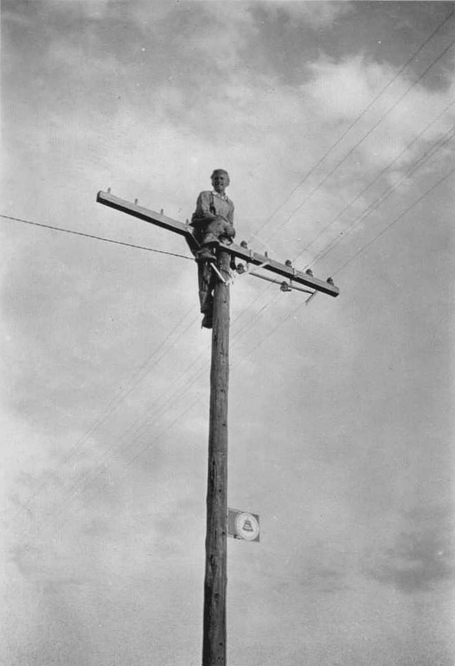
Cherokee, Wyoming, Site 24, (year unknown)
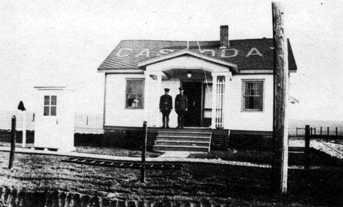
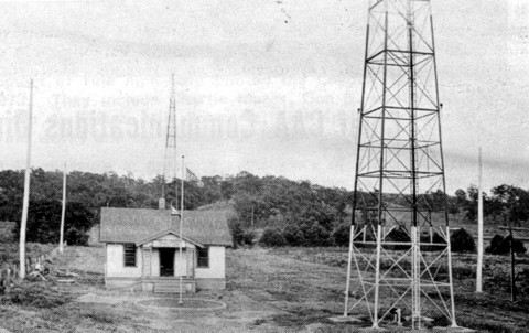
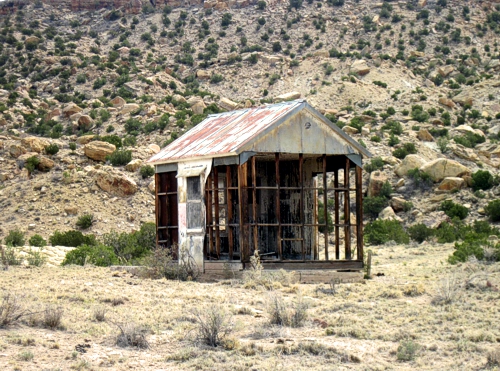
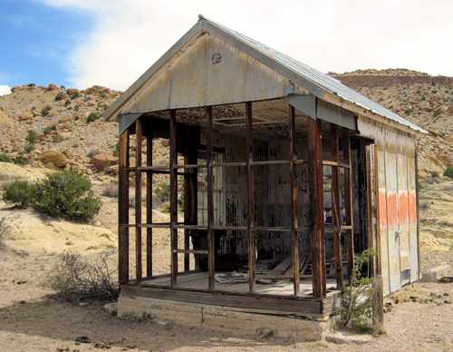
Cassoday Airway Radio Station, Kansas
Station was under the supervision of the Fort Worth, Texas office. Date unknown.
Low frequency “loop” radio range
This type was developed in the late ’20s and was non-simultaneous; that is, the range had to be shut down during voice transmission. This resulted in a temporary loss of navigation guidance in pilots flying on the radio beam.
Submitted by Audra Oliver
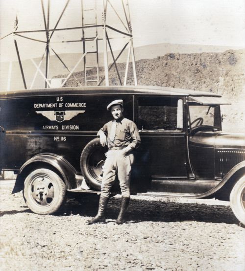
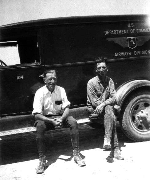
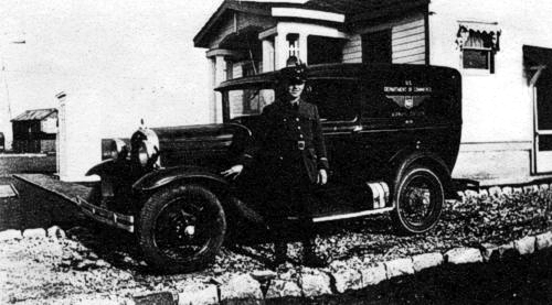
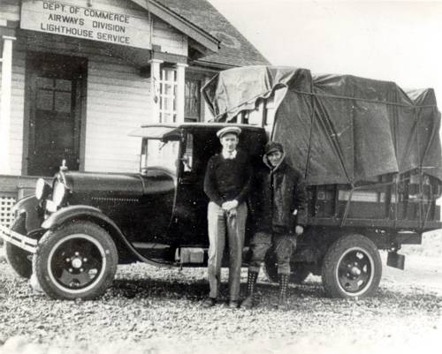
Airway Technician, U.S. Department of Commerce
Airways sector truck and maintenance technician, name and location unknown. Unlike their modern counterparts, the airway station keepers were required to wear distinctive uniforms on the job.
![]()
Submitted by Steve Wolff
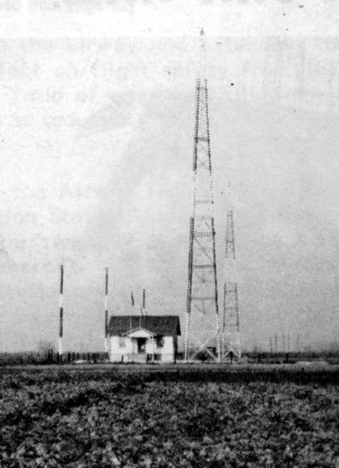
Salt Lake to Omaha Light Beacon, Site 16
15-20 foot high wood tower. Possibly a type “BR” beacon and a 36″ diameter light beacon with power generated from a remote site and supplied by the power lines as seen on the right side of the photo.
Submitted by Steve Wolff
Salt Lake to Omaha Light Beacon Station, Bitter Creek, WY, Site 19 (date unknown)
On the Salt Lake to Omaha airway and type “K” quarters with a standard 51 foot tower and two 550 gallon fuel tanks at the base. Course lights would be green denoting the presence of a landing field.
______________
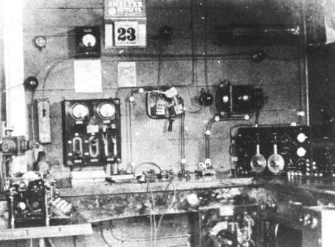
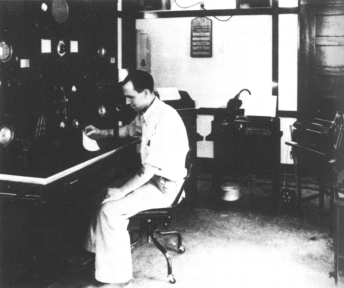
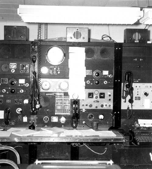
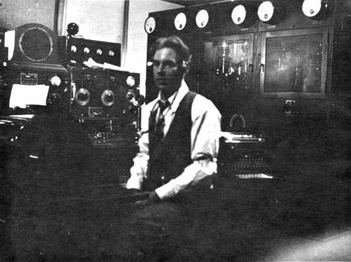
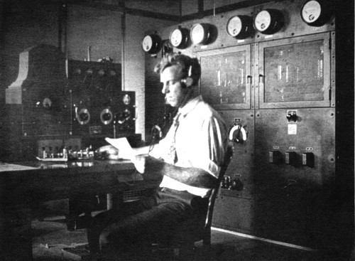
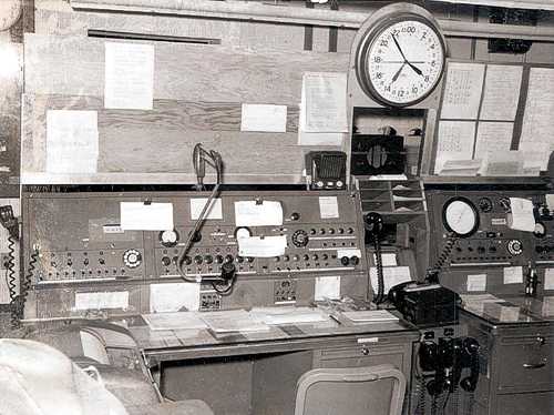
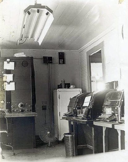
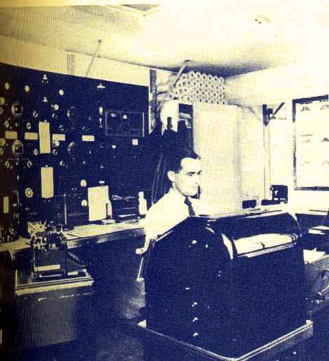
Radio-telegraph 1925
The radio-telegraph position in a 1925 Airway Radio Station, featuring both
hand and semi-automatic sending keys.
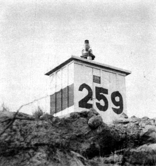
Blinker Light 259, Rodeo, New Mexico
No other information available on this photo.
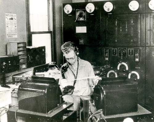
Salt Lake City Air Mail Radio Station (SLC), Utah, March 1925
Famed 2KW arc transmitter at Salt Lake City, Utah, is the type used in the earliest FSSs. The handle at the top is the wave length selector. Cylindrical object at left is the water cooled arc chamber. “CW” key or “bug” can be seen immediately in front of the receiver
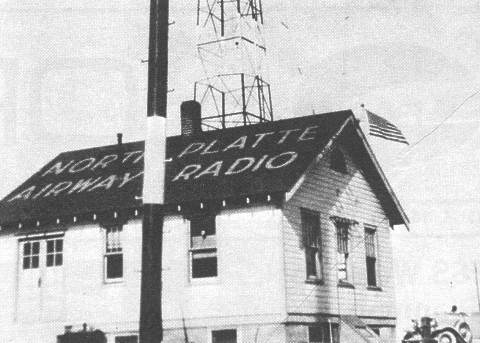
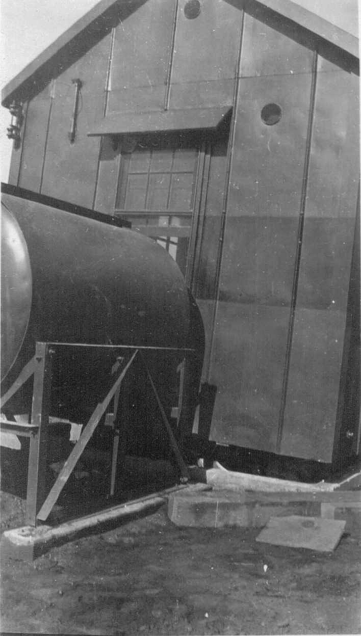
North Platte Radio (LBF), Nebraska about 1925
Typical of the buildings that served as Airway Radio Stations in the 20s and 30s was this mail order prefab structure
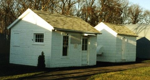
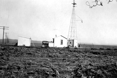
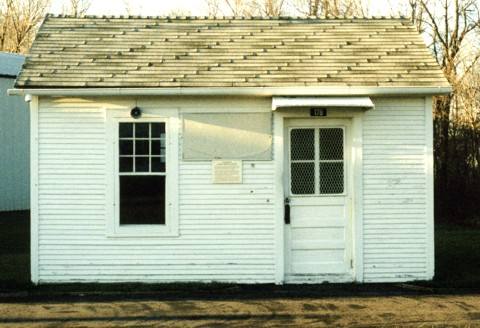
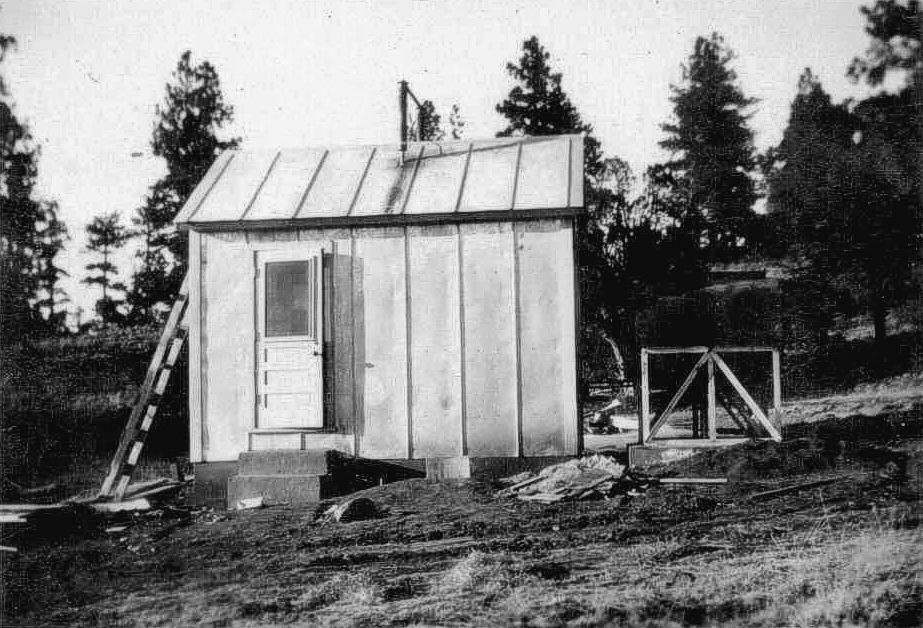
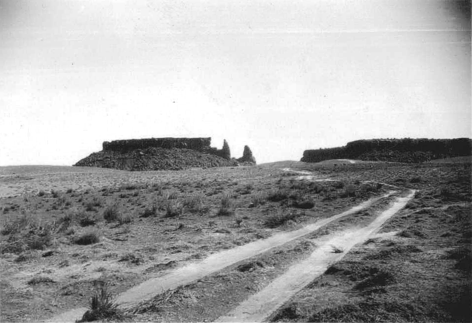
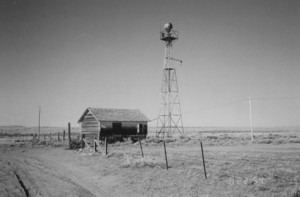
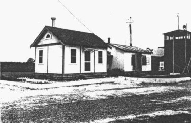
Mauston Aeronautical Light Station, Wisconsin, 1920’s
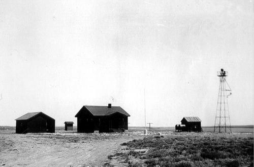
This picture is of the two buildings that comprised the Mauston Aeronautical Light Station in Mauston, Wisconsin. It was in that location from the early to mid 1920’s to approximately 1928. At that time, Mauston was decommissioned and the buildings moved to Lone Rock, WI.
The building on the left was the actual facility. The one on the right was the generator room. Sometime in the late 1940’s or early 50’s, the facility was replaced by a larger building, but the original facility building was maintained and used as a storage room. The generator building continued to house the emergency generator for Lone Rock FSS (LNR) right up to the day the facility closed. Around 1985 both buildings were again moved, this time to Oshkosh, WI and the EAA’s “Pioneer Airport” exhibit, part of the EAA museum.
______________
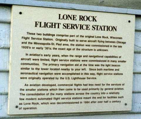
 Another view of the original Mauston/Lone Rock FSS facility building. Notice the plaque on the front wall (see below). The interior has been restored to what it looked like in the late 1930’s, complete with teletype and old radio equipment. There is also a self guided recorded audio tour narrated by Ben Silko, a former LNR FSS specialist who retired in 1977.
______________
Radio Operator
This station operator shows his background. Many CW radio men came to aviation from radio shacks on ocean vessels.
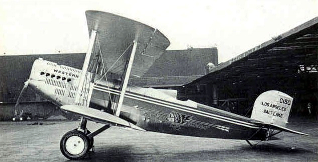
Western Air Express, Douglas M-2 cam-4-1
Year unknown
![]()
Concrete navigation arrow located near Quail Creek Reservoir, Hurricane, Utah. Looking southwest towards St. George, Utah.
Photos and information submitted by David A. Sbur
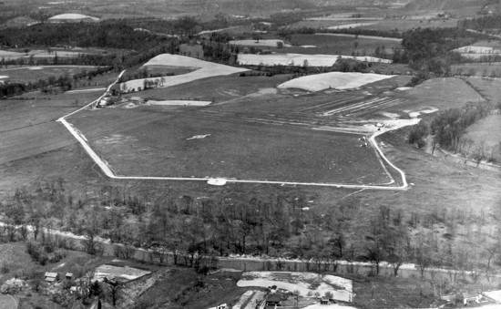
If you look closely you can see some faint numbers on the roofs of the sheds for the Portland-Spokane Airway, part of the C.A.M. 32 route. No trace of a concrete arrow could be found on the site.
The airport was listed in the Dept of Commerce listings in 1931 as a DOCILF (Dept of Commerce intermediate landing field). It was also used as an Army Air Force auxilliary field in WW2. It’s pretty sleepy now, the only activity is a local drone company that does it’s testing there.
Department of Commerce intermediate field, site 12, Portland-Spokane Airway. One and one-fourth miles E. Altitude, 850 feet. Irregular shape, 2,400 feet E./W., 2,000 feet NW./SE., sod, level, natural drainage; entire field available. Directional arrow marked “12 P-S.” Pole line to N., beacon tower to NW. Beacon, boundary, approach, and obstruction lights. Beacon, 24-inch rotating, with green course lights flashing characteristic “2” (.._). Aviation fuel. No other servicing facilities. Teletypewriter. Department of Commerce marker beacon, characteristic signal “H” (. . . .), operating frequencies 248 and 278 kc.
Probably the generator shed.
Inside the generator shed.
Possibly the teletype office
Unknown item
Electrical standoffs on the field along the length of the landing area but offset a few hundred yards.
![]()
The beacon does not appear to be the original 24″ size, perhaps it is an old course light?
![]()
![]()
![]()
Submitted by Darla Shelden
Miss Oklahoma City Mail Plane (about 1926)
The photo, taken from a family album, contained the following handwritten caption:
“Miss Oklahoma City, the first airplane to carry mail from California.” Note: The first airmail plane carried 314 pounds of airmail out of Oklahoma City, OK but the aircraft name is unknown.
Salt Lake City Air Mail Service, Utah, April 17, 1926
This was the first airmail transferred from Air Mail Service to Western Air Express
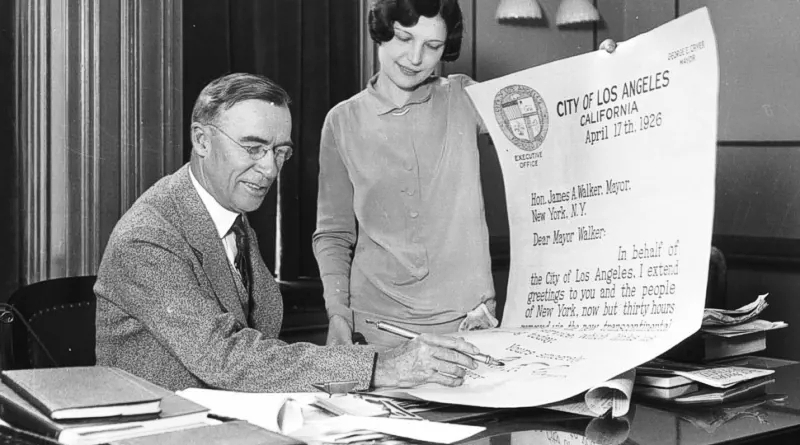
April 17, 1926
The mayor of Los Angeles sent an oversized letter to the mayor of New York City proudly stating it would cross the country in just 30 hours. This was only possible without the new lighted airway system. Once the new lighted airway was in place, that same letter that used to take 83 hours took just 33 hours to get from New York to San Francisco.
![]()
Submitted by Steve Wolff
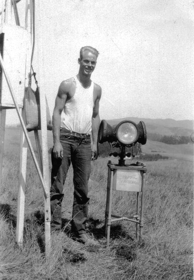
Plate XXXVI. General Electric Company Cluster Beacon, about 1927
Caption above reads: In addition to the 24-in. beacons, it was found advisable in certain sections to place cluster beacons having less candlepower. They consist of four automobile head-lamps surmounted by a top lamp as shown, and to turn at approximately 10 r.p.m. Tests of such a beacon using 21-cp. automobile-type lamps, show that it is visible at a distance of 40 miles in good weather.
Submitted by Raymond Duck
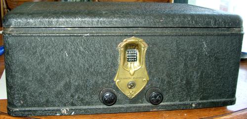
Early Lighthouse or Radio Station Radio
CAN YOU IDENTIFY THIS RADIO’S ORIGIN?
The above radio is manufactured by DeForest Crosley, 1927, and is contained in a metal box. It may have been used in the early days of radio beacon stations or lighthouses. The tuner scale ranges from 200-560. Does anyone know how this radio may have been utilized for navigation?
The following information was provided Anthony Martini in 2021 that may be of some help.
“Before I was an ATC Center controller hired in 1979, I was an Air Force navigator for 6 years. Many aircraft from the 1920’s up had a “radio direction finder” of some sort…. which was the easiest thing to operate in the cockpit. It’s use was very simple. Connected to a loop antenna on the aircraft, a needle in the cockpit would simply point to the source of the broadcast, like any ADF of the last 50 years. Since the Crosley bandbox was both battery powered and/or electrical powered, it is possible that an aircraft may have had the Bandbox onboard for use as a navigational aid….receiver only.
The metal box radio in your photo was normally installed in any attractive wooden cabinet for home use, and attached to external speakers, in other words, the metal box was the “guts” of the radio cabinet….much like car radios in the dashboard. I do not know why a normal AM radio would be in an ATC facility or lighthouse other than recreation, unless in 1927 some aircraft could transmit by radio signal (either voice of Morse Code) within the frequency band of the Bandbox, then the ATC/lighthouse could have had a directional loop antenna to point to the bearing of the aircraft/ship. That would require more research, but there certainly was radio transmission from aircraft before 1927.
As a humorous sidenote…..in the 1970’s USAF, we were flying the F-4 Phantom jet, and in training sessions the “good guy” would takeoff first and patrol somewhere unknown….then the “bad guy” would takeoff and try to find and “kill” the “good guy”. If the “good guy” crew was new, the “bad guy” would key the mic and ask for a “short count” to check the radio….and of course, the new crew would comply, unaware that the “bad guy” was obtaining an ADF relative bearing which gave away the “good guy’s” position by the needle pointing to the transmitting aircraft….and then the fight started…..”
![]()
Submitted by Edward Rajki
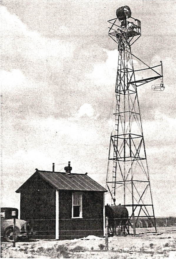
Fernley, Nevada, Beacon Site 22, 1928
Beacon 22 with generator and equipment sheds located at Fernley Intermediate Field.
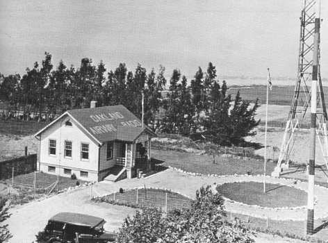
Oakland Airway Radio Station (KCV), California 1928
Located on Bay Farm Island. Prior to this, this building had been relocated from the tidal flats where it was accessed by a rowboat
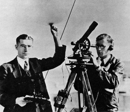
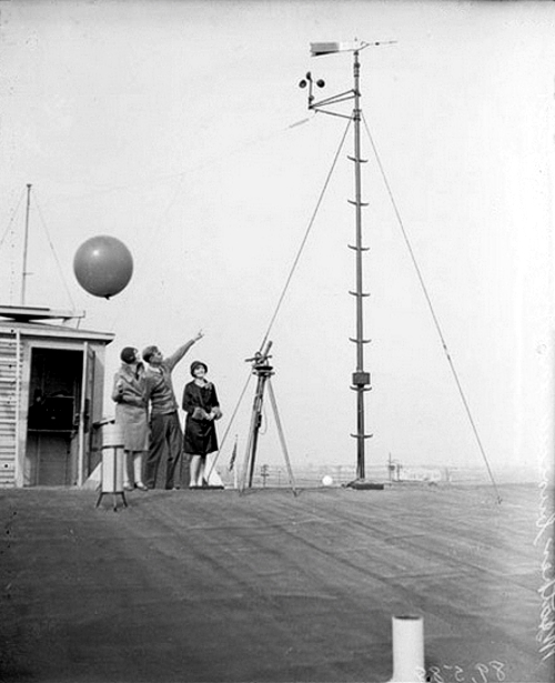
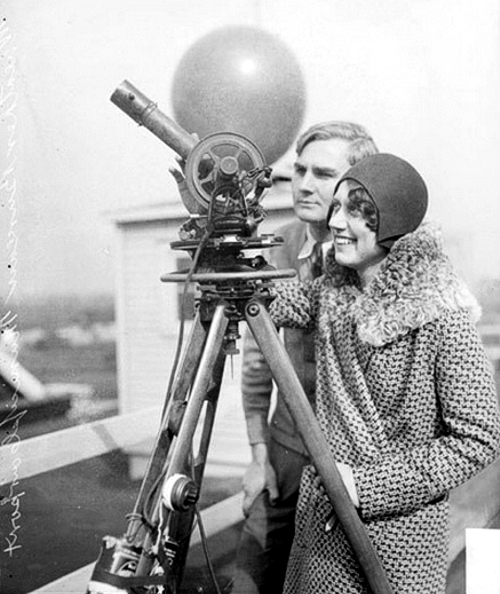
Weather observers, 1928
1928 team of weather observers in action using a theodolite and weather balloon. Location unknown.
Seattle Airway Radio Station (KZC), Washington, 1928
Former employees stationed at Seattle Radio:
Herb Hela
W.A. Siminson
R.A. Clark
Herb Wilson
Norm Bliss
Bernard Swaffield
J.W. Gunsolly
Kansas City Airway Radio Station (KRC), Missouri, 1928
Former employees stationed at Kansas City Radio: Rome Montle and Frank C. Gaynor
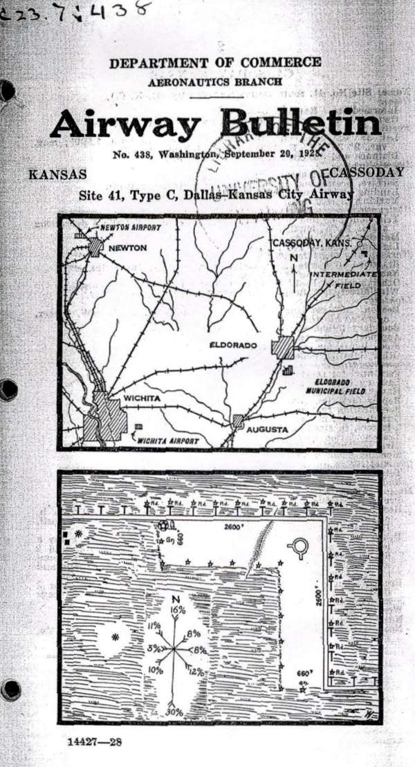
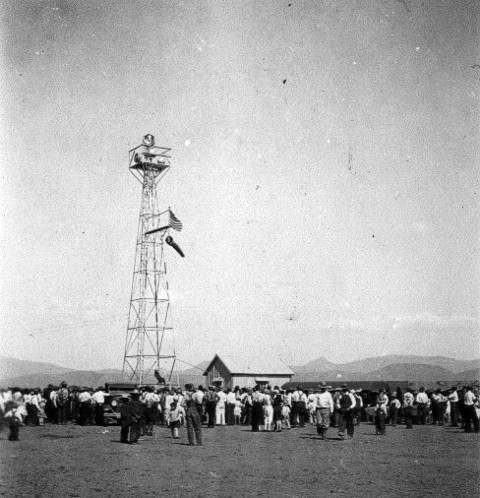
Cassoday, Kansas, Site #41, Dallas to Kansas City Airway Map, Sep 20, 1928
Department of Commerce Airway Bulletin no. 428, Washington DC, depicting the airway and the Cassoday Intermediate Field layout (lower diagram). The field was operated by the Department of Commerce using two grass runways in an ‘L’ formation, 2,600 feet long.
In the northwest corner of the airfield was a 2-million candlepower 24 inch rotating beacon which rotated at 6 RPM. The newly-built field had few amenities (no fuel, repairs, or telegraph) but did have nighttime lights around the boundary of the airfield.
By 1931, the starting point of the airway had been changed from Dallas to Amarillo, and this resulted in a renumbering of the airfields & beacons. Cassoday was changed from Site #41 to Site #34 and, according to the 1931 Bulletin #2, this beacon site was upgraded to a Flight Service Station (FSS), commissioned February 1931, and included course lights and a weather teletype.
Submitted by Ed Dietz
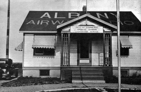
Albany Airway Radio Station (ALB), New York, 1929
Bill Jones, first Operator In Charge, Albany, New York Airways Radio, 1930
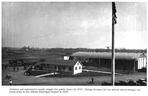
Photo caption: Aviators and aeronautics rally caught the public fancy by 1930. Flying circuses, fly-ins, and air shows brought the whole town to the Albany Municipal Airport in 1930
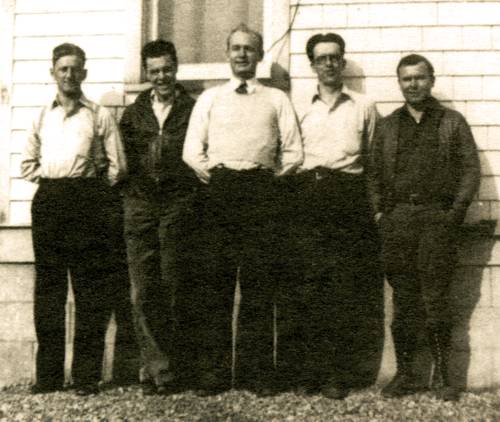
Rock Springs Airway Radio Station (RKS), Wyoming, 1929
Left to right: Sam Kelly, the operator-in-charge, Woodington, and Stan Hutton at Rock Springs Airway Radio Station, Wyoming. Rock Springs was commissioned in 1920 and decommissioned on September 31, 1991.
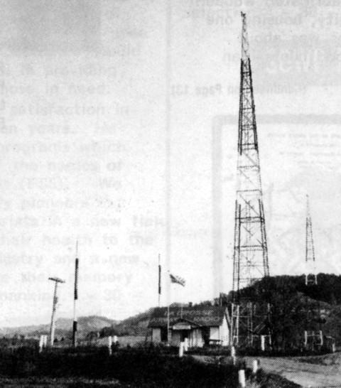
La Crosse Airway Radio Station, Wisconsin, July 1929
Former employees stationed at La Crosse Radio:
Harold C. Burhop
Samuel Allen
L.L. Arnold
A.J. Silva
Portland Radio (PDX), Oregon, 1929
Air Commerce radio operator by the name of Carl Anderson, broadcasts from the Portland, Oregon, Airways Radio Station in 1929
Pasco Airway Radio Station (KCS), Washington, about 1929
Former employees stationed at Pasco Radio:
Bennett
Warren Boeshore
Bill Brenimam
Harold Johnson
Submitted by Ed Dietz
Albany Airway Radio Station (ALB), New York, 1929
Radio operators console
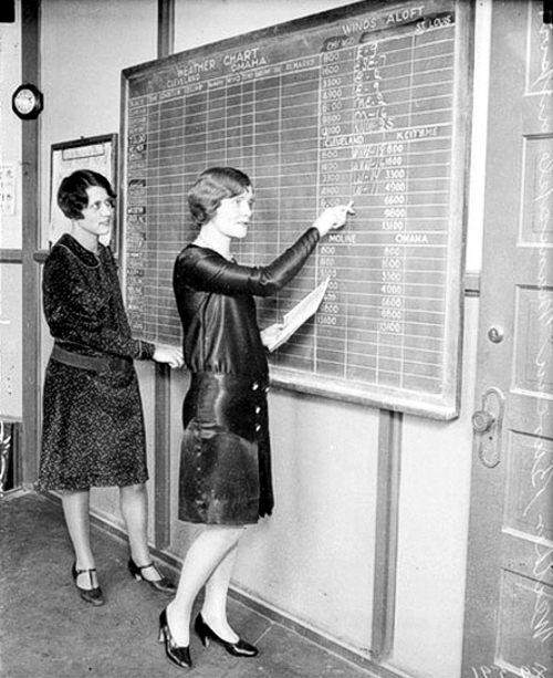
Chicago-Midway Weather Bureau, 1929
Current weather reports are collected and posted on this weather chart. Identifiable city names on this board, left side, under Weather Chart are Cleveland and Omaha. Right side under Winds aloft are Chicago, St. Louis, Cleveland, possibly Kansas City, unknown, and Omaha. Writing on the backside says “Weather Bureau Municipal Airport”.
Rooftop weather recording instruments. The Weather Bureau employee is pointing at the wind speed and wind direction Instruments.
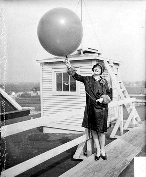
Releasing a helium filled ceiling balloon. Upon release of the balloon the weather observer, using a stop-watch, times its accent until it fades into the clouds overhead. The observer then refers to a chart to determine cloud height above the ground based on the balloons accent time. This method provides a reasonable measurement of the base of a broken or overcast layer of clouds below about 3,000 feet.
Weather Bureau employees taking some type of unknown measurement, possibly a ceilometer to measure cloud height above ground.
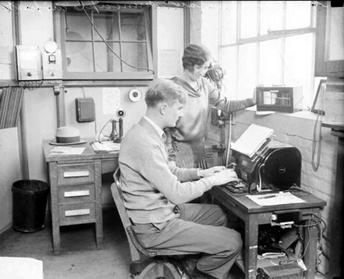
Weather Bureau employees preparing to transmit a weather observation
Oakland Airway Radio Station (KCV), California, July 1929
Operator-in-Charge, C.W. “Bill” Larsen, broadcasting at the Oakland Airway Radio Station
St. Louis Airway Radio Station (KCQ), Missouri, July 1929
Former employees stationed at St. Louis Radio:
Thomas C. Gale
E.E. Nichols
Claude M. Smith
R.S. Allen
Edwin Plagge
F. Robinson
M.E. Walton
M.F. O’Brien
E.E. Frain
Chicago-Midway, Airport, 1929
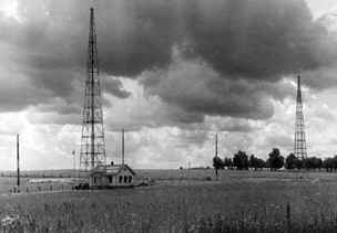
Humboldt Airway Radio Station, Nevada, 1929
This site was also a weather station and intermediate landing field. It may have been located at the Humboldt Auxiliary field, which was located at: 40 degrees 5′ 8.55″ N 118 degrees 9′ 22.34″ W.
Can anyone confirm this location?
![]()
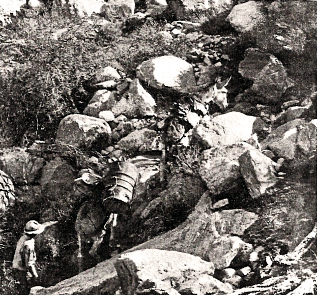
Prewitt, New Mexico Rotating Beacon, 1929
This 1929 photo, from a DoC (Dept of Commerce) journal article by Thomas Chapman, shows the airway beacon light tower under construction at Prewitt (Thoreau), NM. The stoic burro in the foreground was referred to as the “Superintendent of Airways Construction.” This framed photo was a memento given by staff to Fred Hingsburg, the Chief Engineer for the Airways Division.”
“Prewitt (Thoreau) was DoC Site 69 on the original 1929 Winslow-Gallup-Albuquerque segment of the mid-continent airway, first served by Transcontinental Air Transport in July, 1929. It was one of several beacon lights to be shut down in early 1930, as the beacon route was being realigned to match with the new four-course radio range signals. It is not clear where this Prewitt beacon tower was relocated along the new direct airway line.
The above Air Commerce Bulletin describes the shutdown of these beacons, soon to be relocated along the radio beam from new radio range sites at Albuquerque and Winslow for this section of the airway.
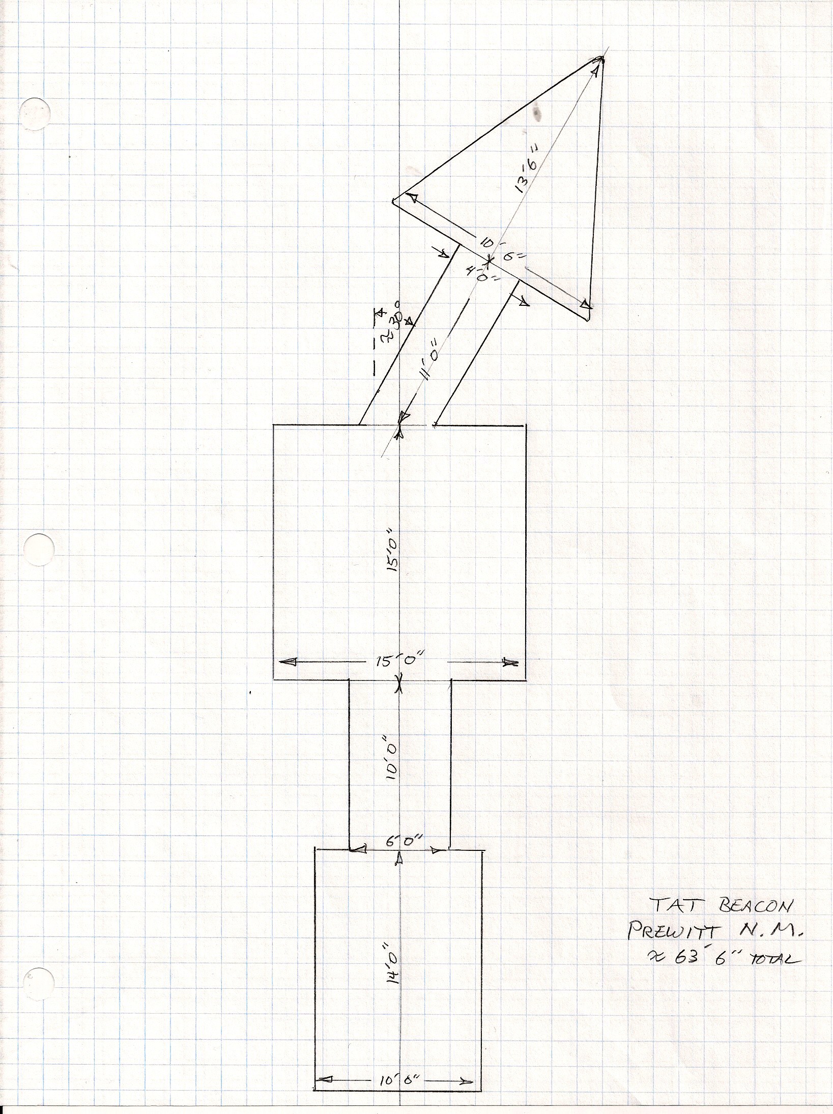 The above sketch is the layout of the Prewitt beacon arrow using the identifier TAT. Arrow location: 35°21’45.27″N 108° 2’45.71″W
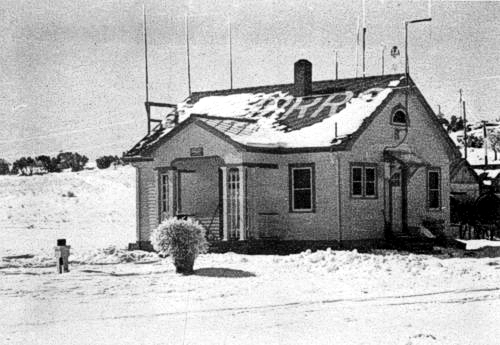
Medicine Bow Radio, Wyoming (date unknown)
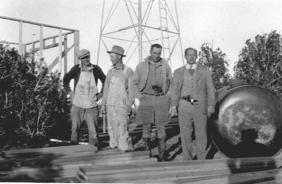
Construction started in 1929 and was completed in 1930. According to the Aircraft Year Book, this site was the last station constructed to complete the entire NYC-SFO Low Frequency Range system. The building in this photo is very solid. It’s two rooms, one for living quarters and the other, a much smaller room, contained the radio gear and later in history, teletype. It was heated with a coal stove and electric power was supplied locally to operate the electrical equipment. In case of power failure a 550 gallon fuel tank (missing) supplied fuel to run a generator. The fuel tank was normally located between the caretakers quarters (above building) and the beacon tower.
Historical note: The Union Pacific Railroad is very close and Highway 30, the first to connect the Midwest with the West is 1 1/2 miles away. The Overland Trail from the 1800’s is very close and of course this Low Frequency Airway. They all converge at this point!
Photos and information submitted by Steve Wolff, Laramie, Wyoming
St. Louis Airways Radio Station -Department of Commerce Airways Division, Lighthouse Service (about 1929)
![]()
Restored LA-A 59B, El Morro, New Mexico Metal Route Arrow
Not all arrows were concrete. Metal arrows were easy to remove when a beacon site was shut down. This 9B El Morro, New Mexico emergency field arrow was salvaged and restored in Grants, New Mexico.
Relocation of airways left concrete arrows behind at many of the sites, but when the site was re-installed in 1930-31 (mostly) the arrows were non-critical due to radio navigation signals, voice radios, enclosed cockpits, and better sectional charts. Only rarely across the US were arrows em-placed as of 1932. These were mainly the rare 1930’s metal arrows shown above but were not always on airfield sites.
![]()
The 2nd transcontinental airway was established across the country from New York to Los Angeles in mid 1929.. . However, not all the beacons were completed by July 1929. Transcontinental Air Transport (C. Lindbergh) established the route as a plane-and-train service coast-to-coast. They partnered with Pennsylvania and Santa Fe Railroads for night travel where beacons were not ready. Result – coast-to-coast in 48 hrs.
![]() Southwestern blowup view of above graphic.
Southwestern blowup view of above graphic.
![]() Transcontinental Airway Map, New York to Los Angeles, 1929
Transcontinental Airway Map, New York to Los Angeles, 1929
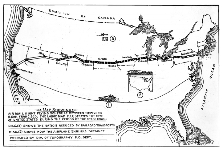
Map showing the air mail night flying schedule between New York and San Francisco. The map illustrates the size of the united States during the period of the stage coach.
![]() Submitted by Lane Floyd
Submitted by Lane Floyd
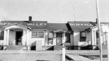
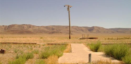
Pershing County, Nevada Radio Beacon Site, December 2020
This site is located at 40°13’13.76″N 117°30’33.77″W, near the Buffalo Valley/Dixie Valley Road.
Photo by Bill and Jack Bell and submitted by Steve Owen
Mesa Gigante, New Mexico, Site 66, Airway Beacon Generator Hut
Above is the generator hut for the soon to be Mesa Gigante, New Mexico airway beacon. This was the former Suwanee generator hut know as site 74 in 1930 and 1931. It was in the process of being moved from the above location to about 5 miles away, where it was to be placed on the realigned LA-A airway route. From 1931 on, it was repainted as Hut 66 and called Mesa Gigante.
Suwanee site 74 was a Transcontinental Air Transport (TAT) beacon, aligned from Gallup to Clovis by this pioneering airline, as the first beacon line in this region (early 1929). The airway beacon and concrete arrows were located uphill atop the mesa rim. After a major aircraft accident at Mt. Taylor, TAT went broke after financial struggles that lasted about 1 year after the accident. TAT merged with Transcontinental and Western Airlines in 1930. The CAA took the airway segment over in 1930 and had the beacons in this segment shifted to the 1930’s-40’s LA-A alignment.
Photo by Bill and Jack Bell and submitted by Steve Owen
1931
The new home for the former Suwanee generator hut, site 74, now relocated, renamed, and repainted to Mesa Gigante, site 66 on the LA-A. The actual airway beacon was located up on the top of the mesa rim with a lengthy run of power cable.
Submitted by Steve Owen
Compare the above 2012 photo with the 1931 black and white photo above. It was taken from the same angle and height.
Submitted by Steve Owen
2012
The above and below photos are all that remains of Site 66, Airway Beacon Generator Hut, Mesa Gigante, New Mexico, The number 59 on the left side of the roof is not a beacon number but a partial coordinate. This generator hut is one of several LA-A beacon huts located on private land and moved from it’s original site which was known as Suwanee, site 74.
Submitted by Steve Owen
Submitted by Steve Owen
Submitted by Steve Owen
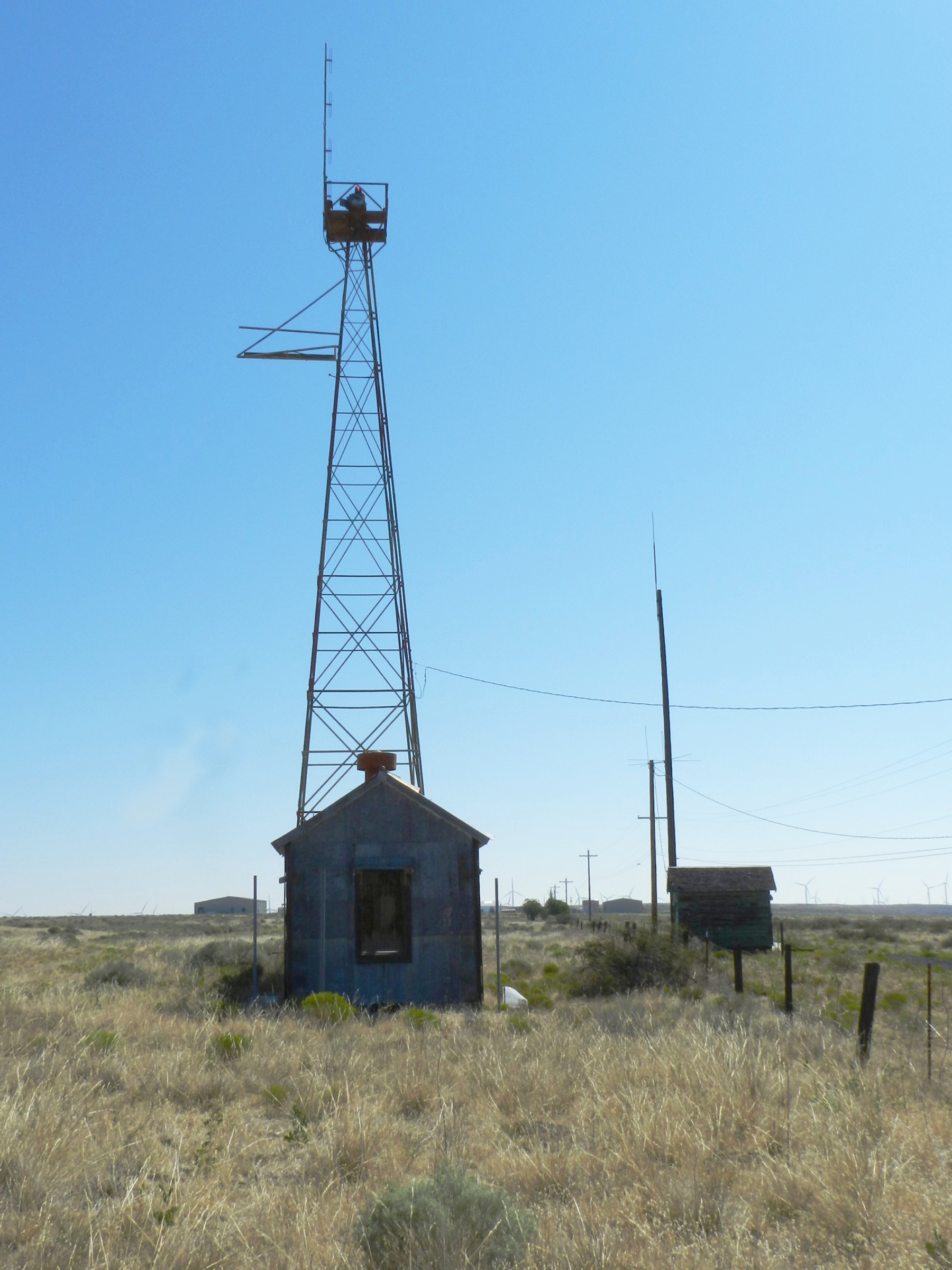
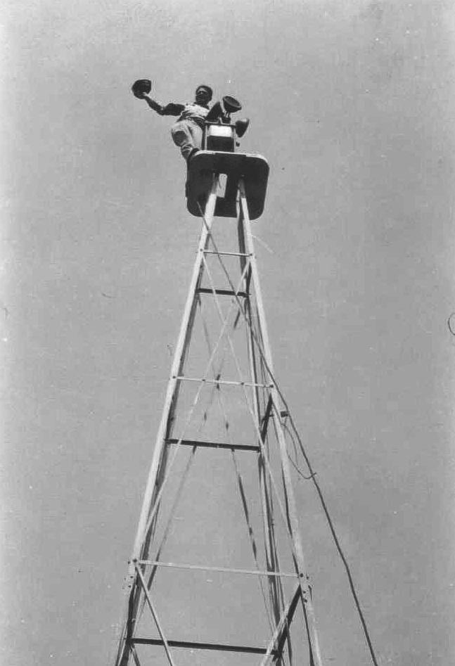
Early Flight Service Antenna (date unknown)
Spindly antennas, many of them adapted from mail order windmill towers, were typical of do-it-yourself ingenuity of early-day flight service station specialists. In spite of crude equipment, radio communications of 600 miles and more were common place
By Mel Duncan
Wyoming’s portion of the Salt Lake to Omaha Airway had 40 beacons spaced about 10 miles apart. The Wyoming portion of the airway closely followed the railroad tracks except between Salt Lake City and Knight and between Laramie and Cheyenne. The beacons were numbered from the west (Salt Lake) to the east (Omaha). Some had names while some were only numbered.
| 1. Salt Lake City, Utah 2. (Wanship, Utah) 3. (Utah) 4. (Utah) 5. (Wyoming) 6. Knight, Wyoming 8. LeRoy 12. Granger 16. Rock Springs 19. Bitter Creek 22. Red Desert 24. Cherokee |
27. Parco 29. Dana 31. Medicine Bow 33. Rock River 37. Laramie 38. Summit (Beacon Hill) 39. Section 33, T15N, R70W. (North of old McIntyre Ranch) 40. Silver Crown 41. Cheyenne 44. Burns 45. Pine Bluffs, Wyoming 46. (Nebraska) 50. Sidney, Nebraska |
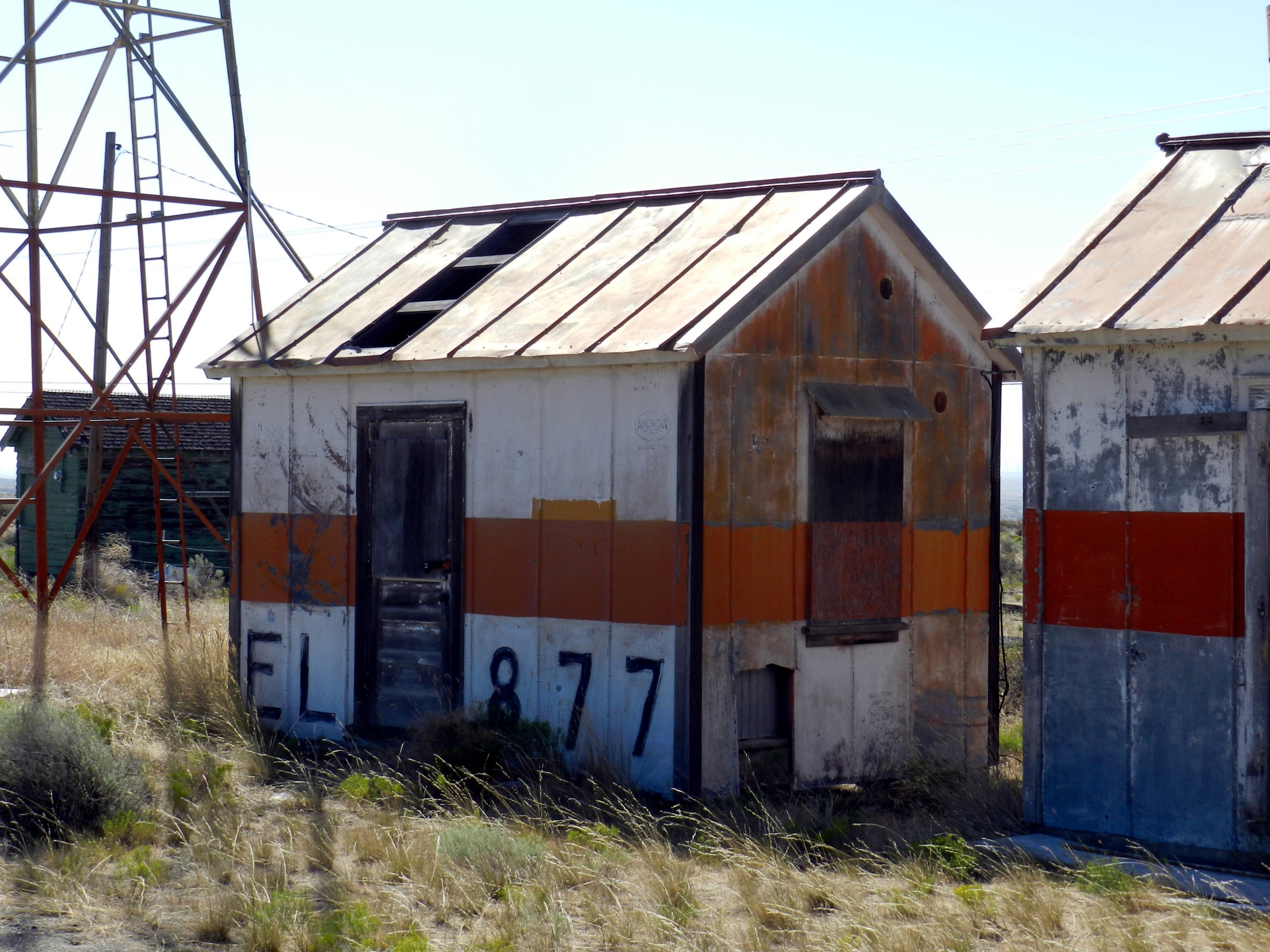
The Summit or Beacon Hill light, number 38, was located one and one-half miles north of the Lincoln Monument at T15N, R72W, Section 14, at 8777 feet. A permit was granted on July 26, 1930 to U.S. Department of Commerce, Lighthouse Service, Airways Division, to use a plot of land, 200 feet square, for beacon site and suitable buildings for caretaker of the light. The 1933 Corps of Engineer’s map indicates a power or telephone line going to the beacon. (photo 1 photo 2 photo 3 photo 4) (41° 16′ 5″ N, 105° 26′ 2″ W) In May of 2004 the site was visited and coordinates confirmed with GPS. Several newer towers now occupy the area but the concrete arrow remains. There also remains some remnants of the old generator system and building foundation.
Beacon number 39 was in Section 33, T15N, R70W about ¾ mile north of McIntyre’s. The elevation is shown as 7528 feet. (photo 1 photo 2 photo 3)
From Happy Jack Road 210 take County road 1 ½ miles to a more or less double turnoff to the east. Take the left branch about 1 ½ mile to the center of Section 33. (Land ownership??)
(41° 13″ 34″ N, 105° 14′ 36″ W) In May of 2004 the site was visited and coordinates checked by GPS. The concrete arrow remains but no buildings.
The Silver Crown Beacon number 40 was located almost dead center of Section 7, T14N, R68W at 41° 11′ 49″ N, 105° 02′ 53″ W. The elevation is about 6729 feet. (Of note: On the Round Top Lake Quadrangle 7.5 minute of 1961, “Airline Camp” is shown located in Section 3, T14N, R68W. This is close to the site of the 1935 airline crash.)
On the Archer Quadrangle of 1963, a beacon is shown located in Section 21 of T14N, R 65W, about one half-mile northwest of U.S. 30 overpass. This was probably beacon number 42. There is no remaining portion of the beacon tower or base.
(41° 09′ 53″ N, 104° 40′ 28″ W)
In 1932 the standard airway beacon was a 24-inch rotating unit of approximately 1 million candlepower. In 1933 a new standard was adapted to utilize a 36-inch rotating unit which showed two beacons of light 180 degrees apart. Each beam was about 1,250,000 candlepower. The beacons were designed to show six flashes per minute. The older 24-inch unit rotated six times per minute and the newer 36-inch unit rotated 3 times per minute. The 24-inch beacons were spaced at 10 mile intervals. The newer 36-inch units allowed spacing up to 15 miles between units. Except for the number 8, LeRoy Beacon, the Wyoming beacons were all 24 inch units and retained their original spacing of about 10 miles. The LeRoy Beacon had a 36-inch light. Two blinking colored course lights were mounted with each beacon, green indicating the presence of a landing facility and red indicating the absence of a landing field. In addition, each beacon course light blinked a code indicating which beacon was being observed. Every ten beacons the code was repeated.
The Silver Crown Beacon for example flashed two dashes for identification. The same signal was used by Sidney, approximately 100 miles away.
Electricity for remote sites required a gasoline-powered generator. In isolated regions permanent quarters were provided for the caretaker of the power plant generator.
Some of these beacon sites were also utilized for the newer radio beacons that were being installed in the early 1930s. The light beacons were retained at these sites. In 1933, radio range beacons were installed at Knight, Rock Springs and Cheyenne. By 1936, additional radio range beacons were installed at Laramie and Medicine Bow.
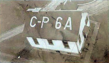
The building roof at each beacon site along the airway was marked with its number and SL-O indicating that you were on the Salt Lake to Omaha Airway. For example, Cherokee Beacon had on its roof “24 SL-O”.
The beacons at the airports were normally located on the highest point of land or atop a building near the site rather than being centered at the landing field.
It behooved a pilot to know his International Morse Code quite well. Cheyenne’s auxiliary code beacon flashed the letter “C” (dash dot dash dot), its radio range station broadcast “CX” (dash dot dash dot, dash dot dot dash) and the course light blinked a modified code for the numeral 1, (dot dot dash).
Intermediate landing fields were provided about every 50 miles affording a theoretical maximum distance of 25 miles to a field in the event of a problem. These intermediate fields were indeed just fields. None of them were paved or oiled and most had a landing space of about 2500 feet.
In 1936, only Cheyenne and Laramie were listed as “Airports” and only Cheyenne had paved or oiled runways. Laramie Airport has a restored beacon and tower. The beacon appears to be a 36 inch double unit.
The above historical article was written and submitted by Mel Duncan of Wyoming, May 2004.
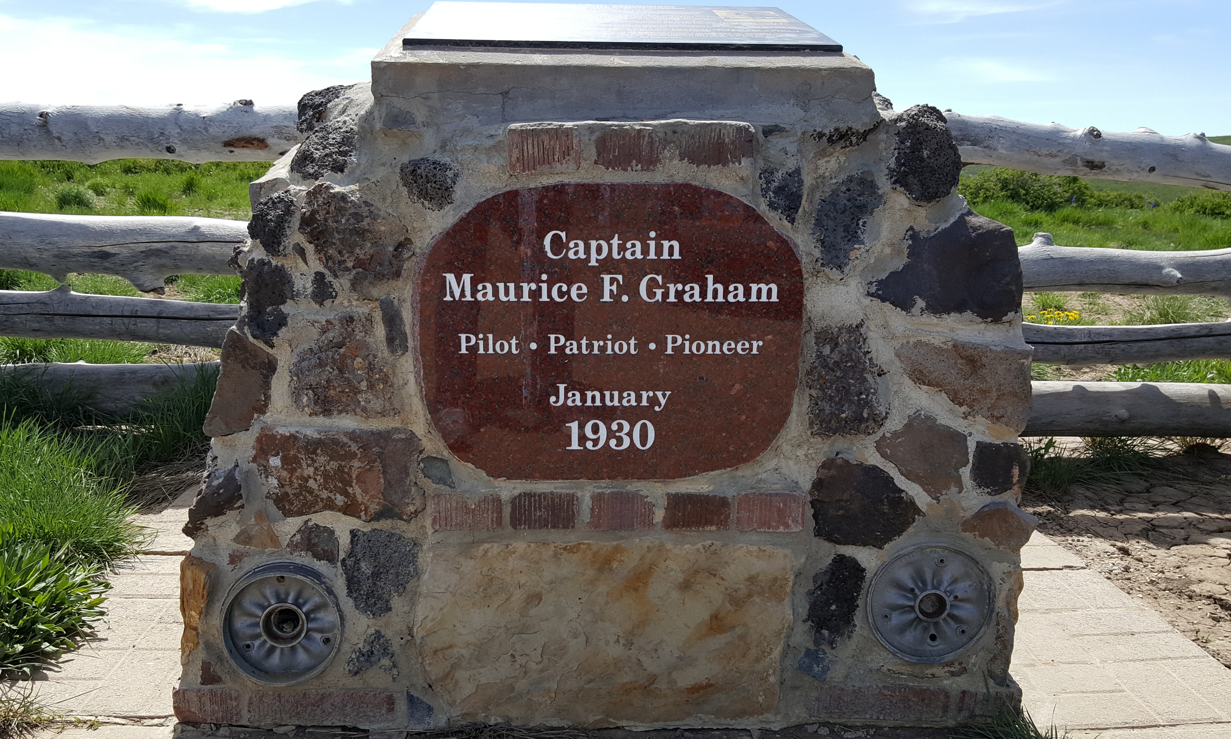
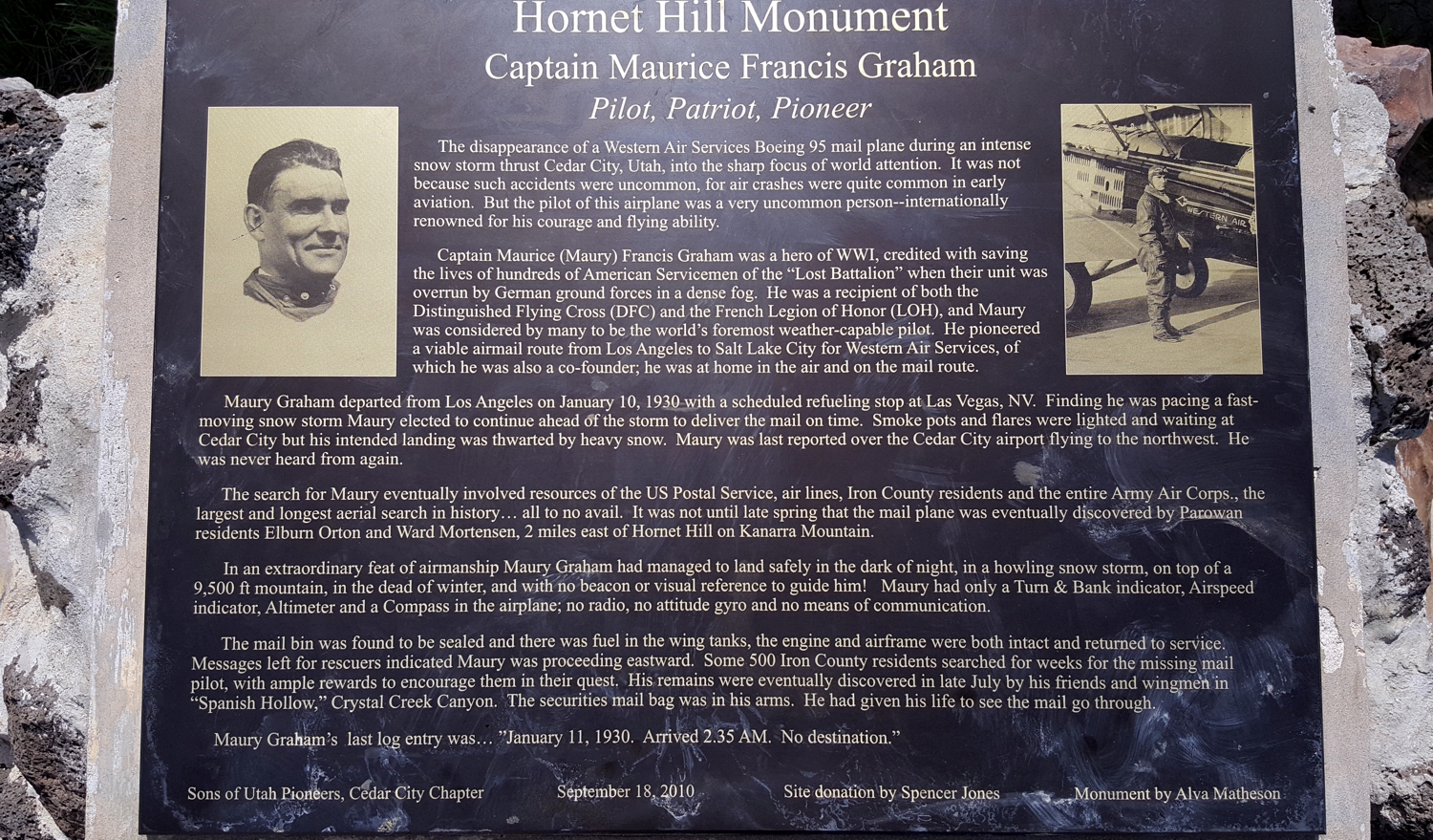
Monument dedicated to Captain Maurice Francis Graham, an airmail pilot, who on January 10, 1930, departed Los Angeles, California for Salt Lake City, Utah. He was forced to safely land his Boeing 95 aircraft during a blinding snow storm on top of a 9,500 foot mountain called Hornet Hill. Sadly, Maurice died of exposure in an attempt to walk out. His body wasn’t found until July 1930.
Location: about 12 miles SE of Cedar City, Utah (37° 29.367′ N, 113° 1.17′ W)
Early Mail Plane
Bingham, Utah, June 12,1930
Construction crew for the light line airway beacon
______________
Submitted by Claude Genest
Wink Radio Station (INK), Texas, 1930’s
Photo by Stan Beaver
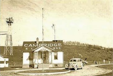
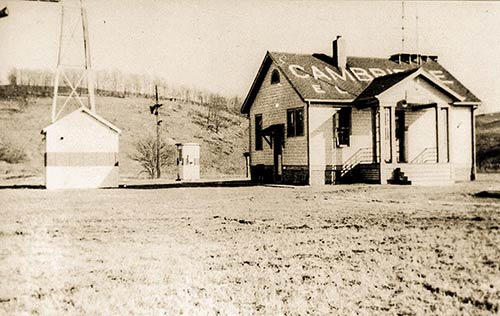
Cambridge Airport, Ohio mid 1934
American Airlines emergency landing at Cambridge with engine difficulty. The cowling was removed, repairs made and the flight continued on to Indianapolis.
Photo by Stan Beaver
Cambridge Airport, Ohio mid 1934
Engine failure on the Pittsburgh to Columbus route at Cambridge. The Cambridge Radio and other stations provided a very valuable service to the aeronautical industry.
Photo by Stan Beaver
Cambridge Airport, Ohio mid 1930s.
Another emergency landing at Cambridge airport
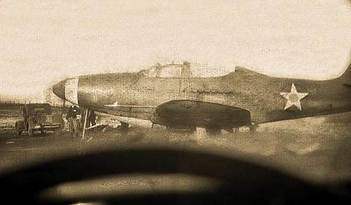
Photo submitted by Jim Jackson
Photo submitted by Jim Jackson
Submitter said “my Dad said several P-39s had to land in Cambridge and spend some time there. This one had engine trouble. A lot of fighters were landed there by WASPS during the war for fuel. My dad flew out of Cambridge in the late 30’s and 40’s, and when I was a kid (very small). I took rides with some of the old timers there.”
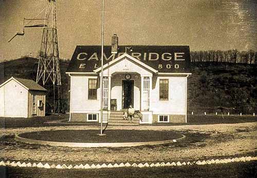
Cambridge Radio, Ohio, 1930s
Cambridge Radio prior to closure and transfer of operations to Zanesville FSS. This small Flight Service was a haven for young ham operators learning CW (Continuous Wave or Morse Code) and learning how to type on a spare teletype machine. It was a source of employment to many area people.
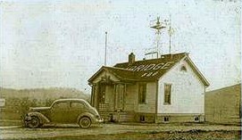
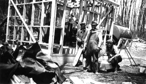
Photo submitted by Joe Jennings
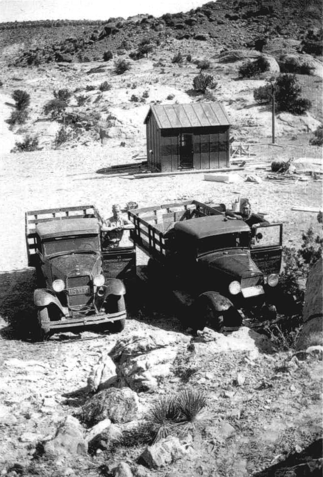
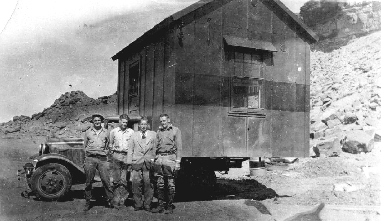
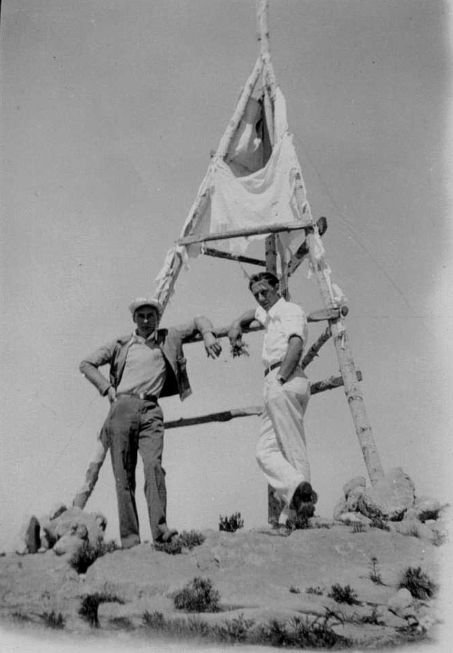
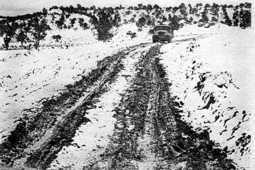
Light Line Airway Beacon Under Construction, 1930’s
Location unknown
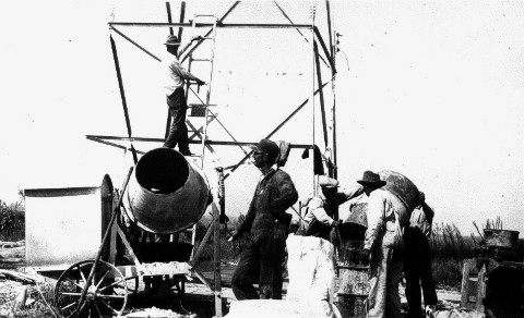
Photo submitted by Joe Jennings
Light Line Airway Beacon Under Construction – Mixing Concrete, 1930’s
Location unknown
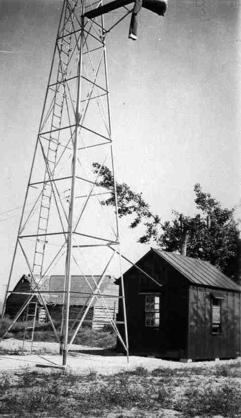
Photo submitted by Joe Jennings
Light Line Airway Beacon,1930’s
Location Unknown
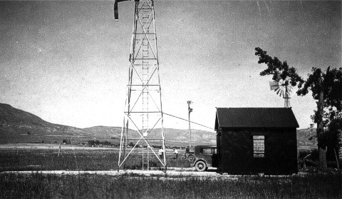
Photo submitted by Joe Jennings
Light Line Airway Beacon, 1930’s.
Location Unknown.
Photo submitted by Joe Jennings
Light Line Airway Beacon, Location Unknown, 1930’s
Francis Jennings and crew constructing a light line pad.
.
Unknown Radio Station
This photo was with a collection of Alaska Flight Service Stations and may be one of the older Alaskan Airway Radio Stations.
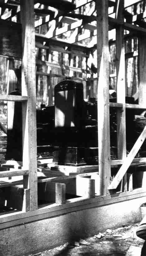
Photo submitted by Joe Jennings
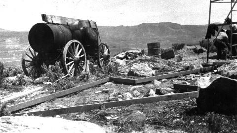
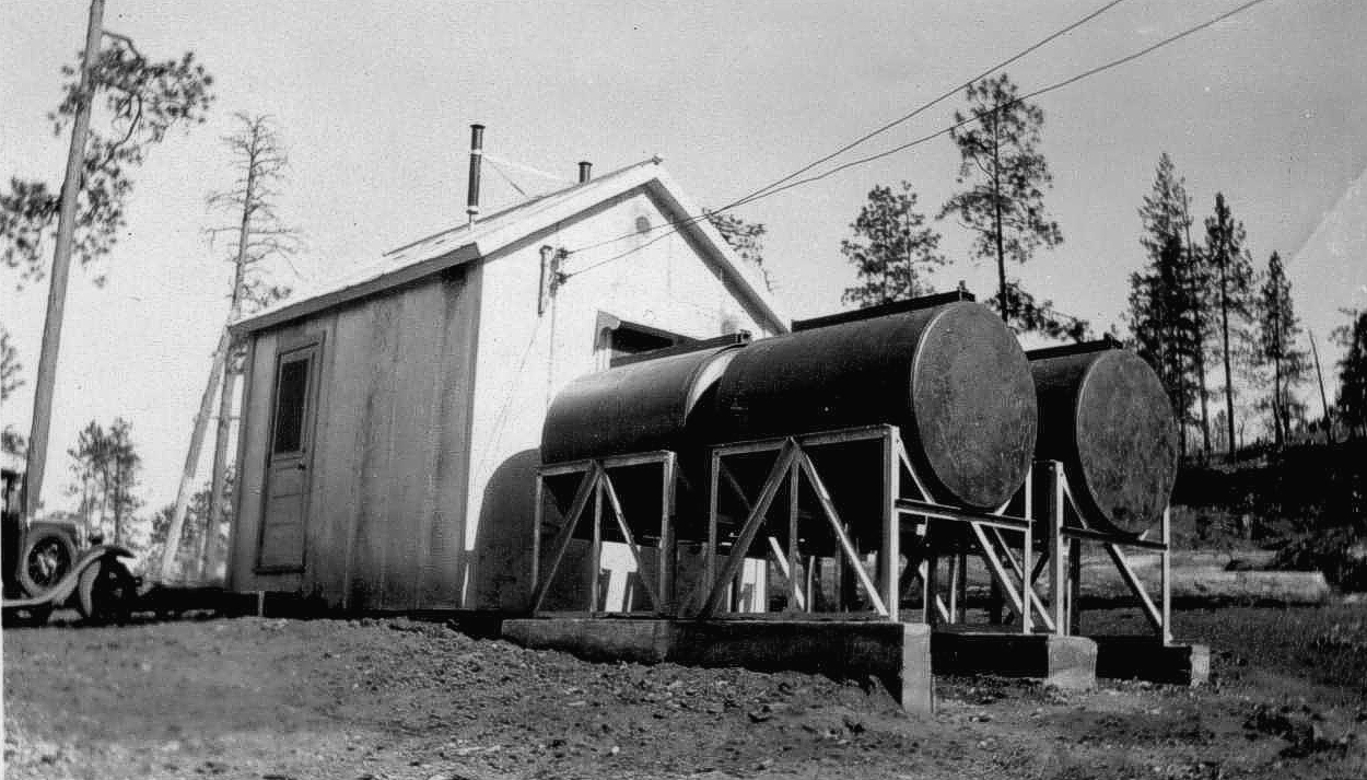
Light Line Airway Beacon Kohler Generators, 1930’s
Location unknown
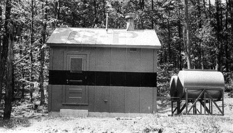
Photo submitted by Joe Jennings
Light Line Airway Beacon Generator Pad, 1930’s
Location unknown
Photo submitted by Joe Jennings
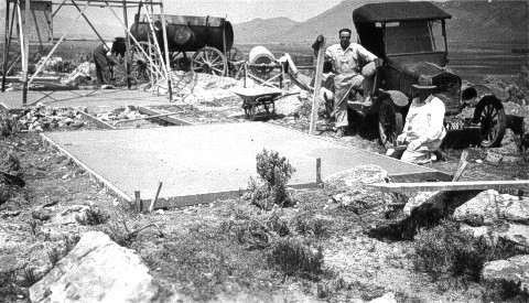
Light Line Airway Beacon Generator and Tower Pads, 1930
Pad site ready for construction. Location unknown
Submitted by Ed Dietz
Albany Airway Radio Station (ALB), New York, 1930
Roy Purdy, first Senior Operator
 Roy C. Purdy, Senior Radio Operator, Albany Airways Radio Station
Albany Airway Radio opened July 1, 1930, with the call-sign of WWAH
St. Louis Radio Station (STL), Missouri, 1930
St. Louis Airway Radio Station during the late 1920s or early ’30s. Barely visible in the photo is the wire strung between the tops of its twin antenna towers. During this era, some stations were making hourly weather broadcasts. When needed for safety, they also accepted messages from the airlines and transmitted them to pilots aloft
Burley Radio (BYI), Idaho, 1930’s
In the early 1930’s, the technicians took care of teletype and radio equipment at stations like this one in Burley, Idaho
| Beacon 18 | N 39° 29.401′, W 119° 57.895′ NGS Data Sheet KR1732 |
| Beacon 19 | N 39° 29.401′, W 119° 57.895′ NGS Data Sheet KR1732 |
| Beacon 19 | N 39° 31.855′, W 119° 39.338′ NGS Data Sheet KR1753 |
| Note: 2011. There are two Beacon 19 locations very close together on a mountain that is today the site of the Mustang VORTAC | |
| Both data sheets refer to “Beacon 19” and one data sheet mentions the beacon being moved. The “Airway Beacon” on the 1:24,000 scale topo map is at a third slightly different location. | |
| Beacon 20 | N 39° 34.851′, W 119° 29.241′ |
| Beacon 22 | N 39° 37.279′, W 119° 11.834′ |
| Note: 2011. This was the beacon located at Fernley Intermediate Field. There are two concentric circles, the outer one approx. 100′ dia., the inner one approx. 50′ dia., both about 24″ wide, with a concrete pad at the center. The outer circle was painted white, the inner circle and pad were painted red. Ed. | |
| Beacon 23 | N 39° 44.831′, W 118° 56.173′ |
| Beacon 24 | N 39° 48.795′, W 118° 51.413′ |
| Note: 2011. This was the beacon at Parran, Nevada. I’m not too sure this was actually Beacon 24 as the old concrete foundation seems too small compared to other beacons in the vicinity, although the coordinates agree with the CGS datasheet for benchmark KR1556, identified as SAN FRAN SALT LAKE AWY BCN 24. I’ve seen some old maps & nautical charts that show both a course light and a main beacon in close proximity to each other at this site. After the weather cools down, I plan on heading back out to this one to look around some more. Ed. | |
| Beacon 26 | N 40° 04.188′, W 118° 34.254′ |
| Note: 2011. This is the beacon at Derby Field near Lovelock, Nevada. I’ve also seen this beacon designated as 26-A. Ed. | |
| Beacon 28-A | N 40° 04.523′, W 118° 10.892′ |
| Beacon 30 | N 40° 12.357′, W 117° 48.272′ NGS Data Sheet LR0848 |
| Note: Located 1.5 miles SW of Mc Kinney Pass. This is on the 24K and 100K scale topo maps. | |
| Beacon 32 | N 40° 20.713′, W 117° 20.852′ NGS Data Sheet LR0841 |
| Note: 2011. This was at the Buffalo Valley CAA Intermediate. Photo | |
| Beacon 212 | N 39° 35.834′, W 119° 22.207′ |
| Beacon 216 | N 39° 36.496′, W 119° 17.395′ Photo |
| Beacon 253 | N 39° 51.032′, W 118° 41.063′ |
| Unknown | N 40° 17.757′, W 118° 21.111′ |
| Note: Unidentified Beacon near Coal Canyon. This concrete arrow is 17.7 miles north of the Humboldt Intermediate field, just off Interstate 80 near Coal Canyon, northeast of Lovelock. Ed. |
Thanks to the dedicated below people for their research and perseverance in locating these sites.
Ed Rajki
Steve Owen
Steve Wolfe
Tom Johnson
Light Line Airway Beacon Site, Malad, Idaho, January 12, 1930
Light Line Airway Beacon Site, Malad, Idaho, June 11, 1930
Photo submitted by Joe Jennings
Light Line Airway Beacon Fuel Tanks and Generator Shed, 1930
Location unknown
Photo and text submitted by Joe Jennings
Light Line Airway Beacon Construction, Malad, Idaho, March 1930
Francis Joseph Jennings was born on 9 January 1894, in Somerville, MA. He enlisted in the US Navy on 17 November 1917. Frank was honorably discharged aboard the USS Langley, on 22 November 1922 at the rank of an Aviation Machinist Mate First Class. On 26 December 1925, FJJ (as he was also known), married my grandmother, Catherine F. Hans, at St. Peters Church in Washington DC.
FJJ worked as an electrician in the late 20’s. I’m not sure when he came to work for the Dept. of Commerce, Airways Division, probably sometime in 1928. Francis Joseph Jennings died on 17 November, 1931 at Anderson’s Infirmary in Meridian, MI, from complications of “Ruptured Gangrenous Appendix”. My father, FJJ’s son, was born 22 days later on 9 December, 1931 in Washington DC.
Francis Joseph Jennings (position unknown)
View below a touching letter written to Mrs. Jennings in 1931, wife of above Francis Joseph Jennings, regarding Joseph’s death in 1931.
Unknown Radio Communications Station
Tom Claxton at one of the airway radio communications station. The three-letter station identifier is partially visible on the roof of the generator shack seen at the far left of the photo.
![]()
Radio Beacon Light
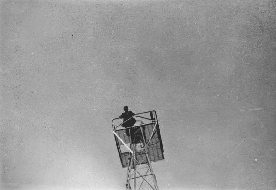
CY Martin adjusts wiring in a 24-inch airway beacon light. Date and location
unknown.
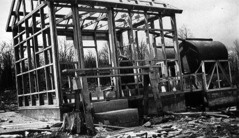
Photo submitted by Joe Jennings
Light Line Airway Beacon Under Construction, 1930’s
Location unknown
Submitted by Joe Jennings
Light Line Construction, Woodruff, Idaho, June 1930
 Submitted by Joe Jennings
Light Line #9 Construction, Woodruff, Idaho, June 1930
![]()
Photos and historical data submitted by Steve Wolff
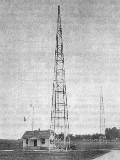
Laramie FSS Radio Beacon (LAR), Wyoming
Laramie FSS was commissioned 1927 and decommissioned on September 29, 1991. This building is the former FSS station at Laramie — now a terminal.
The rectangle white sign is a 90 year old airway beacon (as of 2007). These were manufactured by American Gas Accumulator Co., Elizabeth, NJ, USA, and were powered by acetylene gas allowing beacons to operate for up to 6 months unattended. This beacon is missing the six foot pylon that attaches to the top of the unit in the photo. On top of the pylon would be the prismatic lens that flashed 150 times per minute and could be seen about 10 miles distant. Usually these were placed every three miles between the 50 foot towers. This short one was used in the plains where there were no obstructions. Bigger ones on 21′ – 51′ & 84′ towers were also used. This particular beacon is owned by a private party.
There were a string of these beacons from New York City to San Francisco in the early ’20’s before any navigational aids appeared on the scene. They also had a sun switch that turned the beacon on/off with darkness/sunlight. Hi tech!! Very rare find. It appears the globe is missing.
______________
![]()
Photos of Medicine Bow #32 Radio Beacon, Wyoming, 2006
Photos submitted by Steve Wolff, Wyoming
Mr. Wolff is looking for assistance in restoring this site to it’s original condition.
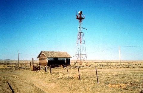
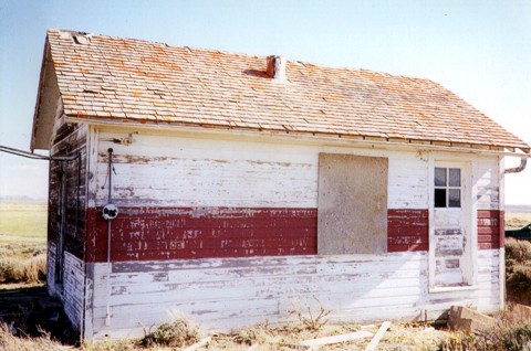
Medicine Bow building looking northeast. Typical of government built beacon sites, this building is 14×22 feet with a 51 foot airway tower. About 2/3 the way up the tower you can see the catwalk that leads out to the windsock. Between the building and the tower extends the sidewalk terminating in an arrow pointing towards the next beacon site, in this case, pointing to Rock River beacon. The whole affair was lighted from overhead so it could be seen at night.
Construction started in 1929 and was completed in 1930. According to the Aircraft Year Book, this site was the last station constructed to complete the entire NYC-SFO Low Frequency Range system. The building in this photo is very solid. It’s two rooms, one for living quarters and the other, a much smaller room, contained the radio gear and later in history, teletype. It was heated with a coal stove and electric power was supplied locally to operate the electrical equipment. In case of power failure a 550 gallon fuel tank (missing) supplied fuel to run a generator. The fuel tank was normally located between the caretakers quarters (above building) and the beacon tower.
Historical note: The Union Pacific Railroad is very close and Highway 30, the first to connect the Midwest with the West is 1 1/2 miles away. The Overland Trail from the 1800’s is very close and of course this Low Frequency Airway. They all converge at this point! Mr. Wolff is looking for assistance in restoring this site to it’s original condition.
______________
The Department of Commerce demanded these sites be kept in pristine condition including mowing lawns. Flight check pilots were always complaining about weeds up against buildings.
Interesting Side Note: The 1935 mystery novel, Obelists Fly High by C. Daly King, features a detailed description of a transcontinental flight in a Boeing 247, with much of the plot action occurring during an emergency bad weather stop at Medicine Bow field.
______________
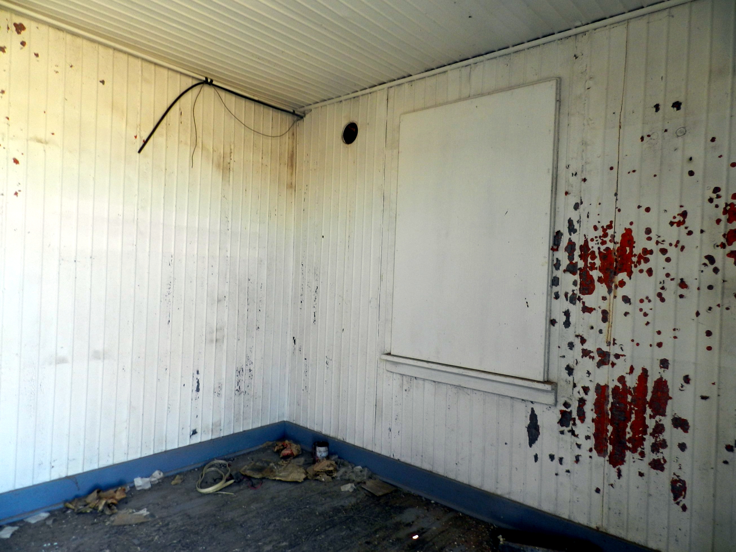
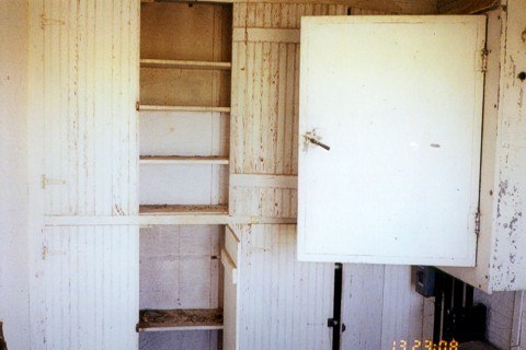 Interior photo. Open cabinet door leads to the junction box located on the north wall. Cabinets would hold fuses, signal flares, and other items.
______________
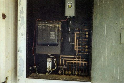 Interior photo. North wall cabinet contains a Westinghouse switch box and circuits.
______________
 Interior photo
______________
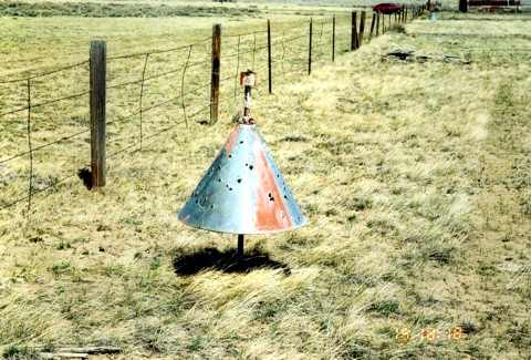 This bullet-riddled boundary cone is located on the west end of the beacon site, inside the fenced boundary
______________
 This boundary cone is located on the north end of the beacon site. The red and white tank in the background is the water supply for the city of Medicine Bow.
______________
 Boundary cone looking south east. The cone and stanchions are in place with wood markers albeit warped and faded.
______________
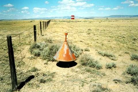
 This boundary cone is located in the south east corner of the site and still houses its original 34 watt light bulb
______________
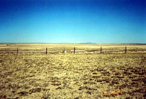
 Obstruction pole on the approach end of the runway. Photo is looking north east.
______________
 This boundary cone is located in the south east corner of the site. A U.S. concrete property marker can be seen laying on the ground along with the triangular stanchion for supporting 1×16 red and white wood runway markers.
Submitted by Steve Wolff
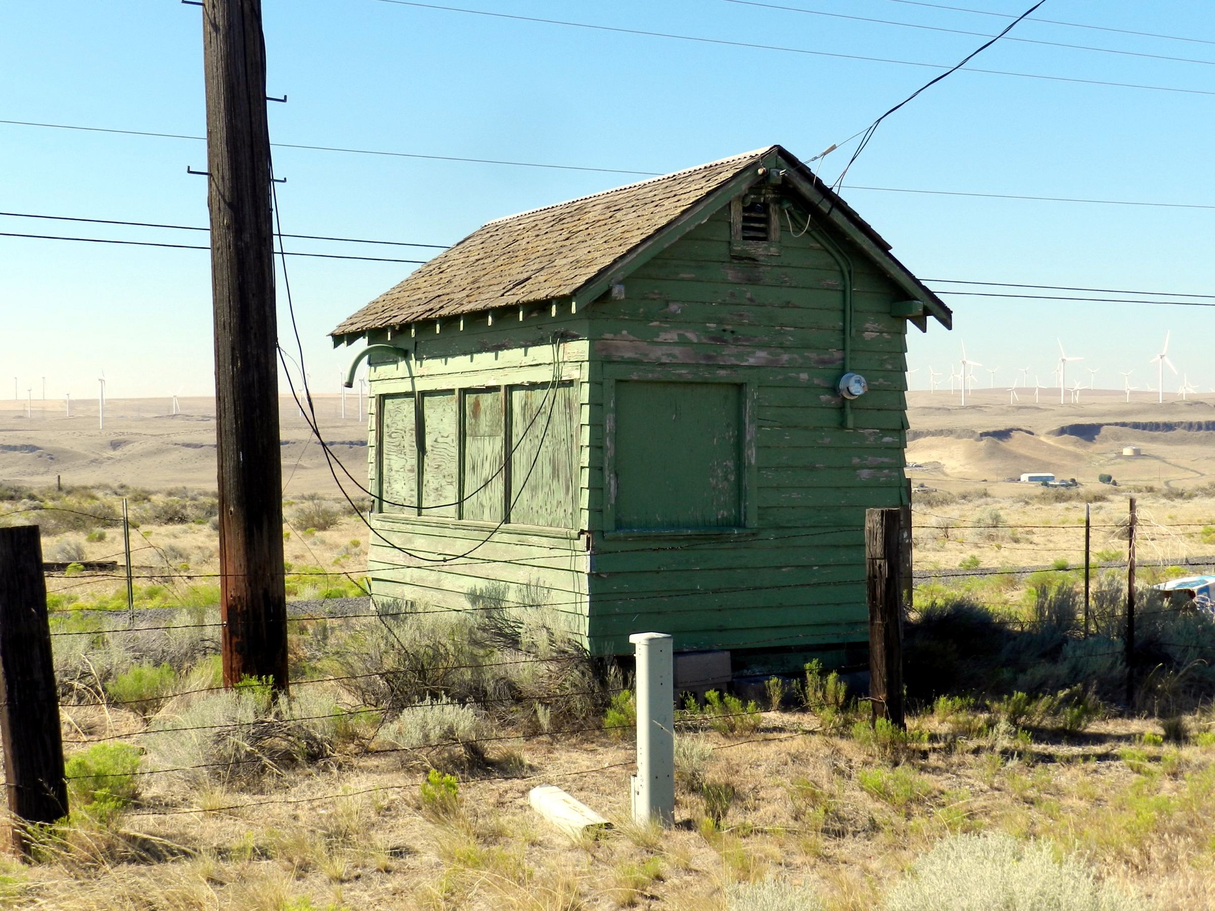
Latham Radio, Site 23, Wyoming (year unknown)
 Four-Course Radio Range, Whitmore, CA, 2019
Located 5 miles west of Whitmore, California, this is one of the few remaining four-course radio range locations. Wooden poles were used instead of steel antennas because metal would have interfered with the pattern created by the loop antennas. Eventually, these were replaced by the VOR.
40°37’30.88″N 121°59’48.60″W
 Early low-frequency radio station (such as the above photo) based on crossed loop antennas; later installations used Adcock antennas for improved performance.
Photos by Jack Bell and Department of Commerce (DoC), courtesy of his son – Bill Bell
Historical Photo Background
The 2nd transcontinental airway was established across the country from New York to Los Angeles in mid 1929.. . However, not all the beacons were completed by July 1929. Transcontinental Air Transport (C. Lindbergh) established the route as a plane-and-train service coast-to-coast. They partnered with Pennsylvania and Santa Fe Railroads for night travel where beacons were not ready. Result – coast-to-coast in 48 hrs.
Charles Lindbergh – was on staff as the Technical Committee Chairman for the entire T.A.T airline venture. He was also a stockholder and the face of T.A.T., of course a household name in 1927 onward. (a plus for getting investors on board and for marketing the air service).
Service began July 1929. Sept 1929 was the first crash. This occurred west of Albuquerque at Mt. Taylor. By the time the western New Mexico beacons were all in place, the four-course radio navigation range was being deployed. Also, post-crash(es), moving the beacons south of the New Mexico mountains in a shorter air-line was desired, and the Department of Commerce forces (including Jack Bell who worked for the DoC from 1930-1932) did most of the work on relocation’s.
Per the photos, no challenge was too great for these crews. Removing the beacon towers left concrete arrows behind at many of the sites, but when re-installed in 1930-31 (mostly) the arrows were non-critical due to radio navigation signals, voice radios, enclosed cockpits, and better sectional charts. Only rarely across the US were arrows em-placed as of 1932. These were mainly the rare 1930’s metal arrows but were not always on airfield sites.
Relocating beacon sites was probably routine for these crews, but the obstacles were unique. Still, the technology was simple and reliable. One has to view these photos through a 1929 lens.
Corrections and historical information provided by Steve Owens and Dave DuPree.
View the beautifully restored LA-A Hut 62 site
![]()

Click here for additional information on on Site 74
![]()
![]()
Both Steve Ownes and Dave DuPree have sought out unique beacon sites searching in Arizona for a concrete arrows and in New Mexico for a metal arrow other than airfield locations. So far, neither search has paid off for them. Metal arrows were easy to remove when a beacon site was shut down. They salvaged and restored the metal route arrow above for LA-A 59B, El Morro emergency field. Donated by the landowners at El Morro, this restored arrow is one key asset of their museum at Grants, New Mexico.
View several great historical videos from Cibola County Historical Society at Grants, New Mexico
Albuquerque Historical Radio Log (ABQ), New Mexico, between 1931-2007
The Albuquerque Radio Log is an incredible 188 page handwritten log of personnel and events that occurred between the time Albuquerque Radio was commissioned on April 1, 1931 to the closing of the Albuquerque AFSS on May 21, 2007.
Albuquerque Historical Radio Log (6.7mb PDF)
Columbia Airway Radio Station, Ohio, 1931
Former employees stationed at Columbia Radio:
C.C. Weigand
C. Malcomb
W.A. LaRue
R.E. Grages
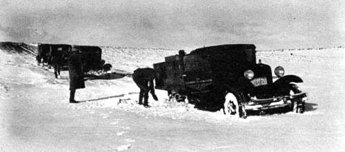
Elko FSS (EKO), Nevada. Supply Truck, 1931
Crew preparing to depart from Elko, Nevada with a load of material for the station at Buffalo Valley, Nevada in 1931
Reading a Light Line in 1931
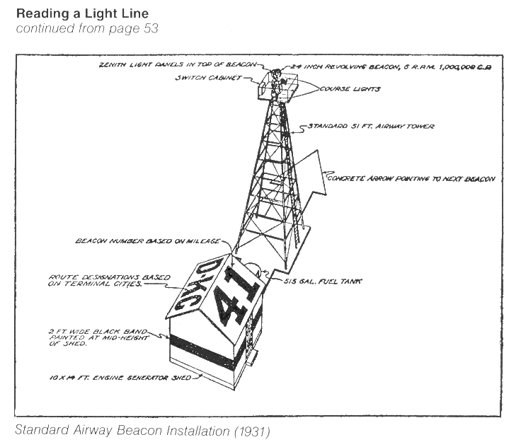 Light Line Tower
ANDERSON INFIRMARY
1421 TWENTIETH AVENUE
MERIDIAN, MISS.
November 30. 1931
Mrs. F. J. Jennings
509 Third Street S. E.,
Washington, D. C.
My dear Mrs. Jennings:
We have meant to write you before now, but for one thing it was a very hard task, and then we have been so very busy.
It was such a sorrow for us to have to give up Mr. Jennings. The doctors and nurses did everything possible for him, and he put up such a game fight from the very beginning, but it seems it just had to be. He made a lasting impression upon us all. He had a dynamic personality, which we all felt the moment Dr. Fowler brought him in. He was brought in by a Doctor Fowler, who lives out from Meridian, about two-thirty P. M. Wednesday, November 11th. Dr. Anderson insisted that he be operated on that afternoon, but he would not consent, as he said he had just about another week’s work to complete and then he was getting a leave of absence to be with you. Doctor Anderson was so worried over him, however, that he had the Laboratory Technician make another blood count that night about ten o’clock, after which he was told that he was taking his life in his hands if he did not have the operation. He then consented and was operated on around twelve o’clock, when it was found that periotinitis had set in. We felt that with his wonderful constitution he might be able to combat it. I want to explain to you also the reason we did not telegraph you immediately. Your husband would not consent to have you disturbed. All during his ill-ness his every thought was to save you worry. We begged him all along to let us communicate with you and when he kept refusing, we got in touch with Mr. Thomason in Birmingham and had then wire you. We felt that you should know and know at once that his condition was serious. We were so sorry you could not come to him, but we were so glad his sister got here in time. When we knew she was coming, we all prayed that he might live to see her and know her. And he did. Of course he was so sick that he could not talk to her very much, but still it must have meant such a lot to him to have his sister come to him. We all fell in love with Mrs. Glennon. We never felt that she was a Stranger. It was so hard on her to have all the responsibility of looking after everything alone. We helped her all we could, however, and I feel that we did a little toward making her burden a little less hard.
I am Dr. Andersen’s sister. I help him in different ways around the hospital, – – office, kitchen, and in fact a little of everything. I spent nearly seven years in Washington during the war and after, and am so familiar with the neighborhood in which you live. During practically the whole time I lived at 206 A Street Southeast and took my meals on Third Street S.E. I went in and told Mr. Jennings that I wanted to talk Washington with him and he smiled and said he’d love to and asked me too come in and stay with him. He was not able to be disturbed and so of course I did not talk to him. You’ll never know how grieved we were for him to go. If he had not been so lovely in his manner and such a cheerful person in his deepest sufferings, perhaps we would not have felt it so keenly. I want you to feel that everything in the world was done for him that was possible. My brother worked with him with all hi a power. He came over about eleven o’clock the last night he lived and spent the whole night. Your husband wanted him. He loved to have “Doc”, as he called him sit by him and talk to him, holding his hand. Dr. Anderson, as Mrs. Glennon will tell you, is a very lovable person. To know him is to love him. During the six days your husband was here, he learned, to love him. Many times Dr. Anderson came to him just to comfort him. We called in two other very fine Doctors to consult with and they agreed that everything possible was being done.
I wish there was something that I could say to you to make your grief less hard; but there isn’t. I want to make you feel that every one was kind to him. He said we treated him as though he were a relative. He had lots of flowers given him by different ones. It is so hard for our loved ones to be alone in their last illness, but I want you to know that, although we know that nothing could take the place of his family with Mr. Jennings, we did all we could to cheer him up. I want you all to know that. It may be that I shall go to Washington next summer and if I do, I, shall look you up. I want very much to see you and the three babies. I have a little son seven years old, an adorable little fellow.
I have not meant to write such a long letter, but it has lengthened out in spite of me. I know that your burden is heavy and I am hoping your new baby has come by now to help make your heart a little happy.
I am enclosing, herewith, an itemized bill, as I am sure you want to get all those details off your mind as soon as possible.
In closing let me ask you to accept the heartfelt sympathy of us all way down in Mississippi. We have all thought of you so much, – you and your babies.
Very sincerely,
Claudia A. Estopinal
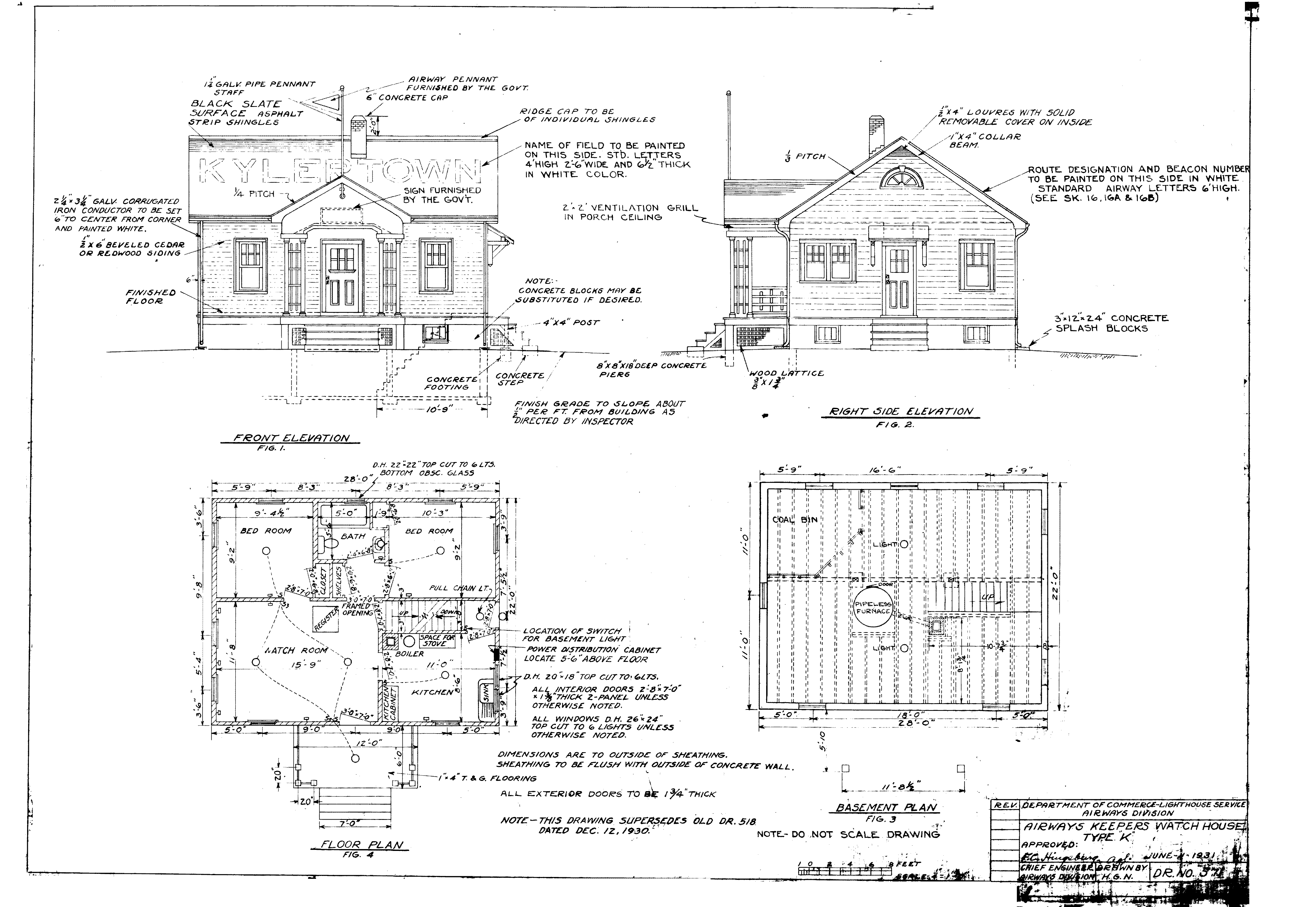
Department of Commerce Airways Keepers Watch House K Floor Plan, June 11, 1931
Submitted by Roger C. Bodtke
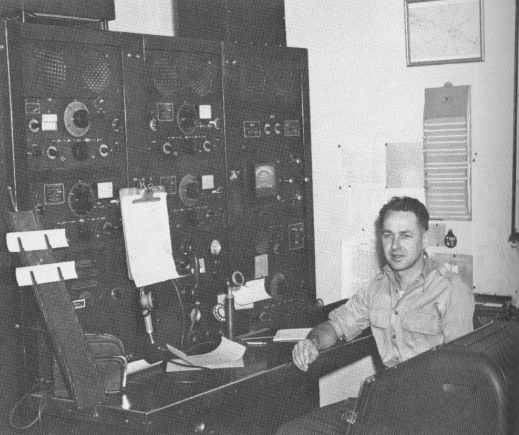
Omaha FSS (OMA), Nebraska, about 1932
The first Inflight position
Cambridge Airport, Ohio 1932
Photo of Cambridge Airport in 1932 taken from an Ohio National Guard aircraft. Cambridge Radio is near the middle right next to two biplanes on the ground. In 2003, this site was just turned into a new high school campus.
Submitted by Ed Dietz
Albany Airway Radio Station (ALB), New York, 1932
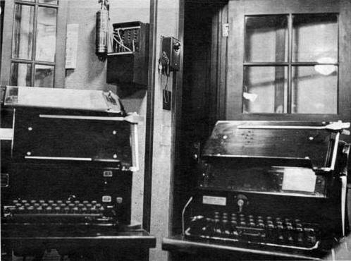
Model 15 Teletype equipment, Albany Airway Radio
Wendover FSS (ENV), Utah, about 1932
Located in the far western desert, Wendover had been an airways installation since the 1920’s and was commissioned in 1932 as a radio beacon and flight services station.
______________
Wendover FSS Employees: A. A. Anderson, J.F Cobb, Joseph H. Tippets, Ray Tucker, and John Renfroe
Kohler Equipped Beacon, in the desert near Columbus, New Mexico, 1932
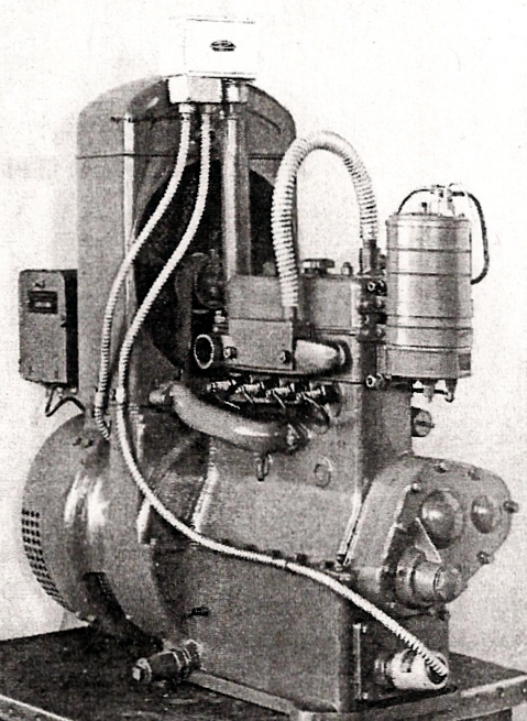
Kohler electric plant equipped with thermostatic control and oil and carburetor heater to operate on high isolated beacon sites where freezing temperatures endanger performance.
Burrows carrying water barrels up Newman Peak, Arizona for mixing concrete for the foundation of the beacon.
El Morro Radio, New Mexico (year unknown)
Wintertime at El Morro Radio, commissioned in 1933
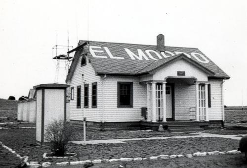
Submitted by Rose Kern
El Morro Radio, New Mexico (year unknown)
The El Morro Radio building, originally commissioned in 1933. The two western New Mexico CAA/FAA intermediate airfield stations were site 59B at El Morro CAA airfield and site 63 at Acomita CAA airfield. The next radio navigation site west of El Morro was site 54A, Deep Lake, Arizona.
Photos submitted by Richard M. Barrett
Santo Department of Commerce, Texas, 1933
A communications station that collected and reported weather and messages
______________
Newell Barrett, about 1933, was the second man on a two man team for the Department of Commerce. He became a CAA employee and later an FAA manager. Newell served from the bottom to the top of the Civil Service grades. He retired in 1953 as manager of the overseas communications station, WEK, in New Orleans, La., which employed 103 people.
______________
About 1933-37 – Newell is holding his son, Richard Barrett, the person who submitted these photos.
______________
Date unknown. The Santo intermediate airfield was located here. It was a grass field then and still is. In the foreground is Turkey Peak where an airway beacon was located on its top. Newell Barrett (in above photos) serviced the beacon and changed the lamps as part of his job.
Idaho Falls INSAC (IDA), Idaho, 1934-1936
This building housed the Federal Interstate Airways Communication Station (INSAC) from 1934 to 1936. Actual date of photo is unknown.
Submitted by Edward Rajki
Fernley Intermediate Field Radio Station, Nevada, Site 22, 1934
Fernley radio, located about 3 miles NE of Fernley, NV (30 miles ENE of Reno), was commissioned in 1930 and decommissioned in 1937. Fernley provided assistance to pilots flying the San Francisco-Salt Lake Airway.
Cambridge Radio, Ohio 1934
Sitting left to right are Robert Baumgardner (1911-1987) and Station Manager, Ward Hixon (1893-1983). Standing left to Right are Stanley Beaver (1904-1991), Dave Gnessin (1914-1991), and the other is unknown.
List of Radio Airway Beacons, Wyoming, 1934
The following is a 1934 list of known radio beacons in the state of Wyoming that stocked aviation fuel.
| Site # | Radio Beacon Name |
| 7 | Altamont |
| 9 | Leroy |
| 10 | Lyman |
| 12 | Granger |
| 14 | Bryan |
| 17 | Thayer Junction |
| 18 | Point of Rocks |
| 20 | Bitter Creek |
| 21 | Tipton |
| 22 | Red Desert |
| 23 | Latham |
| 24 | Cherokee |
| 26A | Knobbs |
| 28 | Walcott |
| 29B | Dana |
| 31 | Old Carbon |
| 32 | Medicine Bow |
| 33 | Rock River |
| 34 | Lookout |
| 35 | Bosler |
| 36 | Howell |
| 37 | Laramie |
| 38 | Sherman Hill |
| 39 | Arps Ranch |
| 40 | Silver Crown |
| 42 | Archer |
| 43 | Hillsdale |
| 45 | Pine Bluffs |
![]() Beacon 27 C-GF (Cheyenne – Great Falls) CAM Route 28, Wyoming Air Service contract.
Beacon 27 C-GF (Cheyenne – Great Falls) CAM Route 28, Wyoming Air Service contract.
Location: 4423N/10643W at Johnson County Airport, Commissioned: June 1934
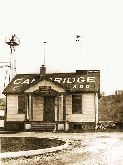
Cambridge Radio, Ohio, 1935
Cambridge radio and teletype equipment. A young ham operator could come in and practice typing on a unused teletype machine. The Chief operator was understanding to the local ham operators. Photo by Beaver.
Photos submitted by Jim Jackson
Cambridge Radio, Ohio 1936
Cambridge Radio building. Photo was taken from a lighted tower.
Cambridge Ohio FSS last day of operation was 23 May 1945, and at that time Zanesville FSS took over with a 45 watt transmitter on HF phone. Article was obtained from the Zanesville Signal dated 24 May 1945. Personnel that transferred to the Zanesville FSS were Earl Casner Chief Opr; Ward Hixson Asst. Chief; Clyde Brown Operations.
 P-39 Aircraft parked on the ramp
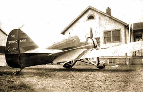 Dart 3 Aircraft parked on the ramp
Photos by Stan Beaver
Cambridge Radio, Ohio 1936
Stan Beaver at the radio when Stan was assigned from Martins Creek, Pa. He was a 42 year employee of the Airway Radio Station (ARS).
 Cambridge Radio personnel, left to right, are Stan Beaver, unknown, and Dave Gnessin.
![]()
Submitted by Ed Dietz
Albany Airway Radio Station (ALB), New York, 1936
Albany, New York Airways Radio transmitter building on Wolfe Road
![]() Albany, New York LM/F Range (SBR AZ) transmitter building, 1936
Albany, New York LM/F Range (SBR AZ) transmitter building, 1936
Transmitting towers were spaced 600 feet apart, and were 133 feet tall. The automobile is a 1935 Hudson “Super 6”
Cedar City FSS (CDC), Utah, 1937
Submitted by Ed Dietz
Albany Airway Radio Station (ALB), New York, 1937
“Cone of Silence” marker on the Albany LM/F Range
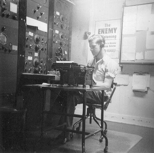
Ephrata Airway Radio Station, Washington, latter 1930’s
Station operator working at the position. The equipment includes rack-mounted RCA multi-band receivers with Model 14 and 15 teletypewriters in the rear
Burley Airway Radio (KCEI), Idaho, 1937
Former employees stationed at Burley Radio:
G.W. Hurst
Busby
Thurman
Ross
Wall
Peirce
Nee
Storm
Silver Lake Radio, California, 1938-1950
Chicago-Midway, Unknown Facility, 1938
Unknown type of radio operator, perhaps an airline dispatcher
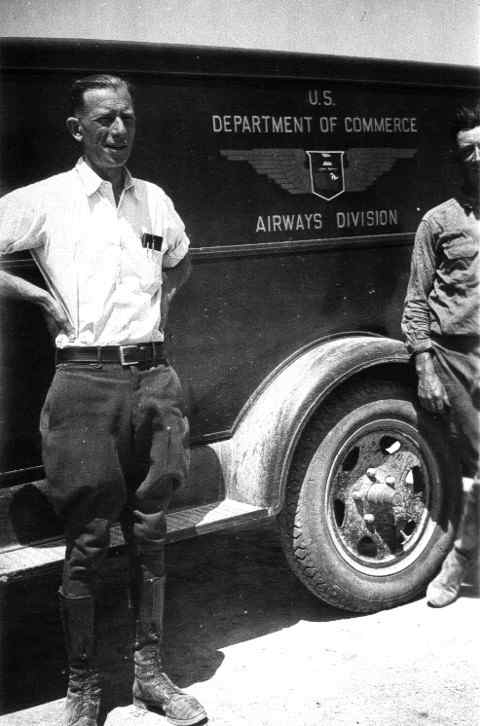
Airway Technician, U.S. Department of Commerce
Airways maintenance technician, “Dusty” Rhodes takes a break alongside his sector truck in the late ’30s. Unlike their modern counterparts, the airway station keepers were required to wear distinctive uniforms on the job.
![]()
Its beam flashes across the sky every five seconds, 720 times an hour. The light is visible for miles and has been guiding planes to safety for 70 years. The Mounds Park beacon, or as it is formally named, the Indian Mounds Park “Airway” Beacon, has been a landmark in Dayton’s Bluff since 1929.
At one time over 600 of these beacons defined nighttime airway corridors across America. The Mounds Park beacon was part of the system that defined the route between St. Paul and Chicago. But electronic guidance equipment eventually made the beacons obsolete and, just like their lighthouse counterparts, most of them eventually went dark. Our beacon is the last of its kind.
It was a marvel in its time and is still impressive by today’s standards. The tower is 110 feet tall. The beacon itself is 24 inches in diameter.
![]()
It was designed by the City of St. Paul’s Bureau of Bridges and built by the St. Paul Structural Steel Co. During a refurbishing in 1994-95, the tower’s original black and chrome-yellow color scheme was restored, replacing the red and white colors that had graced the tower in modern times. The mid-90s restoration was accomplished through a coalition of groups including the Metropolitan Airports Commission, the FAA, the State Historic Preservation Office, the Indian Affairs Council, the State Archeologist and the City of St. Paul.
The beacon has been an attraction ever since it was built. At least three postcards, probably issued in the 1930s, featured the beacon, showing Indian burial mounds in the foreground with the St. Paul skyline in the background.
Besides guiding airplanes, our beacon also welcomes trains, boats and, of course, weary automobile commuters as they return to Dayton’s Bluff from the far reaches of the Twin Cities in the dark of night.
![]()
Observing the beacon is also a very good way to determine prevailing weather conditions. As the beacon sweeps clockwise through the atmosphere, its beam can appear nearly invisible, extremely bright or anything in between, depending on what is in the atmosphere that night.
The beacon’s most spectacular display can only be seen a couple of times a year. Watch its beam when the temperature is near zero and there is an ice fog in the air. As the beacon rotates a hazy glow will be seen in the sky until the beam is pointing directly towards your position. Suddenly, a brilliant shaft of light will appear to shoot straight up into the sky and disappear just as quickly, only to appear five seconds later when the beacon swings around again.
No matter what the sky conditions, Dayton’s Bluff ‘s own Old Faithful will be there, lighting up the sky every five seconds for years to come just as it has for the past 70 years.
And just to make sure the beacon looks its best, it received a new coat of paint in June 1999.
Here are three postcards from the 1930s that featured the beacon
This page was last updated in 1999, courtesy of the University of Minnesota
Rapid City National Weather Service, South Dakota, 1939
Weather Bureau station (left) and hanger at the Rapid City Airport in 1939. Site is presently Ellsworth Air Force Base.
Anchorage Control Station (ANC), Alaska, 1939-1941
Buffalo Radio (BUF), New York (date unknown)
U.S. Airways Radio Station WWAB, Department of Commerce, was located in Buffalo, New York. The Station held the call letters of WWAB until 1961.
![]()
Harrington Ranch Airway Radio Beacon Site 39, New Mexico
This beacon was located at Harrington Ranch Field between El Paso and Columbus, New Mexico, on the Los Angeles-El Paso Airway. A Fan marker was also installed here.
Cross City CAA/FSS (CTY), Florida, Between 1940 and 1950
Cross City served as a CAA and FSS station from July 1940 to May 17, 1960
Historical List of Alaska Flight Service Managers and Staff
January 1 1940 – The CAA established Region 8 covering all of Alaska. Marshall Hoppin was appointed Regional Administrator.
Assistants were:
Walt Plett, Assistant. RA
Al Hulen, Chief Communications
Jack Beardslee, Airway Engineer
G.A. Whittaker, Chief Fairbanks
Bill Hickock, Chief Anchorage
Al Hulen relieved Hoppin as R.A. (Al Hulen was the First Communications man to become Regional Administrator in the CAA).
Staffing of stations were as follows:
1940
Gravino Island – Hoilingsworth
Cordova & Fairbanks – Whittakerm
Juneau -Vic Post
Nome – Grant McMurry
Ruby – Geo Beckett
Summit – J. Flynn
Talkbtna – Ed Musgrave
Yakutat – Thomas Cianfrani
1941
Aniak & Kenai – Lawton
Kodiak – Carl Bassler
McGrath & Moses Point – Norris Kumler
Sitka – Ray Operlund
1942
Bethel – Wootan
Farewell – Mckay
Galena – Ralph Jennings
Gulkana – Johnson
Gustavus – Dufrane
Homer – Gulley
Iliamna – Uzzell
Kotzebue & Minchumina – Dick Collins
Northway – Carl Shute
Yakataga – Joe Tippetts
Big Delta – Inman
1943
Nenana – Robert. Leise
Tanana – John Andrews
Unalakleet – Ed Klopp
1944 and later
Bettles – Robbins
Skwentna – George Wilkins
OTHER – Precise Date Unknown
King Salmon (48) Plagge
Middleton Island (MRL)
Petersburg – Vernon Counter
Point Barrow – Roy Roose
Fort Yukon (WB 278KC) – John Flynn
The OFAC (Overseas Station) was commissioned at Anchorage Dec. 1, 1942 – E.F. Bill Hickok, Chief. The OFACS at Everett, Washington was commissioned at the same time to provide communications stateside. During 1942 Flight Assistance Service was officially inaugurated by CAA at all Stations.
![]()
Submitted by Steve Owen
Guadalupe Pass Radio Beacon Site, EP FW9, Texas, about 1940
Aerial view taken by Life Photographer, possibly David Scheram
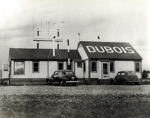
DuBois Radio (DUJ), Pennsylvania, about 1940
Station types of the late 1930’s or early 1940’s. There were several versions of this type of add-on structure.
![]()
Submitted by Steve Owen
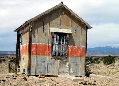
Cassoday Radio Beacon Site, Kansas, 1940
Aerial view taken by Life Photographer, David Scheram
Submitted by John Keith
Mullen Pass Radio, Idaho, about 1940
John R. Keith at the radio console. He started his journey with the US Navy as a radioman on the USS Pelican, a seaplane tender. One of the skills he learned in the Navy was to pound out an
amazing number of words per minute on an old manual typewriter. John also took a photo of Amelia Earhart, probably on the day she was last seen alive.
After leaving the Navy, he joined the Civil Aeronautics Authority (CAA). His first duty station is believed to be at Mullen Pass, ID about 1940. Most of John’s career path is depicted below starting in July 1942. You will notice that he didn’t do a standard bureaucratic job advancement. He was insatiably curious, so he wasn’t too worried about the grade/position, rather, he wanted to experience new places as noted by his son, also John Keith.
| 07/42 Haines, AK | Aircraft Communicator |
| 02/43 Fairbanks, AK | Emergency Relief Communicator |
| 02/45 Gulkana, AK | Chief Aircraft Communicator |
| 05/48 Homer, AK | Chief Aircraft Communicator |
| 10/48 Anchorage, AK | Airways Operations Specialist (AOS) |
| 04/49 Haines, AK | Station Manager |
| 06/52 St. Thomas, VI | AOS |
| 12/52 Superior, MT | AOS (until 10/53) |
| Worked in civilian businesses | |
| 01/55 Battle Mountain, NV | Electronics Technician |
| 01/56 Galena, AK | AOS |
| 12/56 Yakataga, AK | Supervisory AOS |
| 03/58 Farmington, NM | ATC Specialist |
| 09/58 Santa Barbara, CA | ATC Specialist |
| 07/61 Washington, DC | Communications Officer (until death in 04/67) |
Haines Radio (HNS), Alaska, about 1940’s
Chief Albert (Whitey) Machin (left) and Carl Shute (right) at work in the Haines Flight Service Station, 1945/1946. Haines was commissioned on October 10, 1940 and decommissioned on January 11, 1953.
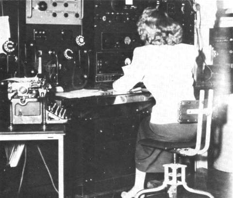
Radio Operator 1940
In the early days, both en route centers and airport towers often had to route communications radio stations such as this. These forerunners of Flight Service Stations (Interstate Airway Communication Stations -INSACs) were often manned by women, particularly during World War II.
Photo taken by Kermit Karns and submitted by John Spencer
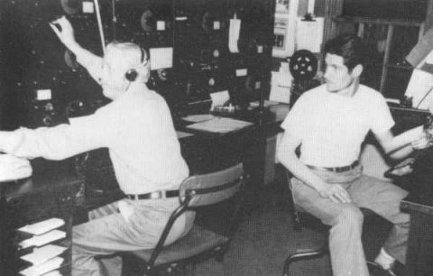
Cherokee, Wyoming INSAC Radio Crew, Site 24, 1940
Crew names, left to right, Cressie W. Hamre, E. G. Sins, Joseph Arlt, Arthur M. Brukhardt (rear), Chief; Earnest G. Igo, and Percy Spencer.
John Spencer, son of Percy Spencer (far right), said his father joined the CAA in 1940, and his first assignment was at the Cherokee Airways Station in Wyoming, where this photo was taken, according to his notes on the back of the print. See letter of employment offer, dated January 2, 1940 below.
______________
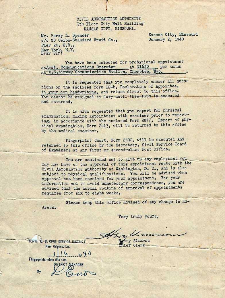 Offer of Employment Letter, Cherokee, Wyoming, Radio Site 24, January 2, 1940
Letter received from the Civil Aeronautics Authority in Kansas City, KS, offering employment to Percy Spencer
______________
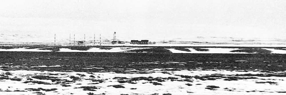 Photo taken by Kermit Karns and submitted by John Spencer
Panorama view of the Cherokee, Wyoming Radio Station
______________
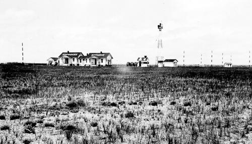 Photo taken by Percy Spencer and submitted by his son, John Spencer
The Cherokee, Wyoming Radio Station rested at 7,070 feet above sea lever
Everett OFACS (PAE), Washington
Overseas Foreign Aeronautical Communications Station at Everett, Washington, in the early 1940’s was the forerunner of the International Flight Service Station
Honolulu (HNL), Hawaii, Teletypewriters, 1941
Communications between the CW operators and the teletypewriters was via conveyor belt. Messages would come around to the drop-off point in front of the machine operators. From left to right, Pobanz, Pauley, and Casey, where often as not, it would miss the box below and sail in behind the teletypewriter machines.
Honolulu OFACS (HNL), Hawaii, 1941
The man with the “cans” on his ears is Johnny Johnson at the Honolulu OFACS, around 1941
El Paso to Pueblo Airway Sites (PDF)
Written navigation directions from site to site
Buffalo Valley Radio and Radio Beacon, Nevada, 1942
The left side of the building consisted of living quarters. The radio station was located in the center and the right side was temporary housing or bachelor quarters. The building on the left was moved to Battle Mountain and still in use today (2007) as an FAA office.
COMPARE PHOTOS: Below is the same photo perspective taken by Robert Pearce in August 2007. The sidewalk leading up to the entrance is still there but the old buildings are no longer there. The short vertical pipe in the lower right corner is the stub of the flagpole in the above photo, far right side.
Buffalo Valley Radio Lat/Long: 40°23’55.36″N 117°19’23.79″W
______________
Buffalo Valley Radio and Radio Beacon, Nevada, 1942
This is the location where the Buffalo Valley Radio Station was located in the 1940’s.
Submitted by Ted Manis
Gladwin CAA (GDW), Michigan, 1943
Gladwin CAA employees
OFACS Radio Positions
Radio positions in an Overseas-Foreign Aeronautical Communications Station WWII
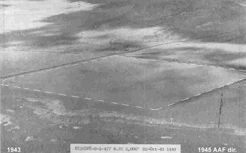
Fernley Intermediate Field, Nevada, 1943
Poor quality aerial photo of Fernley Intermediate Field, located within the doted white lines.
| History of Barrow FSS Facilities and Services | |
| Barrow, Alaska | |
| 11/04/44 | MRL range commissioned by Navy. Aerophare also in operation. AACS guards 4420, 3105 and 1638 kcs, point-to-point on 5065, 2610. Air/ground 4220 and 2994. |
| 3/30/46 | AACS decommissioned. Navy assumes operation. |
| 8/11/46 | 2912/4220 kcs commissioned. |
| 10/09/46 | Moved to new control station. |
| 3/13/47 | 130 kcs decommissioned. |
| 4/01/47 | Aerophare on 437 kcs relocated to 2 miles from SW end runway 2-20 with output of 2kw. |
| 4/08/47 | High powered “H” marker commissioned. |
| 9/08/47 | New MRLZ range commissioned. Located 13,768 feet SW end of runway 2-20 at a bearing 200 degrees magnetic. Operation of AN/CPN-11 range discontinued. |
| 3/07/48 | Homing beacon on 437 kc has been relocated to 15,000 feet from field on a magnetic bearing of 200 degrees. Old Homer will be used as standby. |
| 3/18/48 | Radar beacon AN/CPN-6 commissioned by AACS. |
| 3/20/48 | D/F station commissioned by AACS. D/F service on frequencies between 2 and 10 mcs. |
| 3/20/48 | Air/ground facilities commissioned by AACS; send-receive channels, 3452.5, 6355, 7560, 8200, 10645, 11445 kcs, A-1 emission only. |
| 4/01/48 | MEW range on 287 kc commissioned. Identification POOL. |
| 3/04/49 | Army airways established 24 hour guard on 8200 and 4595 kcs. |
| 3/24/49 | MLW radio range on 287 kcs converted to MHW. |
| 8/05/49 | Circuit 177V moved from Army receiver site to Army transmitter site. |
| 9/01/49 | Guard on 6210 kcs discontinued. |
| 3/16/50 | Off airways frequency 4055 kc commissioned. |
| 8/18/50 | Transmit/receive on 2912 kc decommissioned. 5037.5 kc commissioned. |
| 5/10/51 | 121.5 mc commissioned. |
| 3/30/53 | Air/ground 122.1, 122.2 and 126.7 commissioned. |
| 4/14/53 | Radio beacon 437 kc decommissioned. |
| 6/30/53 | 4220 kc decommissioned. |
| 9/20/53 | MHW radio range on 287 kc decommissioned. |
| 10/01/53 | FAA operation of Point Barrow discontinued. |
| Can you help? We are building a Flight Service historical page. Do you have access to any old photos related to Flight Service buildings, equipment, personnel, or other related historical data? | |
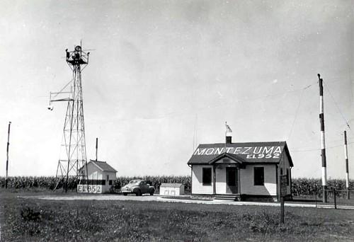
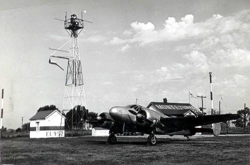
Montezuma Radio (KCEV), Iowa 1944-47
Photos submitted by A.C. Miller
Submitted by A.C. Miller
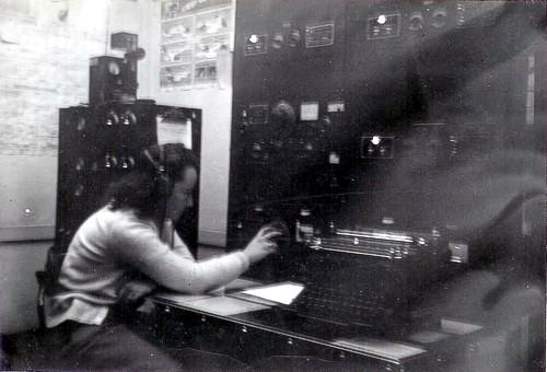
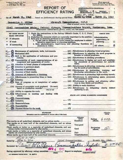
Montezuma Radio (KCEV), Iowa 1944-47
My mother, Gwendolyn Jeanette Miller was an Aircraft Communicator, CAF-5 and CAF-7 in Montezuma, Iowa during WWII, between 1944 and 1947. Submitted by Gwendolyn’s daughter, A.C. (Ace) Miller.
View photo of Gwendolyn’s CAA class photo, 1944
Submitted by A.C. Miller
Montezuma Radio (KCEV), Iowa 1944-47
Efficiency rating for Gwendolyn Jeanette Miller. Aircraft Communicator, CAF-5.
Submitted by Martha Ronaldson, daughter of above Arley Evans
Nenana Radio (ENN), Alaska, 1944
Arley Evans (1905-1980) working as a radio operator at Nenana Radio with his wife Bernice (see below photo). Arley was originally stationed at Nome Radio, his first Alaskan assignment, when World Ward II broke out.
Submitted by Martha Ronaldson, daughter of above Bernice Evans.
Nenana Radio (ENN), Alaska, 1944
Bernice Evans (1910-1999) working as a radio operator at Nenana Radio. Bernice’s daughter, Martha, said her mother was working in the local cafe and heard the news of the attack on Pearl Harbor. The CAA asked my mother if she’d like to join my father (see Arley Evans photo above) as a husband/wife team, so she attended the first class in Anchorage and was assigned to Nenana with her husband, Arley. There are many references to them in the Mukluk Telegraph (an Alaskan newsletter).
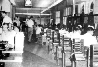
Seattle Military FSS & Seattle En Route Combined Facility, Washington, 1945
Courtesy of Society of Airway Pioneers
This was a combined facility with a military Flight Service Station and the Seattle En Route Center.
Memphis FSS (MEM), Tennessee, about 1945
From left to right are: Vernon Goldsmith, Earth Baumgartner, Walter Mewborn, Jean Franks, Carol Fakes (seated).o
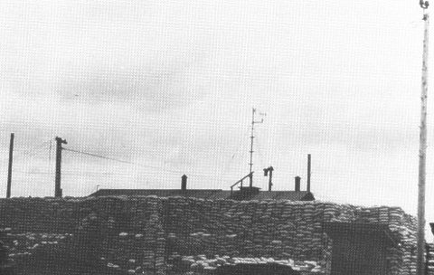
Everett OFACS (PAE), Washington, during World War II
Everett, Washington (Seattle) Overseas Foreign Aeronautical Communications Station. The facility was camouflaged during World War II.
Courtesy of Society of Airway Pioneers
Courtesy of Society of Airway Pioneers
Mullan Pass Interstate Airway Communication Stations (INSAC), Montana, 1946
Summer vs. winter photos
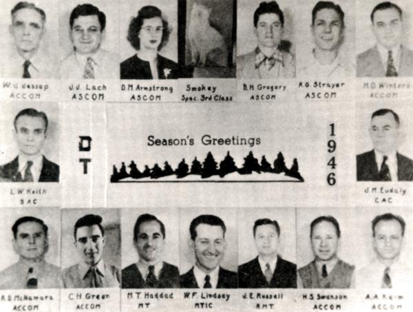
Courtesy of Society of Airway Pioneers
Detroit Interstate Airway Communication Stations (INSAC) (DET), Michigan, 1946
Detroit INSAC employees Christmas card.
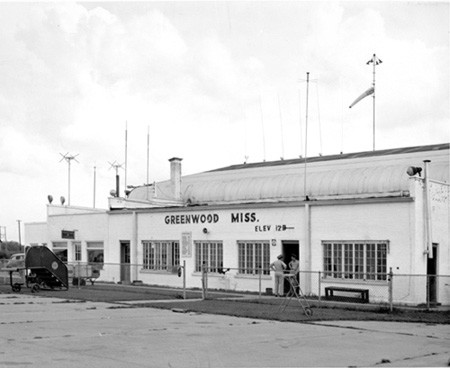
Greenwood CAA (GRW), Mississippi, 1946
Submitted by Ted Manis
Gladwin CAA (GDW), Michigan, 1947
Gladwin CAA employee, Tom Manis and his wife Eileen.
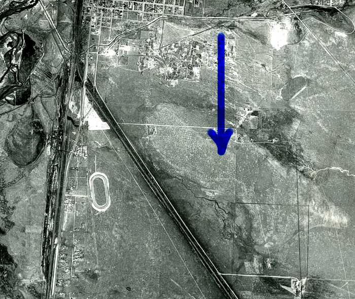
Photo submitted by Steve Wolff
Laramie CAA Intermediate Field (LAR), Wyoming, Site 37
Soil survey photo, June 30, 1947. The arrow points to the general location of the 115 acre former CAA intermediate field (the lighter shaded area). Most of it is covered up now with Mini storages. Some underground cable still remains. The field was probably in use between 1923 to 1934.
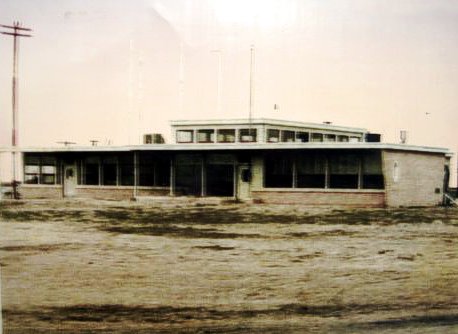
Submitted by Phillip Schulz
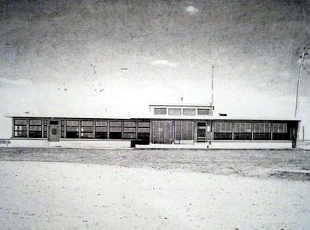
Submitted by Phillip Schulz
Russell FSS Building, Kansas, 1948-49
The city of Russell, about 2011, uncovered the windows around the top and opened and removed the false ceilings
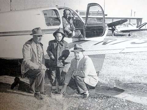
Submitted by Phillip Schulz
Russell FSS Building, Kansas, 1948-49
Photo taken in front of the Russell Flight Service Station just after the facility opened in the late forties. Names are unknown.
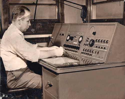
Eau Claire Radio Station, Wisconsin, 1949
Carroll Norgaard working the radio position
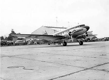
Greenwood Airport (GWO), Mississippi. 1949
A C&S DC-3 parked on the Greenwood ramp
Submitted by Phillip Schulz
Russell FSS Building, Kansas, 1949
Crescent City FSS (CEC), California
Date unknown
Crissy Field FSS, San Francisco, California (Crissy Field)
 Green Bay FSS, Wisconsin Commission Log, 1949 to 1971
Facility and equipment commissioning dates
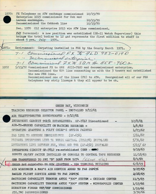 Facility Log
Seattle-Tacoma Airport Dedication Ceremony, July 9, 1949
São Tomé Lighthouse Flight Information Service, Rio de Janeiro, Brazil, 2003.
The São Tomé Lighthouse Flight Information Service is located on the Cape of São Tomé and is staffed with six radio operators and a supervisor. This is a helicopter airport that supports the oil platforms in Campos-Rio de Janeiro basin. Operations commenced on June 13,1999. São Tomé is a small coastal city in the State of Rio de Janeir.
The lighthouse is an important geographical mark not only for boats and ships, but also for the helicopters that fly to the oil & gas offshore platforms of Petrobras Company, in Campos Basin.
![]()
Submitted by Paul Domeier
Crouse-Hinds DCB-10 Beacon Light
Comments by Paul Domeier.
This particular unit was at KVCB Nut Tree in Vacaville, CA, and the local lore is that it was originally installed at Travis AFB (formerly Fairfield-Suisun Army Air Base) in Fairfield, CA… but as this is not a white/white/green flash unit, I’m not so sure of that.
There’s a real Buck Rogers type feature that doesn’t show up well in the photos: The unit has two bulbs, but only fires one at a time. The second bulb is spring-loaded in an auto-switchover mechanism that would slam it into the primary position if the first bulb failed… or maybe it’s supposed to be triggered by a remote switch?
![]()
![]()
![]()
![]()
Submitted by Steve Owen
San Rafael Mesa Airway Beacon Generator, Hut LA-A-62, Site 62, 2011
The US Forest Service, Passport in Time volunteers, plan to begin restoration of this generator hut in the fall of 2011, which supplied power to the San Rafael Mesa Airway Beacon, which was part of the Midcontinent Airway system.
![]()
Submitted by Steve Owen
San Rafael Mesa Airway Beacon, Generator Hut, LA-A-62, Site 62, 2011
Backside view of the same building at top of page
![]()
Submitted by Steve Owen
(Above) In 2011, Site 62 building was moved to Grants Airport and placed next to the Grants Flight Service Station for restoration. In this photo the base structure has been repaired and is almost ready for painting.
![]()
Submitted by Steve Owen
Site 62 Restored
The above and below photos are site 62 after a restoration project by “Cibola County Historical Society.” Completed in June 2012.
![]()
Submitted by Steve Owen
![]()
Submitted by Steve Owen
![]() Submitted by Steve Owen
Submitted by Steve Owen
![]() Submitted by Steve Owen
Submitted by Steve Owen
View several great historical videos from Cibola County Historical Society at Grants, New Mexico

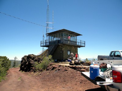
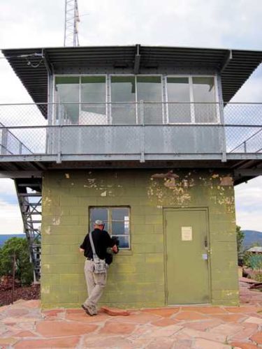
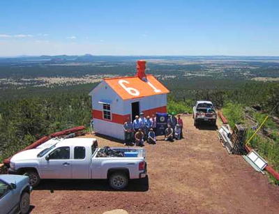
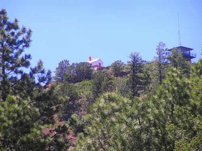
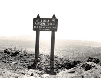
Above restoration was accomplished by the dedicated members of the Cibola County, New Mexico Historical Society
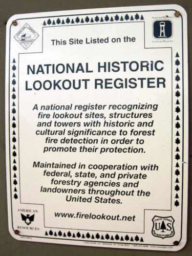
Medicine Bow National Register
A 203 page document requesting Medicine Bow Airport and surrounding structures be preserved as an historical landmark by the United States Department of Interior National Park Service.
This searchable file contains the initial application and 180 pages of historical supporting documents from 1929 to 1941.
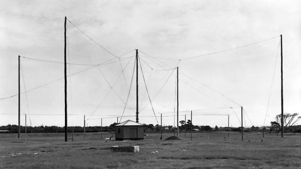
Four-Course Radio Range
Date and location unknown
![]()
Location of arrow is unknown.

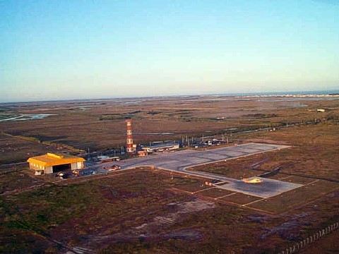