Submitted by Steve Wolff
Day marker, location possibly in Wyoming? Year unknown.
Submitted by Steve Wolff
Day marker, location possibly in Wyoming? Year unknown.
![]()
Photo submitted by Mick Batt
This concrete arrow is located in Washington City (St. George) on top of the 3,300 foot Shinob Kibe Plateau (37° 7’2.76″N 113°29’15.91″W). Contract Air Mail Route (CAM) #4 Los Angeles, California to Salt Lake City, Utah. Looking WSW.
![]()
Photo submitted by Mick Batt
Looking ENE. There is no arrow on the west end.
![]()
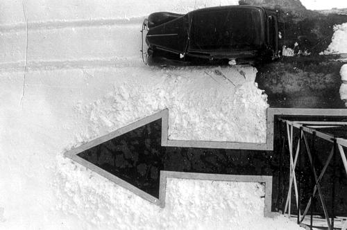
Submitted by Carl Schott
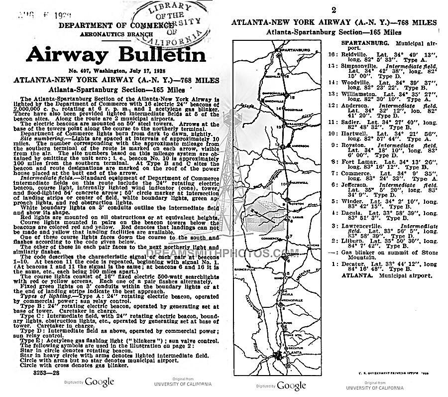
Possibly the last surviving concrete arrow in South Carolina, as well as on the Atlanta-New York airway route,
is located near Reidville, South Carolina. The arrow has been repainted, and a new sign has been posted.
The arrow and beacon #16 is located on the Atlanta-New York airway, shown in the 1928 bulletin below.
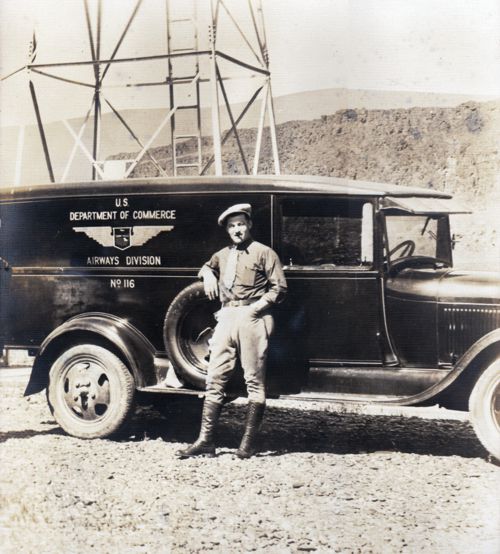
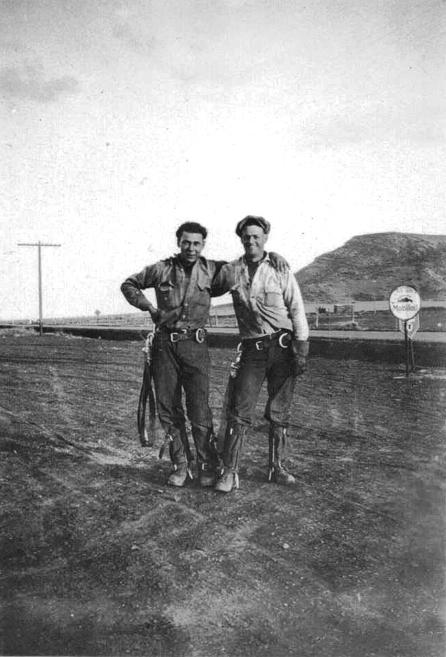
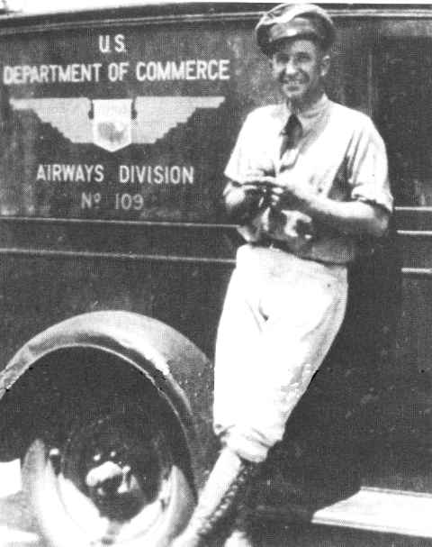
Submitted by Audra Oliver
Airway Technician, U.S. Department of Commerce
Airways sector truck and maintenance technician, name and location unknown. Unlike their modern counterparts, the airway station keepers were required to wear distinctive uniforms on the job.
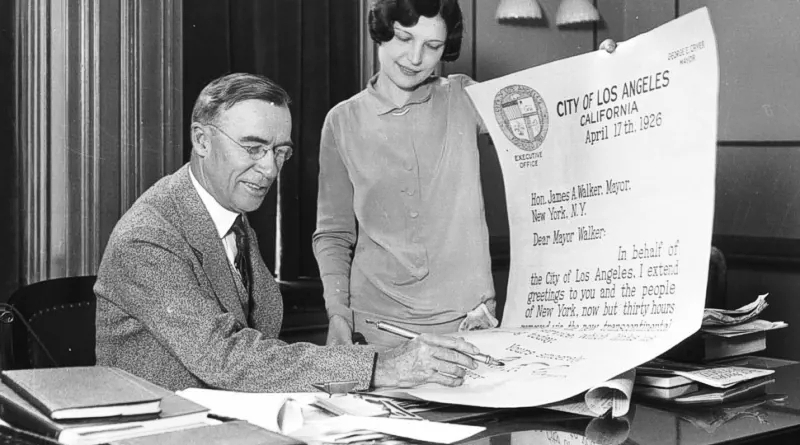
April 17, 1926
The mayor of Los Angeles sent an oversized letter to the mayor of New York City proudly stating it would cross the country in just 30 hours. This was only possible without the new lighted airway system. Once the new lighted airway was in place, that same letter that used to take 83 hours took just 33 hours to get from New York to San Francisco.
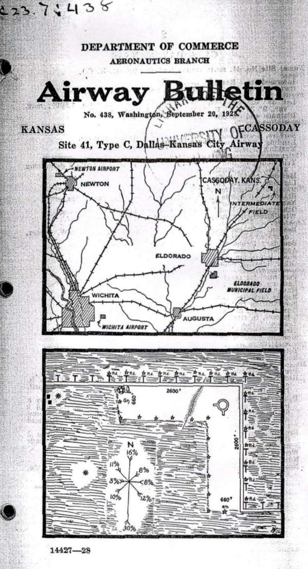
Cassoday, Kansas, Site #41, Dallas to Kansas City Airway Map, Sep 20, 1928
Department of Commerce Airway Bulletin no. 428, Washington DC, depicting the airway and the Cassoday Intermediate Field layout (lower diagram). The field was operated by the Department of Commerce using two grass runways in an ‘L’ formation, 2,600 feet long.
In the northwest corner of the airfield was a 2-million candlepower 24 inch rotating beacon which rotated at 6 RPM. The newly-built field had few amenities (no fuel, repairs, or telegraph) but did have nighttime lights around the boundary of the airfield.
By 1931, the starting point of the airway had been changed from Dallas to Amarillo, and this resulted in a renumbering of the airfields & beacons. Cassoday was changed from Site #41 to Site #34 and, according to the 1931 Bulletin #2, this beacon site was upgraded to a Flight Service Station (FSS), commissioned February 1931, and included course lights and a weather teletype.
![]()
Restored LA-A 59B, El Morro, New Mexico Metal Route Arrow
Not all arrows were concrete. Metal arrows were easy to remove when a beacon site was shut down. This 9B El Morro, New Mexico emergency field arrow was salvaged and restored in Grants, New Mexico.
Relocation of airways left concrete arrows behind at many of the sites, but when the site was re-installed in 1930-31 (mostly) the arrows were non-critical due to radio navigation signals, voice radios, enclosed cockpits, and better sectional charts. Only rarely across the US were arrows em-placed as of 1932. These were mainly the rare 1930’s metal arrows shown above but were not always on airfield sites.
![]()
The 2nd transcontinental airway was established across the country from New York to Los Angeles in mid 1929.. . However, not all the beacons were completed by July 1929. Transcontinental Air Transport (C. Lindbergh) established the route as a plane-and-train service coast-to-coast. They partnered with Pennsylvania and Santa Fe Railroads for night travel where beacons were not ready. Result – coast-to-coast in 48 hrs.
![]() Southwestern blowup view of above graphic.
Southwestern blowup view of above graphic.
![]() Transcontinental Airway Map, New York to Los Angeles, 1929
Transcontinental Airway Map, New York to Los Angeles, 1929
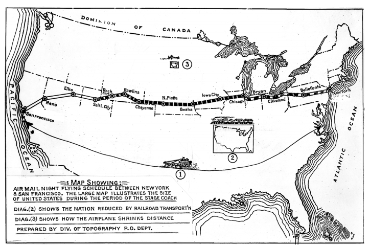
Map showing the air mail night flying schedule between New York and San Francisco. The map illustrates the size of the united States during the period of the stage coach.
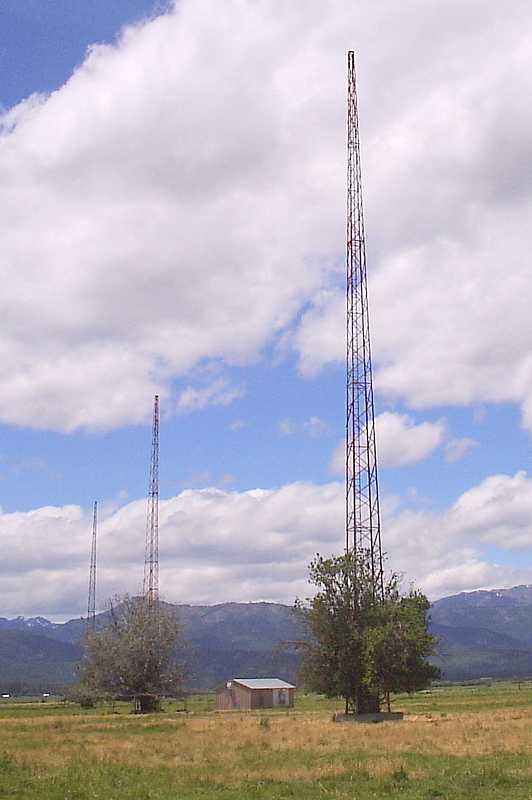
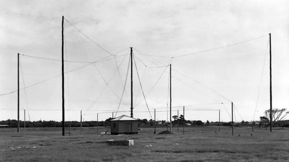
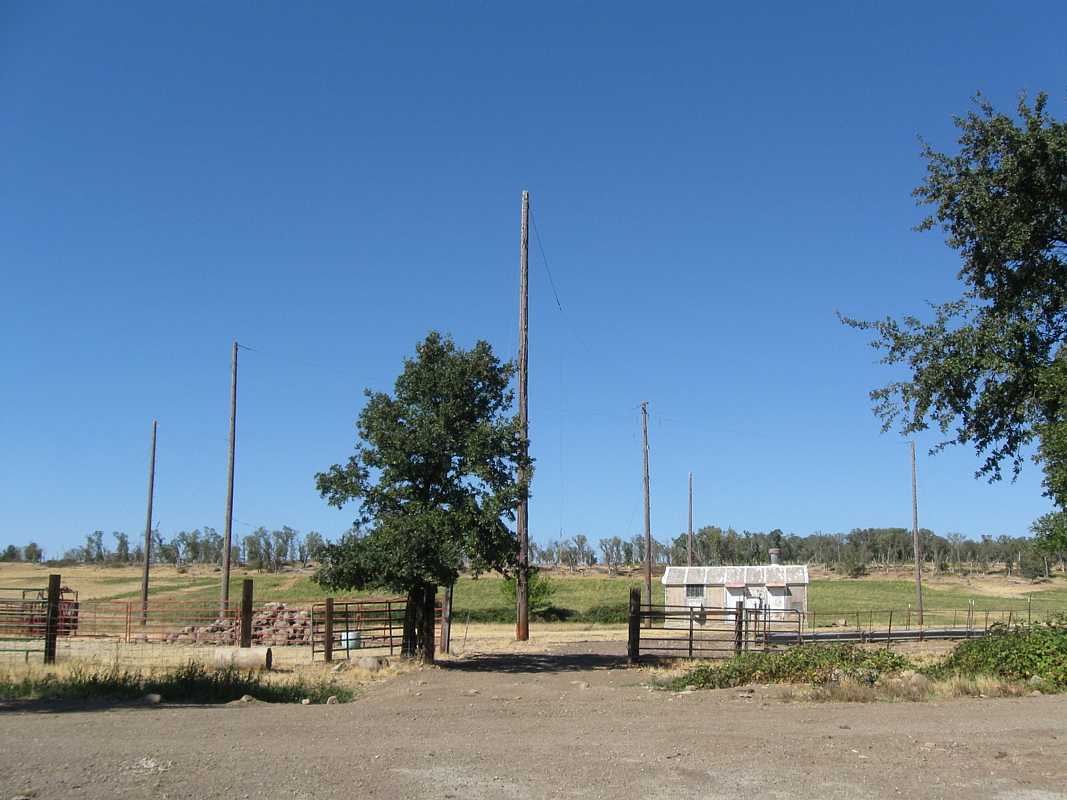 Four-Course Radio Range, Whitmore, CA, 2019
Located 5 miles west of Whitmore, California, this is one of the few remaining four-course radio range locations. Wooden poles were used instead of steel antennas because metal would have interfered with the pattern created by the loop antennas. Eventually, these were replaced by the VOR.
40°37’30.88″N 121°59’48.60″W
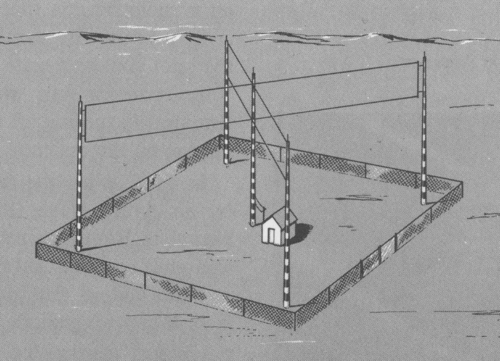 Early low-frequency radio station (such as the above photo) based on crossed loop antennas; later installations used Adcock antennas for improved performance.
Photos by Jack Bell and Department of Commerce (DoC), courtesy of his son – Bill Bell
Historical Photo Background
The 2nd transcontinental airway was established across the country from New York to Los Angeles in mid 1929.. . However, not all the beacons were completed by July 1929. Transcontinental Air Transport (C. Lindbergh) established the route as a plane-and-train service coast-to-coast. They partnered with Pennsylvania and Santa Fe Railroads for night travel where beacons were not ready. Result – coast-to-coast in 48 hrs.
Charles Lindbergh – was on staff as the Technical Committee Chairman for the entire T.A.T airline venture. He was also a stockholder and the face of T.A.T., of course a household name in 1927 onward. (a plus for getting investors on board and for marketing the air service).
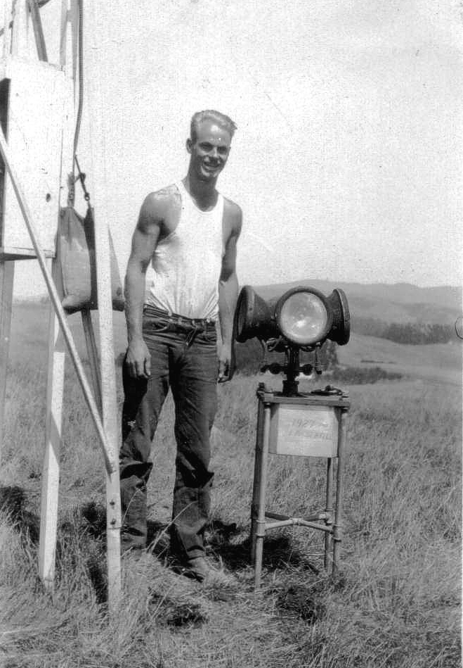
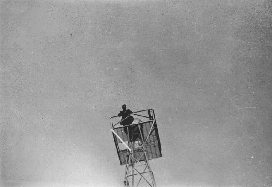
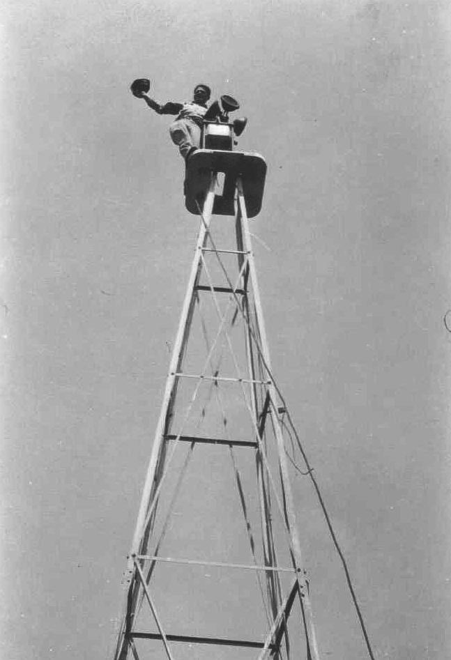
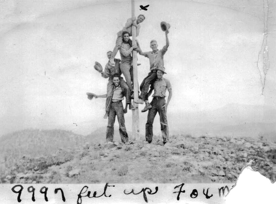
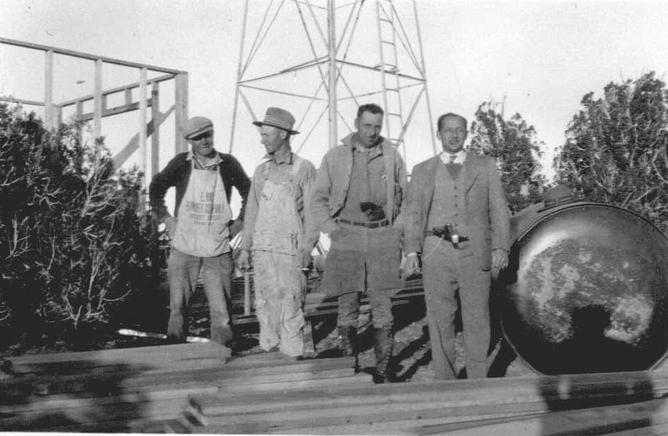
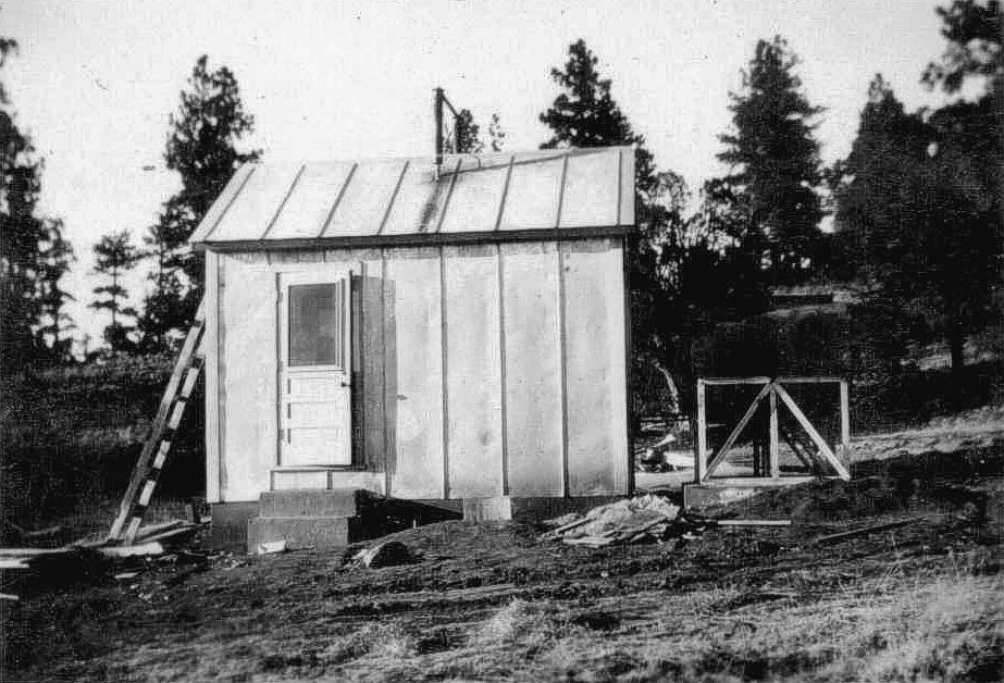
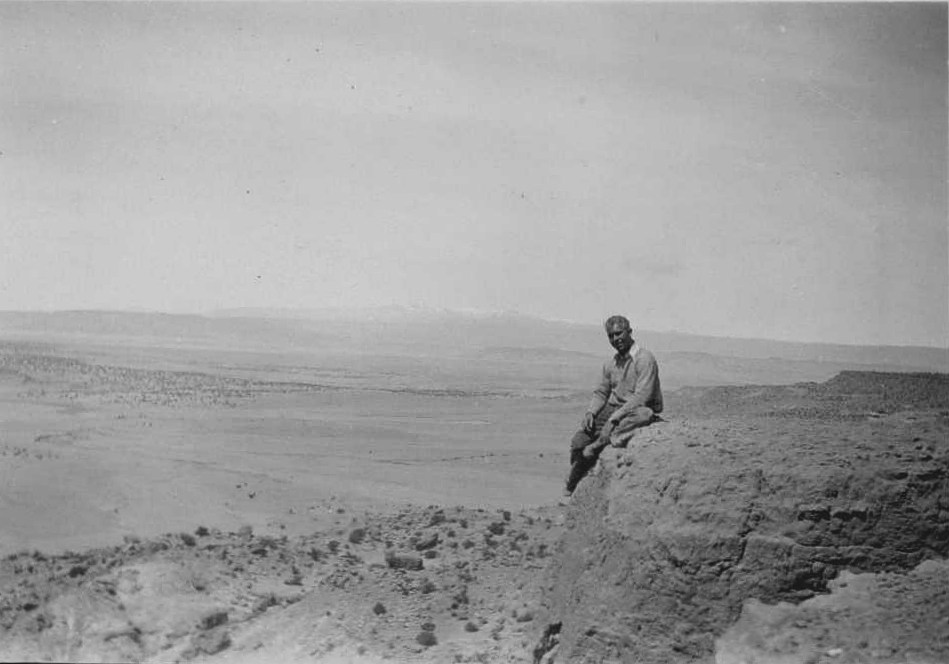
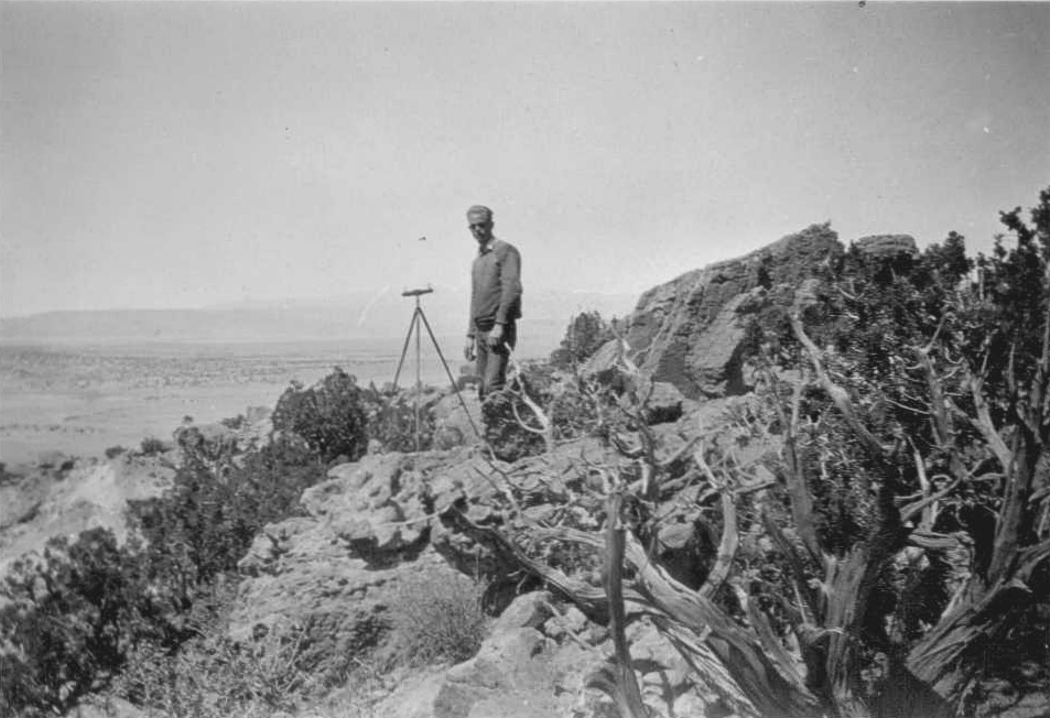
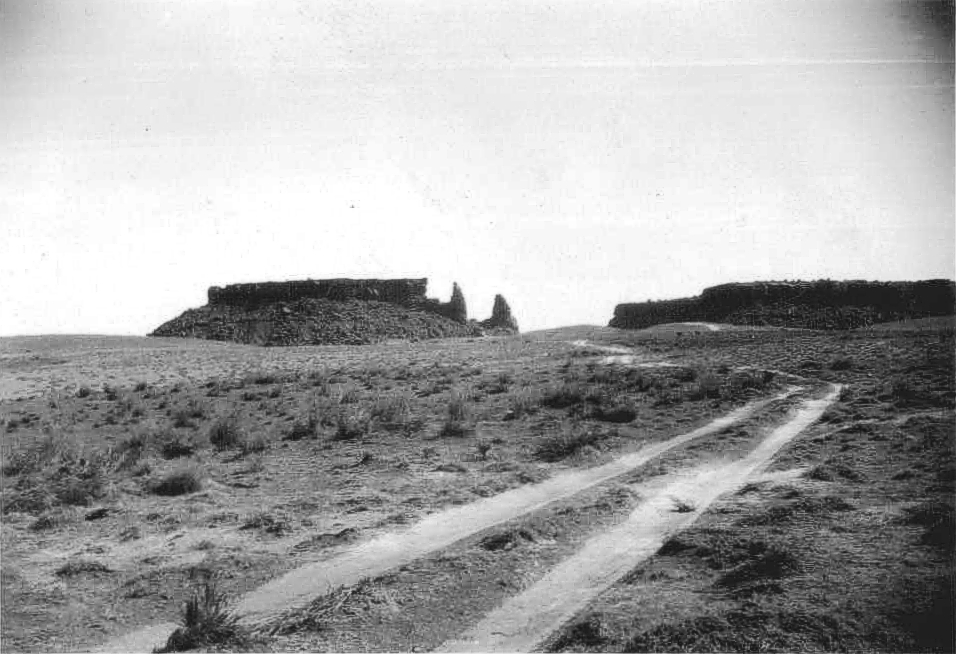
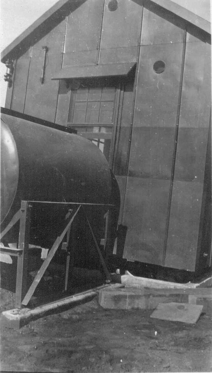
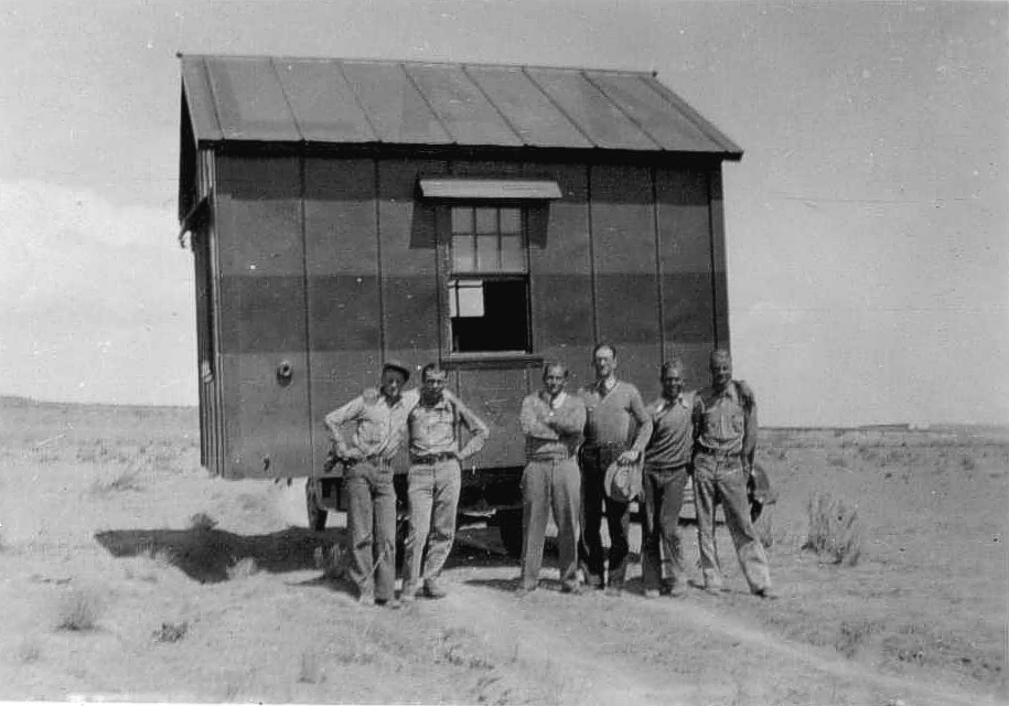
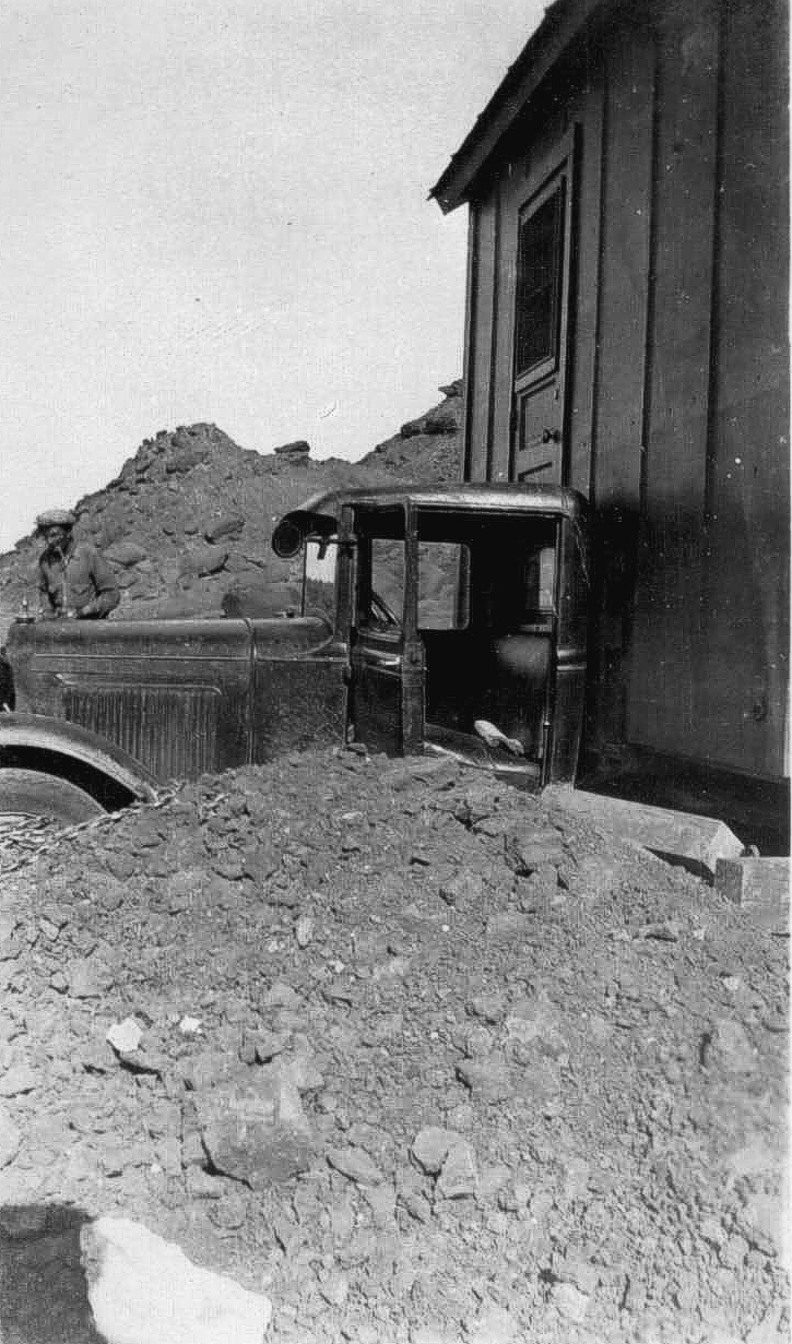
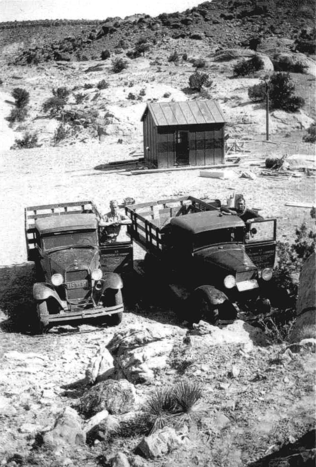
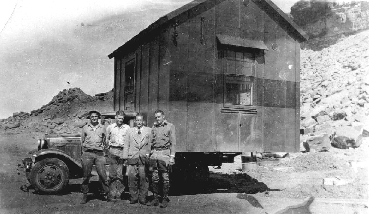
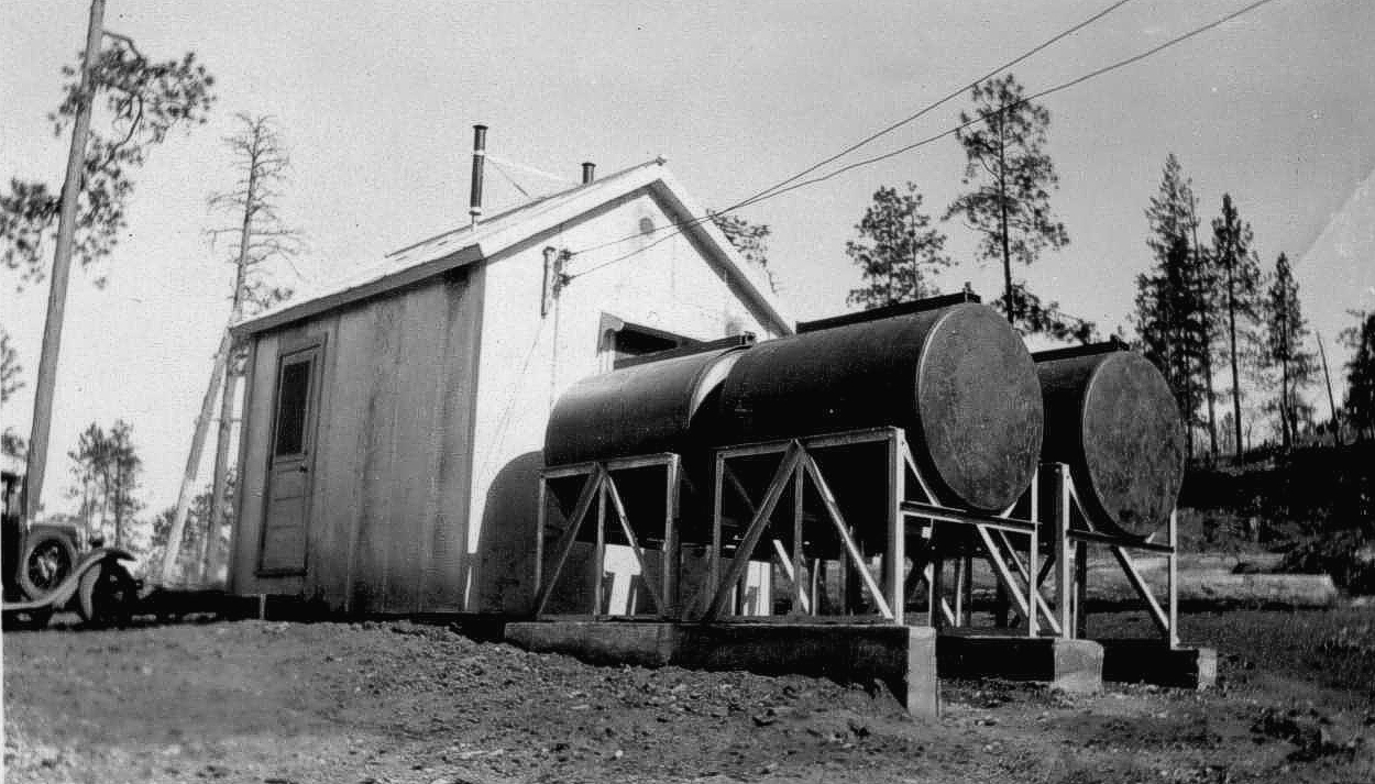
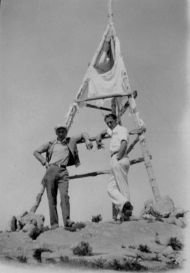
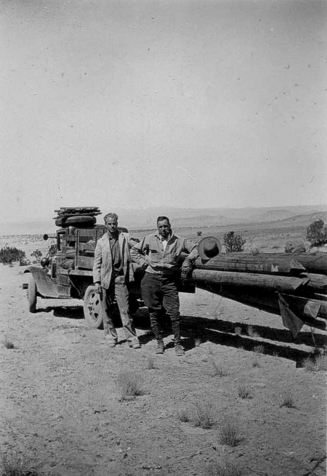
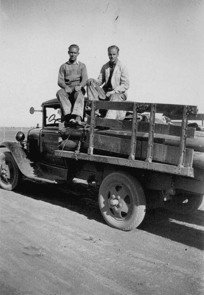
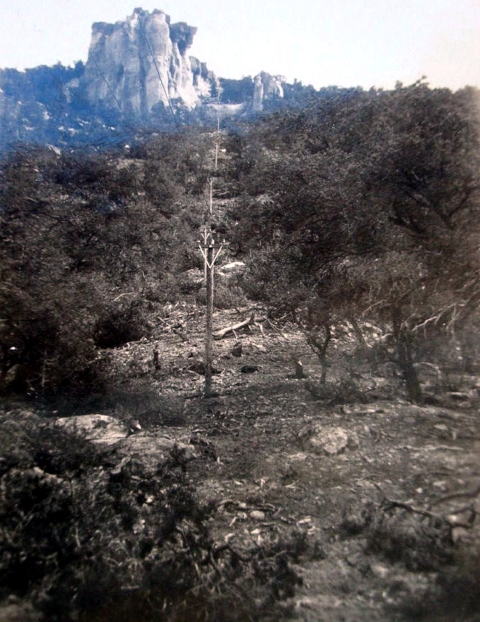
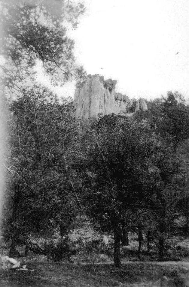
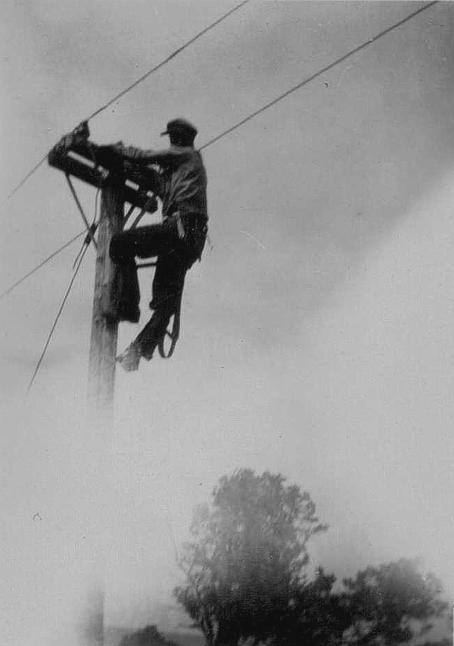
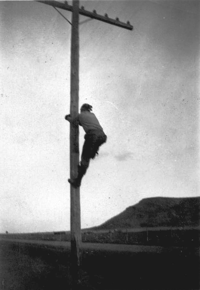
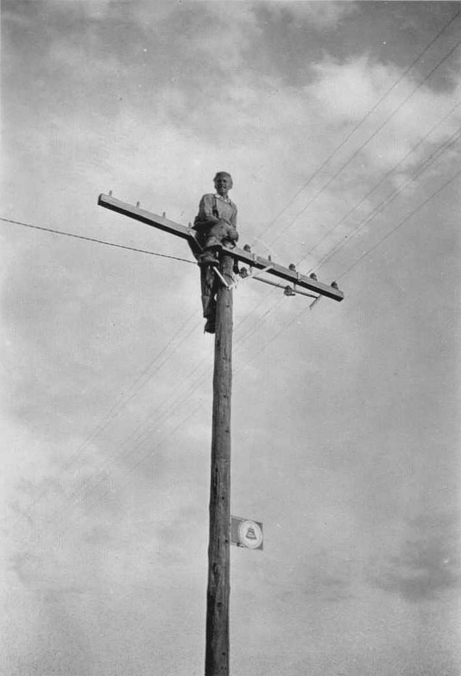
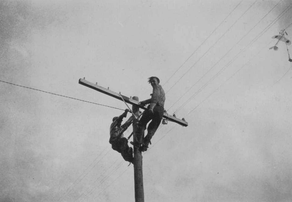
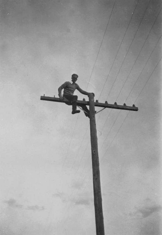
Service began July 1929. Sept 1929 was the first crash. This occurred west of Albuquerque at Mt. Taylor. By the time the western New Mexico beacons were all in place, the four-course radio navigation range was being deployed. Also, post-crash(es), moving the beacons south of the New Mexico mountains in a shorter air-line was desired, and the Department of Commerce forces (including Jack Bell who worked for the DoC from 1930-1932) did most of the work on relocation’s.
Per the photos, no challenge was too great for these crews. Removing the beacon towers left concrete arrows behind at many of the sites, but when re-installed in 1930-31 (mostly) the arrows were non-critical due to radio navigation signals, voice radios, enclosed cockpits, and better sectional charts. Only rarely across the US were arrows em-placed as of 1932. These were mainly the rare 1930’s metal arrows but were not always on airfield sites.
Relocating beacon sites was probably routine for these crews, but the obstacles were unique. Still, the technology was simple and reliable. One has to view these photos through a 1929 lens.
Corrections and historical information provided by Steve Owens and Dave DuPree.
View the beautifully restored LA-A Hut 62 site

Click here for additional information on on Site 74
![]()
Both Steve Ownes and Dave DuPree have sought out unique beacon sites searching in Arizona for a concrete arrows and in New Mexico for a metal arrow other than airfield locations. So far, neither search has paid off for them. Metal arrows were easy to remove when a beacon site was shut down. They salvaged and restored the metal route arrow above for LA-A 59B, El Morro emergency field. Donated by the landowners at El Morro, this restored arrow is one key asset of their museum at Grants, New Mexico.
View several great historical videos from Cibola County Historical Society at Grants, New Mexico
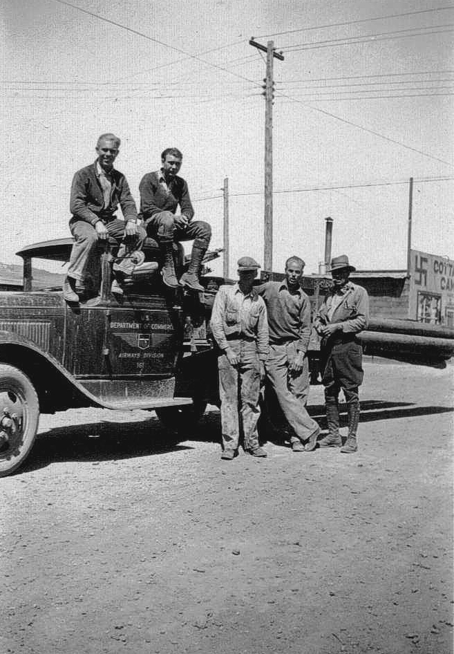
Airway Technician, U.S. Department of Commerce
Airways maintenance technician, “Dusty” Rhodes takes a break alongside his sector truck in the late ’30s. Unlike their modern counterparts, the airway station keepers were required to wear distinctive uniforms on the job.
El Paso to Pueblo Airway Sites (PDF)
Written navigation directions from site to site
Fort Jones, California, 2019
Four of five Four-Course Radio Range towers were still in existence in 2019. Located about two miles south of Scott Valley Airport, California.
41°31’38.26″N 122°51’37.55″W
Four-Course Radio Range
Date and location unknown