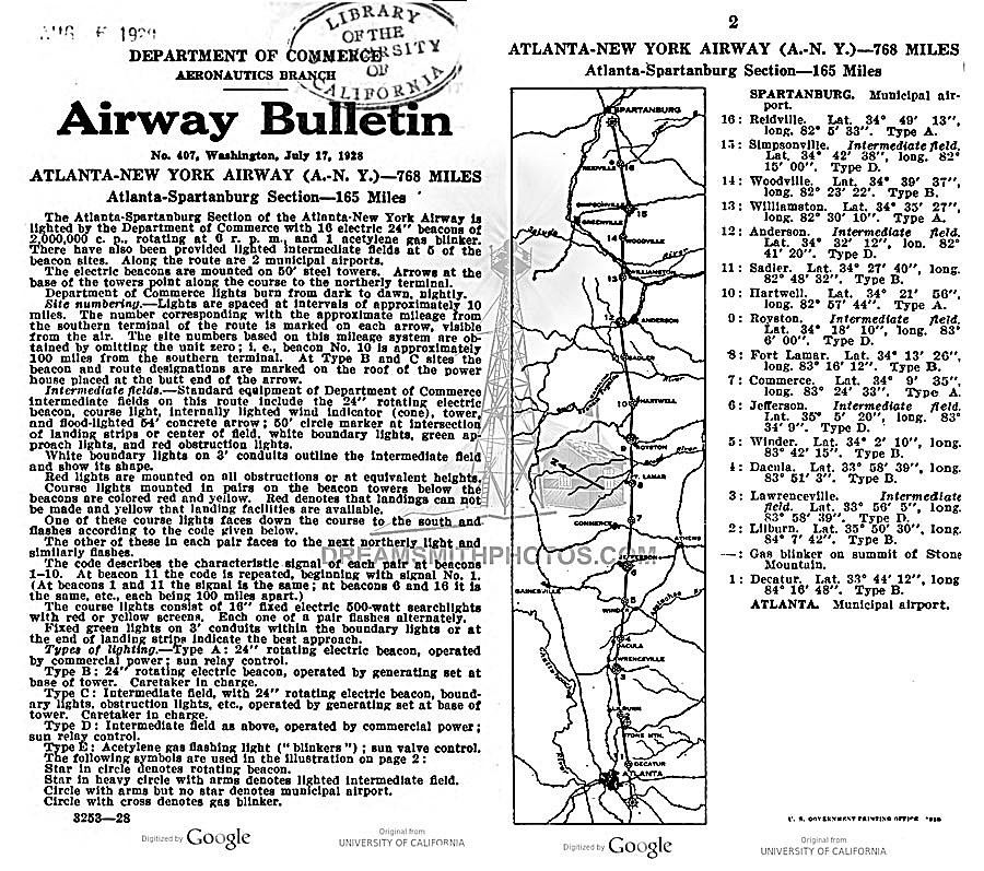
Cassoday Airway Beacon #41

Cassoday Airway Beacon Site, #41, Kansas
An aeronautical bulletin was published about the Cassoday airfield which identified it as Site #41 along the airway.  The bulletin further detailed the field as being operated by the Department of Commerce & having 2 grass runways in an ‘L’ formation, 2,600 feet long (see airport diagram).

In the northwest corner of the airfield was a 2-million candlepower 24 inch rotating beacon, which rotated at 6 RPM.  The newly-built field had few amenities (no fuel, repairs, or telegraph) but did have nighttime lights around the boundary of the airfield.

By 1931, the starting point of the airway had been changed from Dallas to Amarillo, and this resulted in a renumbering of the airfields & beacons. Cassoday was changed from Site #41 to Site #34 and, according to the 1931 Bulletin #2 this beacon site was upgraded to a Flight Service Station (FSS), commissioned February 1931, and included course lights and a weather teletype.

Radio Beacon, Section 33, Wyoming, 2004

Historical summary and photo submitted by Mel Duncan of Wyoming

A concrete arrow is all that remains of the old Section 33 beacon site.  This site is located about 3/4 mile north of McIntyre’s, WY.  Elevation 7,528 feet, coordinates 41° 13″ 34″ N, 105° 14′ 36″ W.

Submitted by Mel Duncan of Wyoming


Submitted by Mel Duncan of Wyoming

Some old parts found at the site


Submitted by Mel Duncan of Wyoming


Submitted by Mel Duncan of Wyoming


Submitted by Mel Duncan of Wyoming

Arlington, Oregon Intermediate Field, Site 12

Photos and information submitted by David A. Sbur 

If you look closely you can see some faint numbers on the roofs of the sheds for the Portland-Spokane Airway, part of the C.A.M. 32 route. No trace of a concrete arrow could be found on the site.

The airport was listed in the Dept of Commerce listings in 1931 as a DOCILF (Dept of Commerce intermediate landing field). It was also used as an Army Air Force auxilliary field in WW2. It’s pretty sleepy now, the only activity is a local drone company that does it’s testing there.

Department of Commerce intermediate field, site 12, Portland-Spokane Airway. One and one-fourth miles E. Altitude, 850 feet. Irregular shape, 2,400 feet E./W., 2,000 feet NW./SE., sod, level, natural drainage; entire field available. Directional arrow marked “12 P-S.” Pole line to N., beacon tower to NW. Beacon, boundary, approach, and obstruction lights. Beacon, 24-inch rotating, with green course lights flashing characteristic “2” (.._). Aviation fuel. No other servicing facilities. Teletypewriter. Department of Commerce marker beacon, characteristic signal “H” (. . . .), operating frequencies 248 and 278 kc.


Probably the generator shed.


Inside the generator shed.


Possibly the teletype office


Unknown item


Electrical standoffs on the field along the length of the landing area but offset a few hundred yards.


The beacon does not appear to be the original 24″ size, perhaps it is an old course light?


Help identify this 1927 radio


Submitted by Raymond Duck

Early Lighthouse or Radio Station Radio

CAN YOU IDENTIFY THIS RADIO’S ORIGIN?
The above radio is manufactured by DeForest Crosley, 1927, and is contained in a metal box.  It may have been used in the early days of radio beacon stations or lighthouses.  The tuner scale ranges from 200-560.  Does anyone know how this radio may have been utilized for navigation?

The following information was provided Anthony Martini in 2021 that may be of some help.

“Before I was an ATC Center controller hired in 1979, I was an Air Force navigator for 6 years. Many aircraft from the 1920’s up had a “radio direction finder” of some sort…. which was the easiest thing to operate in the cockpit. It’s use was very simple. Connected to a loop antenna on the aircraft, a needle in the cockpit would simply point to the source of the broadcast, like any ADF of the last 50 years. Since the Crosley bandbox was both battery powered and/or electrical powered, it is possible that an aircraft may have had the Bandbox onboard for use as a navigational aid….receiver only.

The metal box radio in your photo was normally installed in any attractive wooden cabinet for home use, and attached to external speakers, in other words, the metal box was the “guts” of the radio cabinet….much like car radios in the dashboard. I do not know why a normal AM radio would be in an ATC facility or lighthouse other than recreation, unless in 1927 some aircraft could transmit by radio signal (either voice of Morse Code) within the frequency band of the Bandbox, then the ATC/lighthouse could have had a directional loop antenna to point to the bearing of the aircraft/ship. That would require more research, but there certainly was radio transmission from aircraft before 1927.

As a humorous sidenote…..in the 1970’s USAF, we were flying the F-4 Phantom jet, and in training sessions the “good guy” would takeoff first and patrol somewhere unknown….then the “bad guy” would takeoff and try to find and “kill” the “good guy”. If the “good guy” crew was new, the “bad guy” would key the mic and ask for a “short count” to check the radio….and of course, the new crew would comply, unaware that the “bad guy” was obtaining an ADF relative bearing which gave away the “good guy’s” position by the needle pointing to the transmitting aircraft….and then the fight started…..”

G.E. Cluster Beacon, 1927


Submitted by Steve Wolff

Plate XXXVI.  General Electric Company Cluster Beacon, about 1927

Caption above reads:  In addition to the 24-in. beacons, it was found advisable in certain sections to place cluster beacons having less candlepower.  They consist of four automobile head-lamps surmounted by a top lamp as shown, and to turn at approximately 10 r.p.m.  Tests of such a beacon using 21-cp. automobile-type lamps, show that it is visible at a distance of 40 miles in good weather.

Prewitt Rotating Beacon, 1929

Prewitt, New Mexico Rotating Beacon, 1929

This 1929 photo, from a DoC (Dept of Commerce) journal article by Thomas Chapman, shows the airway beacon light tower under construction at Prewitt (Thoreau), NM. The stoic burro in the foreground was referred to as the “Superintendent of Airways Construction.” This framed photo was a memento given by staff to Fred Hingsburg, the Chief Engineer for the Airways Division.”

“Prewitt (Thoreau) was DoC Site 69 on the original 1929 Winslow-Gallup-Albuquerque segment of the mid-continent airway, first served by Transcontinental Air Transport in July, 1929. It was one of several beacon lights to be shut down in early 1930, as the beacon route was being realigned to match with the new four-course radio range signals. It is not clear where this Prewitt beacon tower was relocated along the new direct airway line.

The above Air Commerce Bulletin describes the shutdown of these beacons, soon to be relocated along the radio beam from new radio range sites at Albuquerque and Winslow for this section of the airway.

The above sketch is the layout of the Prewitt beacon arrow using the identifier TAT.  Arrow location: 35°21’45.27″N 108° 2’45.71″W

Mesa Gigante Beacon Building, LA-A 66, 1930


Photo by Bill and Jack Bell and submitted by Steve Owen

Mesa Gigante, New Mexico, Site 66, Airway Beacon Generator Hut

Above is the generator hut for the soon to be Mesa Gigante, New Mexico airway beacon. This was the former Suwanee generator hut know as site 74 in 1930 and 1931. It was in the process of being moved from the above location to about 5 miles away, where it was to be placed on the realigned LA-A airway route. From 1931 on, it was repainted as Hut 66 and called Mesa Gigante.

Suwanee site 74 was a Transcontinental Air Transport (TAT) beacon, aligned from Gallup to Clovis by this pioneering airline, as the first beacon line in this region (early 1929). The airway beacon and concrete arrows were located uphill atop the mesa rim. After a major aircraft accident at Mt. Taylor, TAT went broke after financial struggles that lasted about 1 year after the accident. TAT merged with Transcontinental and Western Airlines in 1930. The CAA took the airway segment over in 1930 and had the beacons in this segment shifted to the 1930’s-40’s LA-A alignment.


Photo by Bill and Jack Bell and submitted by Steve Owen

1931
The new home for the former Suwanee generator hut, site 74, now relocated, renamed, and repainted to Mesa Gigante, site 66 on the LA-A. The actual airway beacon was located up on the top of the mesa rim with a lengthy run of power cable.


Submitted by Steve Owen

Compare the above 2012 photo with the 1931 black and white photo above. It was taken from the same angle and height.


Submitted by Steve Owen

2012
The above and below photos are all that remains of Site 66, Airway Beacon Generator Hut, Mesa Gigante, New Mexico, The number 59 on the left side of the roof is not a beacon number but a partial coordinate. This generator hut is one of several LA-A beacon huts located on private land and moved from it’s original site which was known as Suwanee, site 74.


Submitted by Steve Owen


Submitted by Steve Owen


Submitted by Steve Owen

Nevada Known Light Beacon Sites

Beacon 18 N 39° 29.401′, W 119° 57.895′ NGS Data Sheet KR1732
Beacon 19 N 39° 29.401′, W 119° 57.895′ NGS Data Sheet KR1732
Beacon 19 N 39° 31.855′, W 119° 39.338′ NGS Data Sheet KR1753
  Note: 2011. There are two Beacon 19 locations very close together on a mountain that is today the site of the Mustang VORTAC
  Both data sheets refer to “Beacon 19” and one data sheet mentions the beacon being moved.  The “Airway Beacon” on the 1:24,000 scale topo map is at a third slightly different location.
Beacon 20 N 39° 34.851′, W 119° 29.241′
Beacon 22 N 39° 37.279′, W 119° 11.834′
  Note:  2011. This was the beacon located at Fernley Intermediate Field. There are two concentric circles, the outer one approx. 100′ dia., the inner one approx. 50′ dia., both about 24″ wide, with a concrete pad at the center. The outer circle was painted white, the inner circle and pad were painted red. Ed.
Beacon 23 N 39° 44.831′, W 118° 56.173′
Beacon 24 N 39° 48.795′, W 118° 51.413′
  Note: 2011. This was the beacon at Parran, Nevada. I’m not too sure this was actually Beacon 24 as the old concrete foundation seems too small compared to other beacons in the vicinity, although the coordinates agree with the CGS datasheet for benchmark KR1556, identified as SAN FRAN SALT LAKE AWY BCN 24. I’ve seen some old maps & nautical charts that show both a course light and a main beacon in close proximity to each other at this site. After the weather cools down, I plan on heading back out to this one to look around some more. Ed.
Beacon 26 N 40° 04.188′, W 118° 34.254′
  Note: 2011. This is the beacon at Derby Field near Lovelock, Nevada. I’ve also seen this beacon designated as 26-A. Ed.
Beacon 28-A N 40° 04.523′, W 118° 10.892′
Beacon 30 N 40° 12.357′, W 117° 48.272′    NGS Data Sheet LR0848  
  Note: Located 1.5 miles SW of Mc Kinney Pass.   This is on the 24K and 100K scale topo maps.
Beacon 32 N 40° 20.713′, W 117° 20.852′    NGS Data Sheet LR0841
  Note: 2011. This was at the Buffalo Valley CAA Intermediate.  Photo
Beacon 212 N 39° 35.834′, W 119° 22.207′
Beacon 216 N 39° 36.496′, W 119° 17.395′  Photo
Beacon 253 N 39° 51.032′, W 118° 41.063′
Unknown N 40° 17.757′, W 118° 21.111′
  Note: Unidentified Beacon near Coal Canyon.  This concrete arrow is 17.7 miles north of the Humboldt Intermediate field, just off Interstate 80 near Coal Canyon, northeast of Lovelock. Ed.

Thanks to the dedicated below people for their research and perseverance in locating these sites.

Ed Rajki
Steve Owen
Steve Wolfe
Tom Johnson

History of Wyoming Airway Beacons

By Mel Duncan

Wyoming’s portion of the Salt Lake to Omaha Airway had 40 beacons spaced about 10 miles apart. The Wyoming portion of the airway closely followed the railroad tracks except between Salt Lake City and Knight and between Laramie and Cheyenne. The beacons were numbered from the west (Salt Lake) to the east (Omaha). Some had names while some were only numbered.

1. Salt Lake City, Utah
2. (Wanship, Utah)
3. (Utah)
4. (Utah)
5. (Wyoming)
6. Knight, Wyoming
8. LeRoy
12. Granger
16. Rock Springs
19. Bitter Creek
22. Red Desert
24. Cherokee
27. Parco 29. Dana
31. Medicine Bow
33. Rock River
37. Laramie
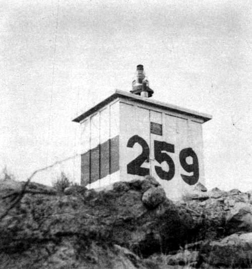
38. Summit (Beacon Hill)
39. Section 33, T15N, R70W. (North of old McIntyre Ranch)
40. Silver Crown
41. Cheyenne
44. Burns
45. Pine Bluffs, Wyoming
46. (Nebraska)
50. Sidney, Nebraska

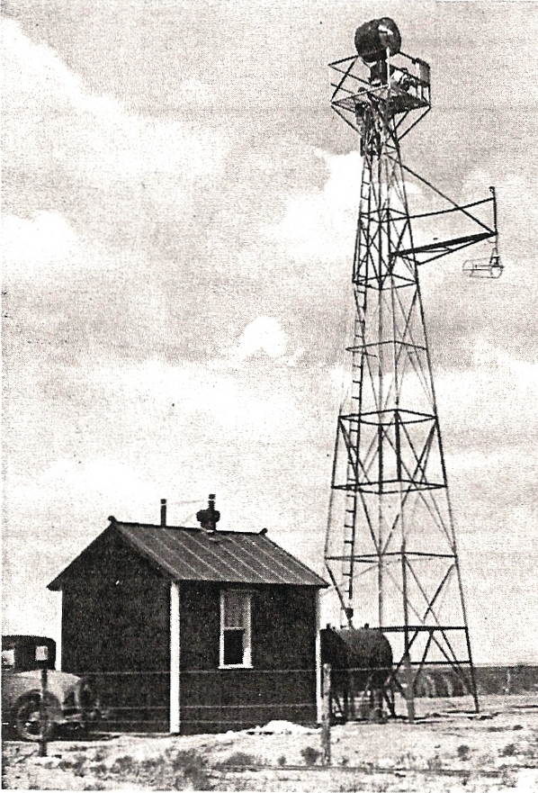
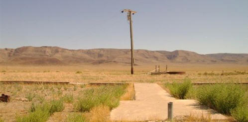
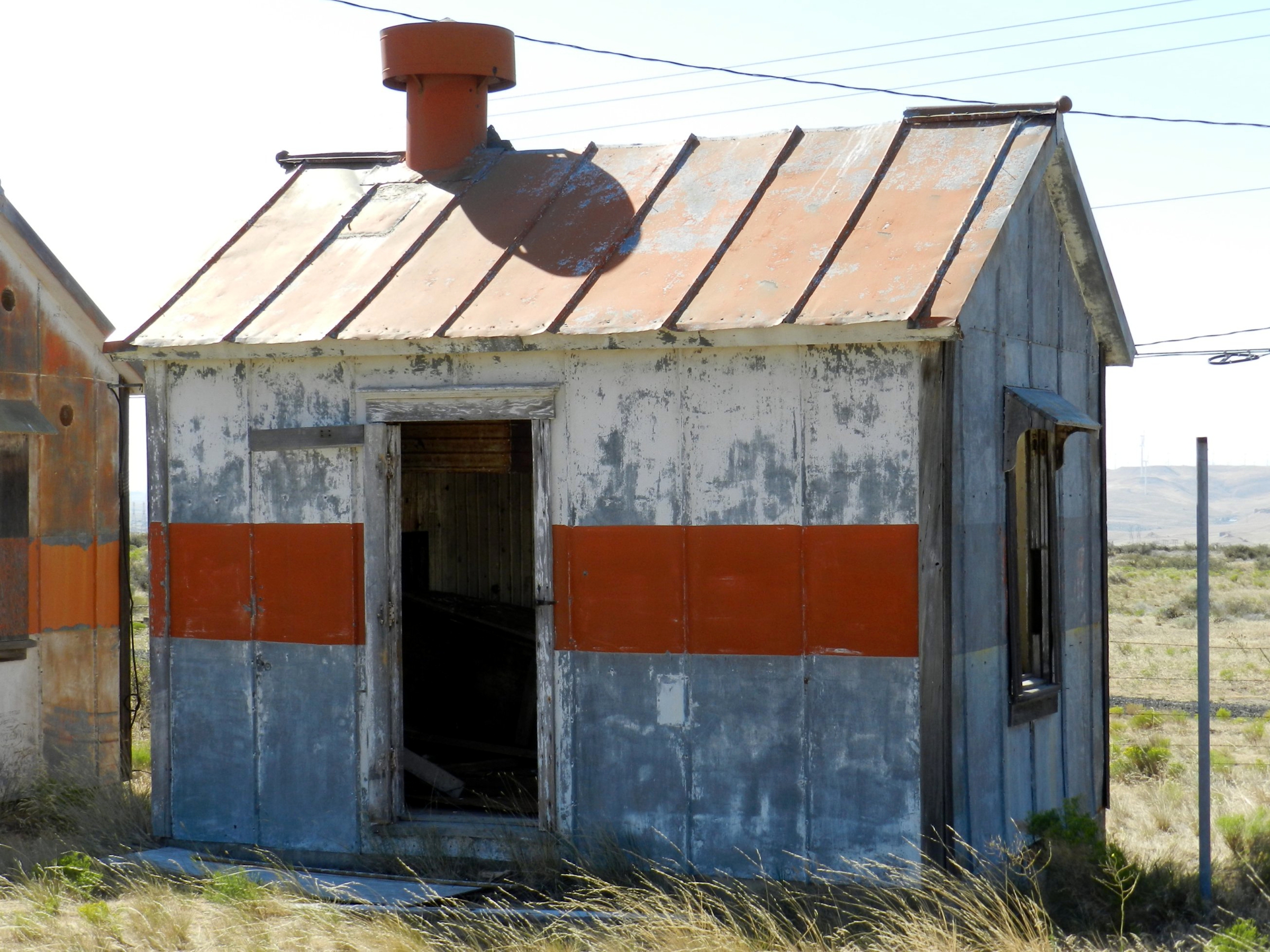
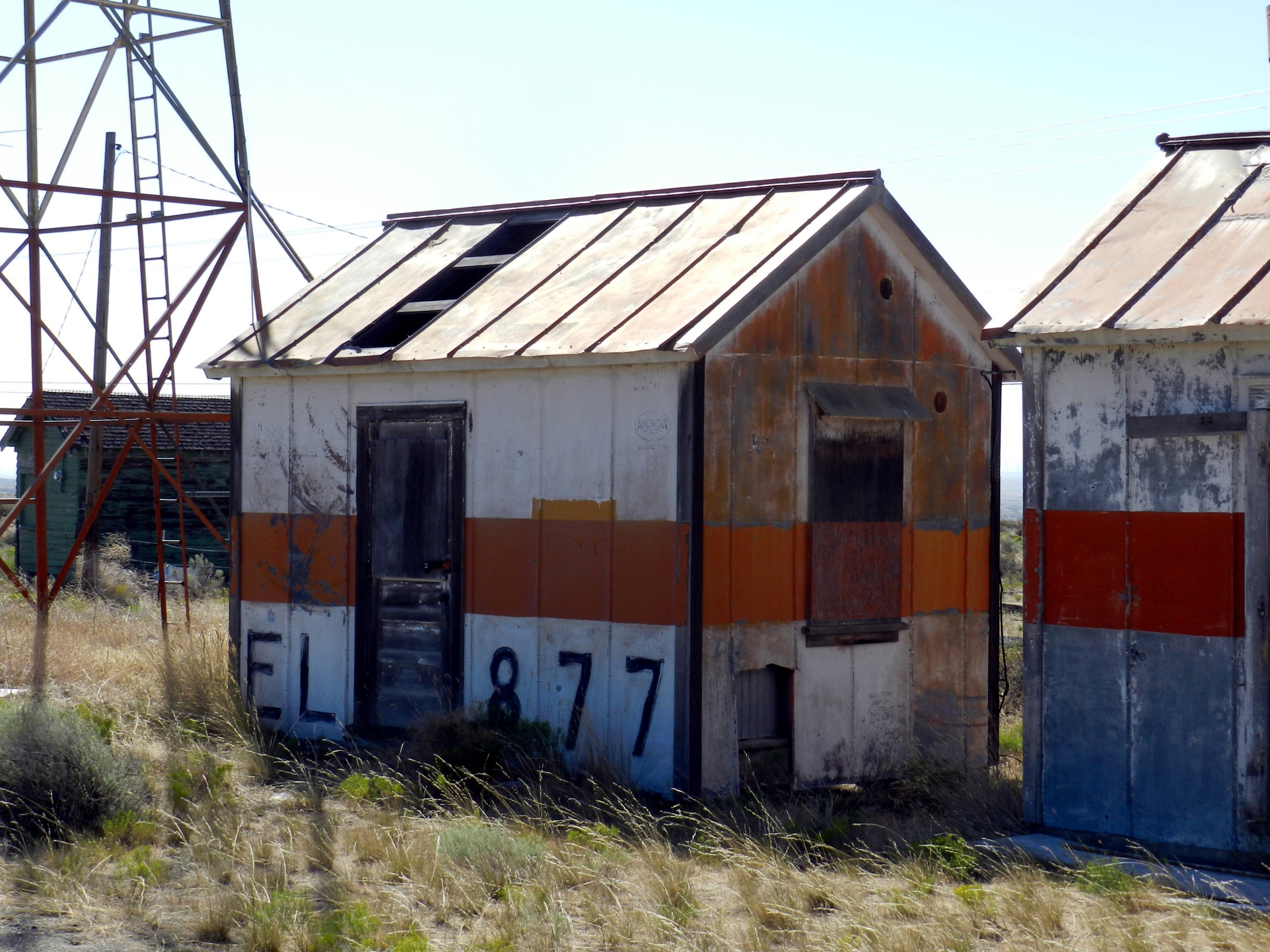
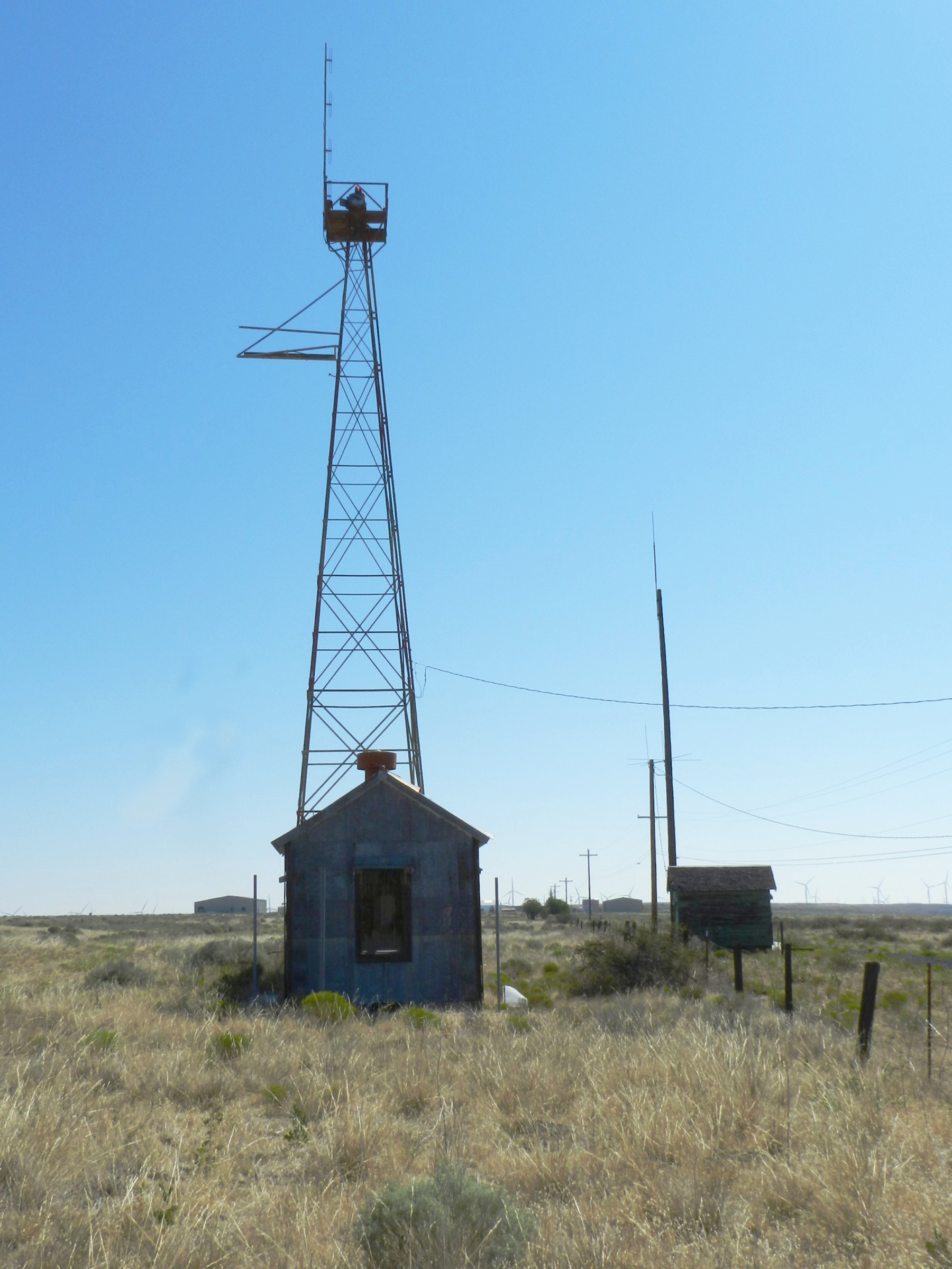
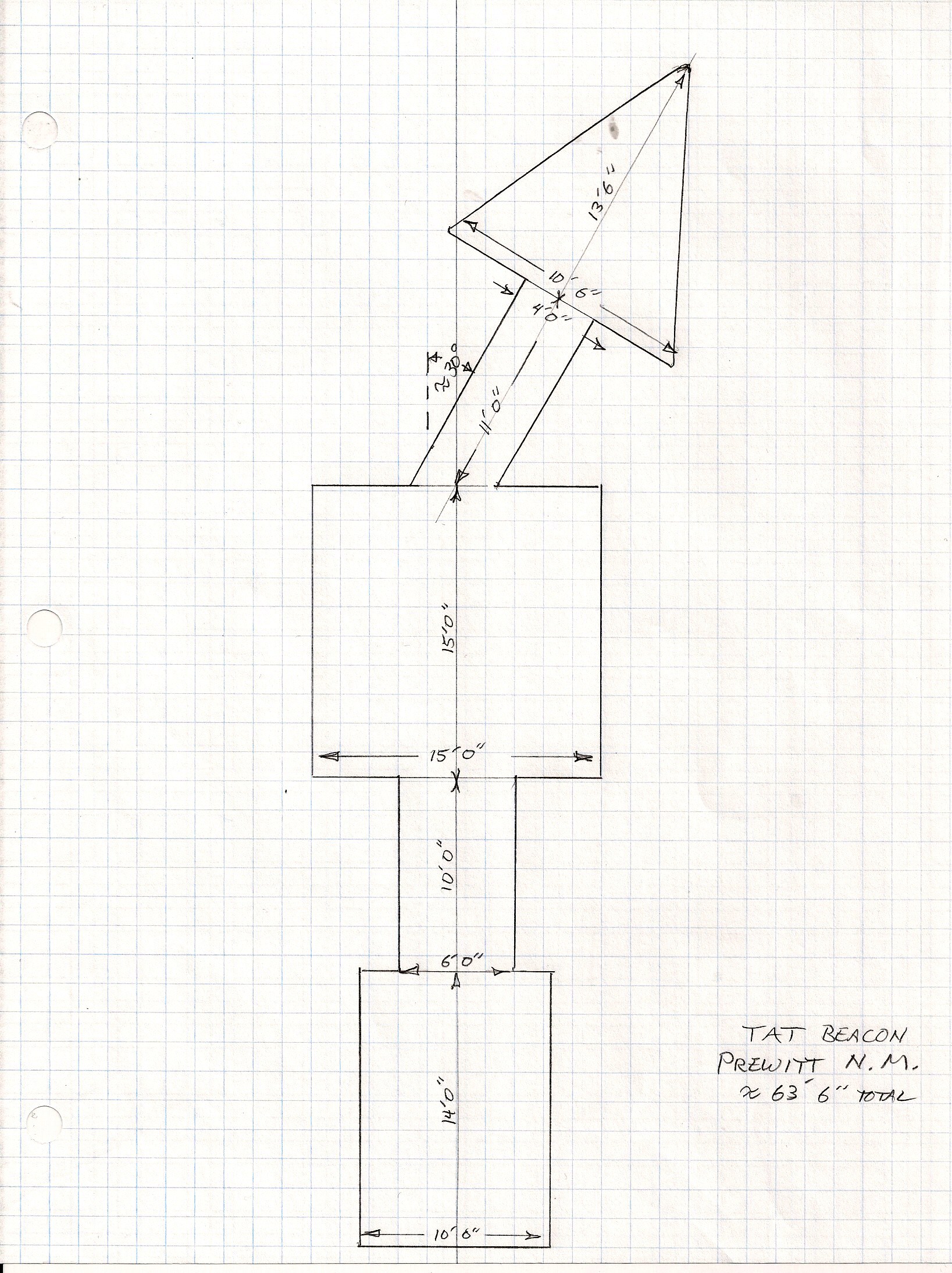
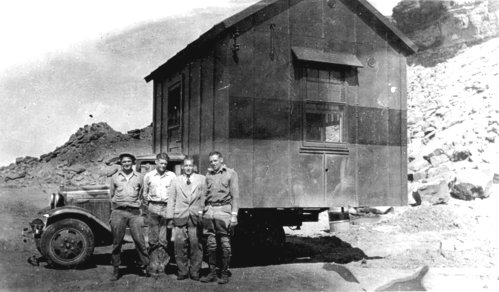
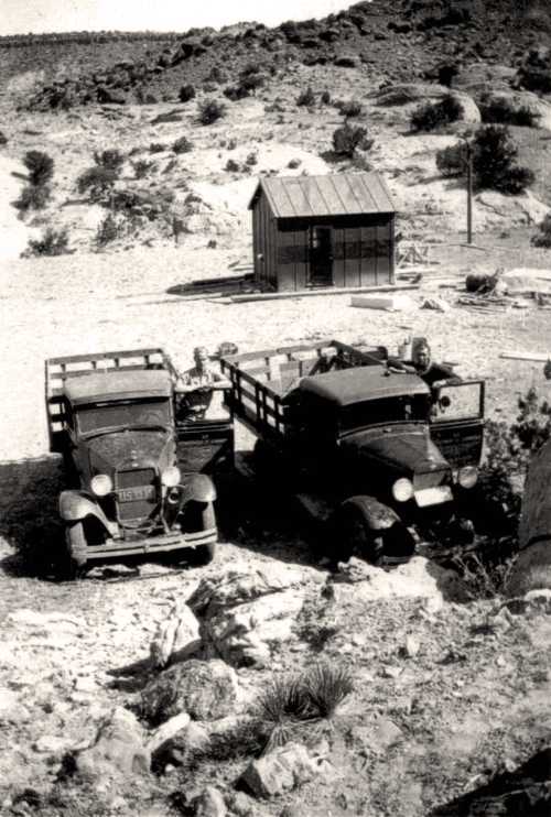
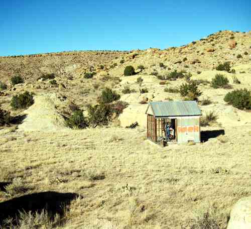
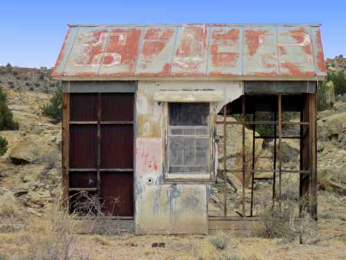
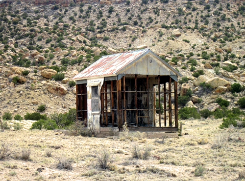
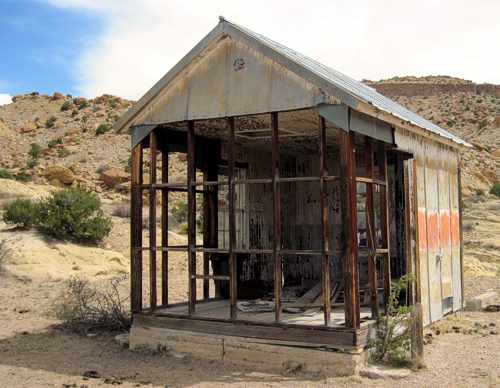
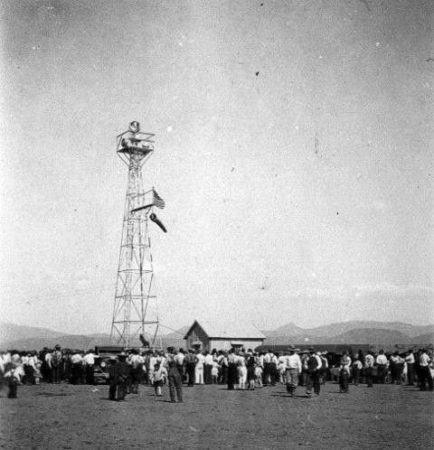
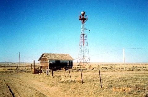
The Summit or Beacon Hill light, number 38, was located one and one-half miles north of the Lincoln Monument at T15N, R72W, Section 14, at 8777 feet. A permit was granted on July 26, 1930 to U.S. Department of Commerce, Lighthouse Service, Airways Division, to use a plot of land, 200 feet square, for beacon site and suitable buildings for caretaker of the light. The 1933 Corps of Engineer’s map indicates a power or telephone line going to the beacon. (photo 1 photo 2 photo 3 photo 4) (41° 16′ 5″ N, 105° 26′ 2″ W) In May of 2004 the site was visited and coordinates confirmed with GPS. Several newer towers now occupy the area but the concrete arrow remains. There also remains some remnants of the old generator system and building foundation.

Beacon number 39 was in Section 33, T15N, R70W about ¾ mile north of McIntyre’s. The elevation is shown as 7528 feet. (photo 1 photo 2 photo 3)

From Happy Jack Road 210 take County road 1 ½ miles to a more or less double turnoff to the east. Take the left branch about 1 ½ mile to the center of Section 33. (Land ownership??)

(41° 13″ 34″ N, 105° 14′ 36″ W) In May of 2004 the site was visited and coordinates checked by GPS. The concrete arrow remains but no buildings.

The Silver Crown Beacon number 40 was located almost dead center of Section 7, T14N, R68W at 41° 11′ 49″ N, 105° 02′ 53″ W. The elevation is about 6729 feet. (Of note: On the Round Top Lake Quadrangle 7.5 minute of 1961, “Airline Camp” is shown located in Section 3, T14N, R68W. This is close to the site of the 1935 airline crash.)

On the Archer Quadrangle of 1963, a beacon is shown located in Section 21 of T14N, R 65W, about one half-mile northwest of U.S. 30 overpass. This was probably beacon number 42. There is no remaining portion of the beacon tower or base.

(41° 09′ 53″ N, 104° 40′ 28″ W)

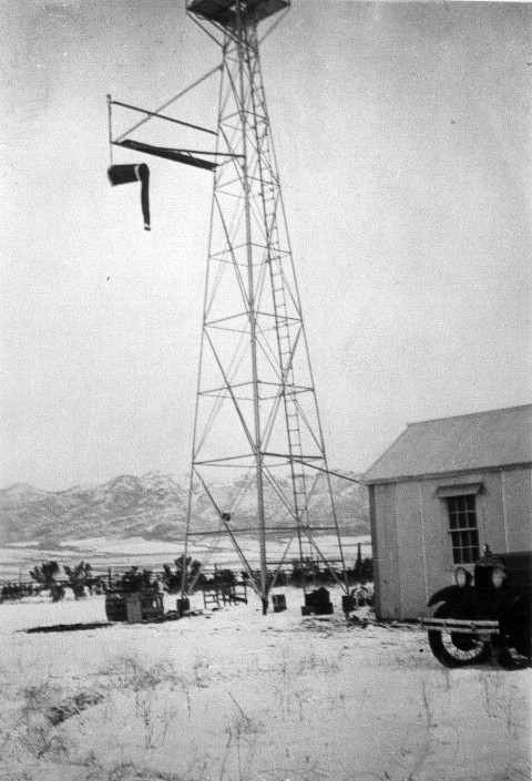
In 1932 the standard airway beacon was a 24-inch rotating unit of approximately 1 million candlepower. In 1933 a new standard was adapted to utilize a 36-inch rotating unit which showed two beacons of light 180 degrees apart. Each beam was about 1,250,000 candlepower. The beacons were designed to show six flashes per minute. The older 24-inch unit rotated six times per minute and the newer 36-inch unit rotated 3 times per minute. The 24-inch beacons were spaced at 10 mile intervals. The newer 36-inch units allowed spacing up to 15 miles between units. Except for the number 8, LeRoy Beacon, the Wyoming beacons were all 24 inch units and retained their original spacing of about 10 miles. The LeRoy Beacon had a 36-inch light. Two blinking colored course lights were mounted with each beacon, green indicating the presence of a landing facility and red indicating the absence of a landing field. In addition, each beacon course light blinked a code indicating which beacon was being observed. Every ten beacons the code was repeated.

The Silver Crown Beacon for example flashed two dashes for identification. The same signal was used by Sidney, approximately 100 miles away.

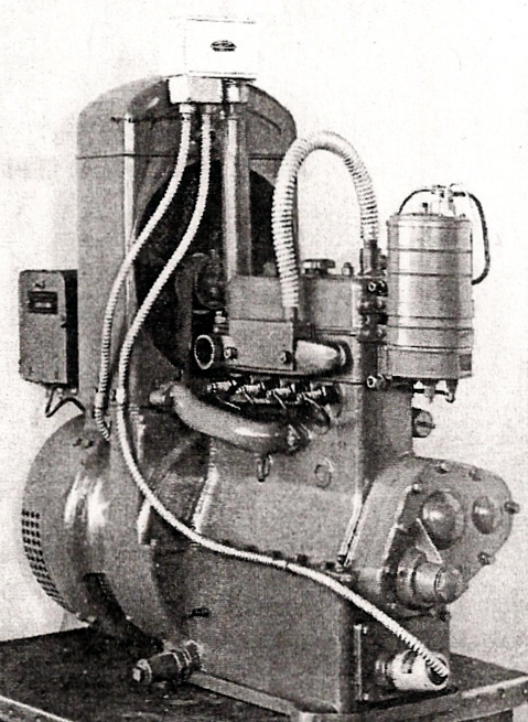
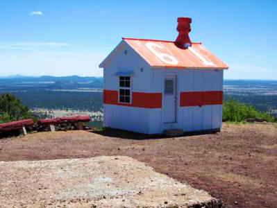
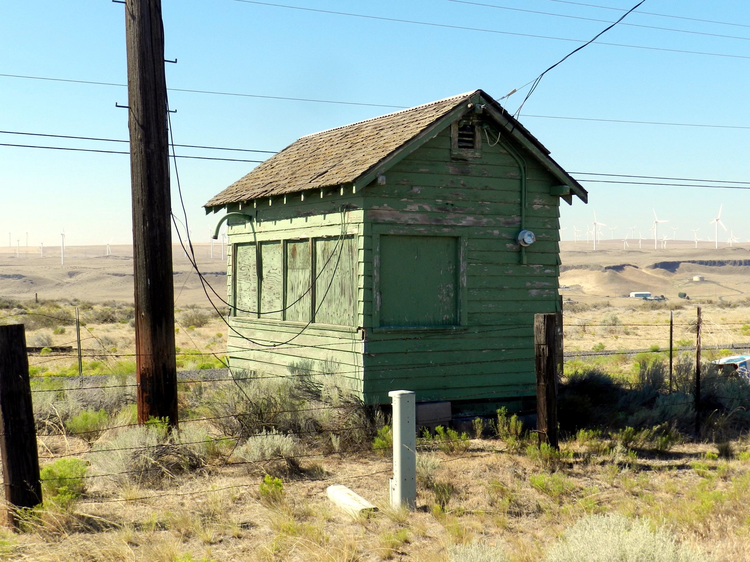
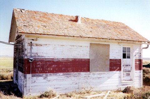
Electricity for remote sites required a gasoline-powered generator. In isolated regions permanent quarters were provided for the caretaker of the power plant generator.

Some of these beacon sites were also utilized for the newer radio beacons that were being installed in the early 1930s. The light beacons were retained at these sites. In 1933, radio range beacons were installed at Knight, Rock Springs and Cheyenne. By 1936, additional radio range beacons were installed at Laramie and Medicine Bow.

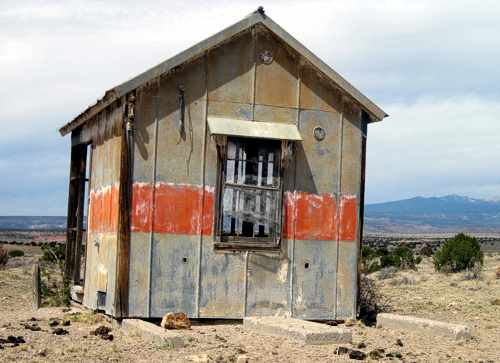
The building roof at each beacon site along the airway was marked with its number and SL-O indicating that you were on the Salt Lake to Omaha Airway. For example, Cherokee Beacon had on its roof “24 SL-O”.

The beacons at the airports were normally located on the highest point of land or atop a building near the site rather than being centered at the landing field.

It behooved a pilot to know his International Morse Code quite well. Cheyenne’s auxiliary code beacon flashed the letter “C” (dash dot dash dot), its radio range station broadcast “CX” (dash dot dash dot, dash dot dot dash) and the course light blinked a modified code for the numeral 1, (dot dot dash).

Intermediate landing fields were provided about every 50 miles affording a theoretical maximum distance of 25 miles to a field in the event of a problem. These intermediate fields were indeed just fields. None of them were paved or oiled and most had a landing space of about 2500 feet.

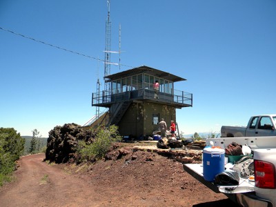
In 1936, only Cheyenne and Laramie were listed as “Airports” and only Cheyenne had paved or oiled runways. Laramie Airport has a restored beacon and tower. The beacon appears to be a 36 inch double unit.

The above historical article was written and submitted by Mel Duncan of Wyoming, May 2004.

Laramie Beacon


Photos and historical data submitted by Steve Wolff

Laramie FSS Radio Beacon (LAR), Wyoming

Laramie FSS was commissioned 1927 and decommissioned on September 29, 1991. This building is the former FSS station at Laramie — now  a terminal.

The rectangle white sign is a 90 year old airway beacon (as of 2007).  These were manufactured by American Gas Accumulator Co., Elizabeth, NJ, USA, and were powered by acetylene gas allowing beacons to operate for up to 6 months unattended.  This beacon is missing the six foot pylon that attaches to the top of the unit in the photo.  On top of the pylon would be the prismatic lens that flashed 150 times per minute and could be seen about 10 miles distant. Usually these were placed every three miles between the 50 foot towers. This short one was used in the plains where there were no obstructions.  Bigger ones on 21′ – 51′ & 84′ towers were also used.  This particular beacon is owned by a private party.

There were a string of these beacons from New York City to San Francisco in the early ’20’s before any navigational aids appeared on the scene.  They also had a sun switch that turned the beacon on/off with darkness/sunlight.  Hi tech!!  Very rare find.  It appears the globe is missing.

______________

Medicine Bow Radio Beacon, Site 32

Photos of Medicine Bow #32 Radio Beacon, Wyoming, 2006
Photos submitted by Steve Wolff, Wyoming

Mr. Wolff is looking for assistance in restoring this site to it’s original condition.

Medicine Bow building looking northeast.  Typical of government built beacon sites, this building is 14×22 feet with a 51 foot airway tower.  About 2/3 the way up the tower you can see the catwalk that leads out to the windsock.  Between the building and the tower extends the sidewalk terminating in an arrow pointing towards the next beacon site, in this case, pointing to Rock River beacon.  The whole affair was lighted from overhead so it could be seen at night.

Construction started in 1929 and was completed in 1930.  According to the Aircraft Year Book, this site was the last station constructed to complete the entire NYC-SFO Low Frequency Range system.  The building in this photo is very solid. It’s two rooms, one for living quarters and the other, a much smaller room, contained the radio gear and later in history, teletype.  It was heated with a coal stove and electric power was supplied locally to operate the electrical equipment.  In case of power failure a 550 gallon fuel tank (missing) supplied fuel to run a generator. The fuel tank was normally located between the caretakers quarters (above building) and the beacon tower.

Historical note:  The Union Pacific Railroad is very close and Highway 30, the first to connect the Midwest with the West is 1 1/2 miles away.  The Overland Trail from the 1800’s is very close and of course this Low Frequency Airway.  They all converge at this point! Mr. Wolff is looking for assistance in restoring this site to it’s original condition.

______________

The Department of Commerce demanded these sites be kept in pristine condition including mowing lawns. Flight check pilots were always complaining about weeds up against buildings.

Interesting Side Note: The 1935 mystery novel, Obelists Fly High by C. Daly King, features a detailed description of a transcontinental flight in a Boeing 247, with much of the plot action occurring during an emergency bad weather stop at Medicine Bow field.

______________

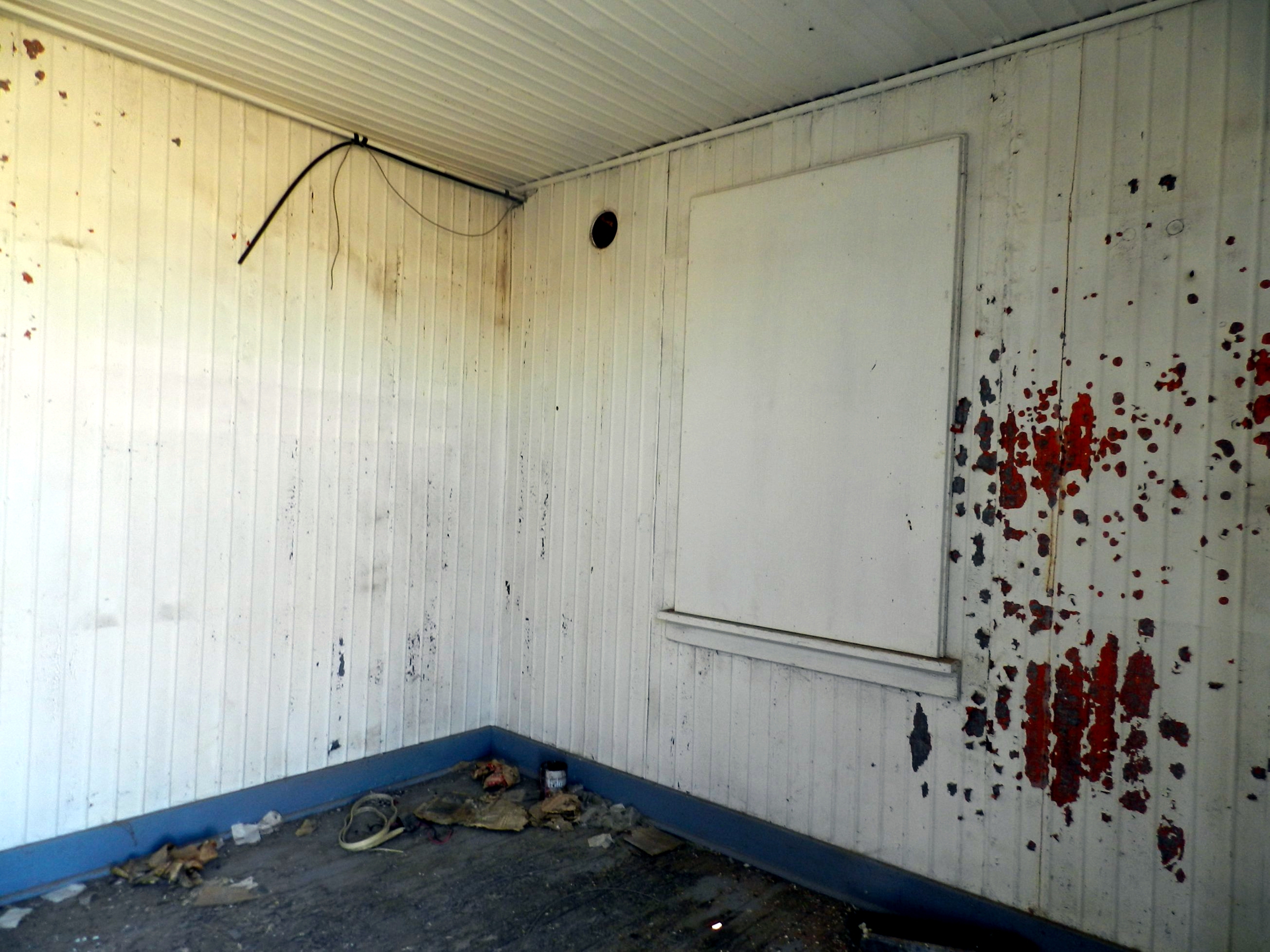
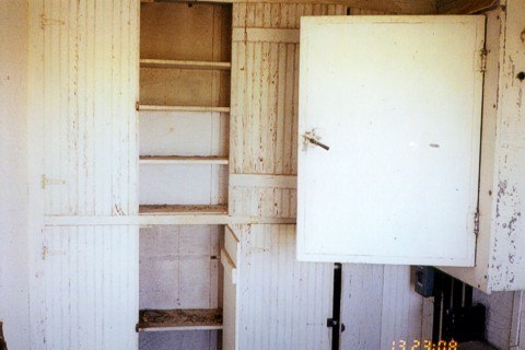
Interior photo. Open cabinet door leads to the junction box located on the north wall. Cabinets would hold fuses, signal flares, and other items.

______________

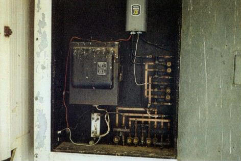
Interior photo. North wall cabinet contains a Westinghouse switch box and circuits.
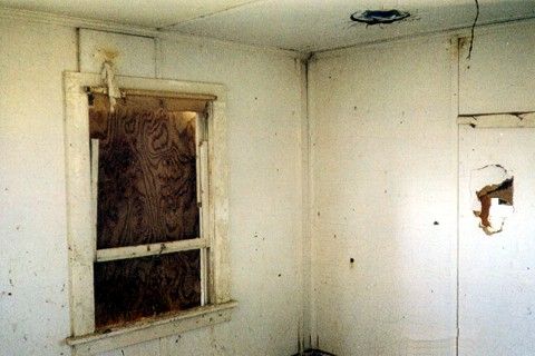
______________

Interior photo

______________

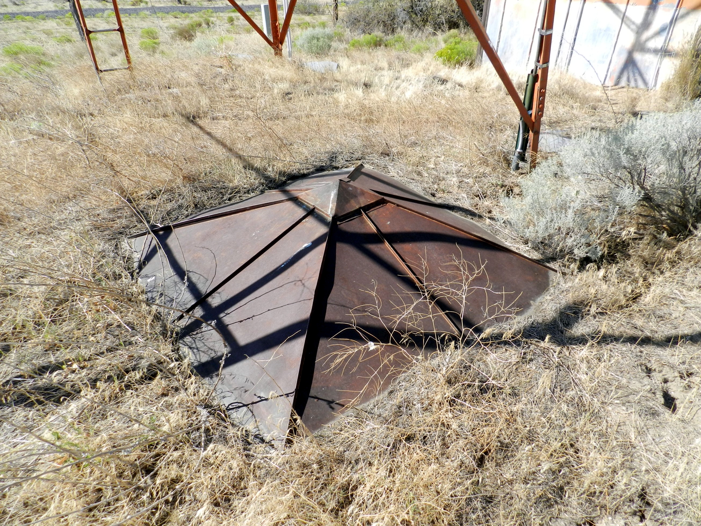
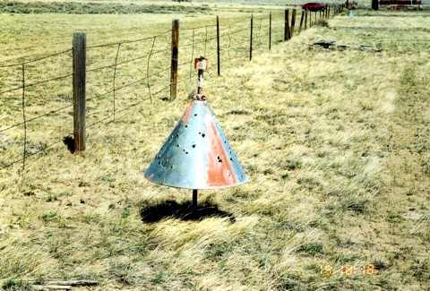
This bullet-riddled boundary cone is located on the west end of the beacon site, inside the fenced boundary

______________

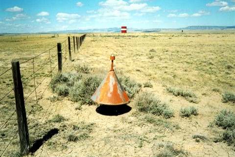
This boundary cone is located on the north end of the beacon site. The red and white tank in the background is the water supply for the city of Medicine Bow.

______________

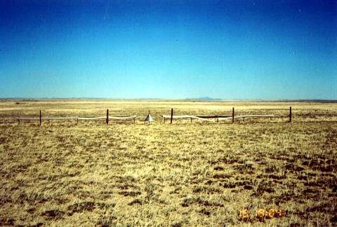
Boundary cone looking south east. The cone and stanchions are in place with wood markers albeit warped and faded.

______________

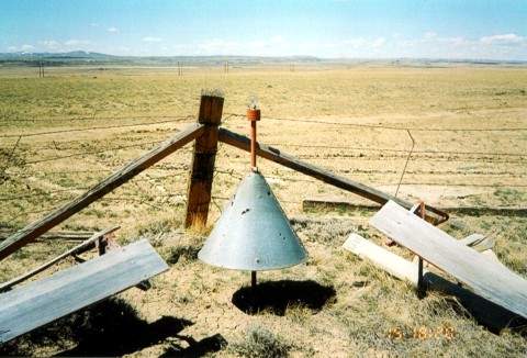
This boundary cone is located in the south east corner of the site and still houses its original 34 watt light bulb

______________

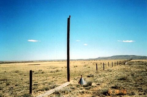
Obstruction pole on the approach end of the runway. Photo is looking north east.

______________

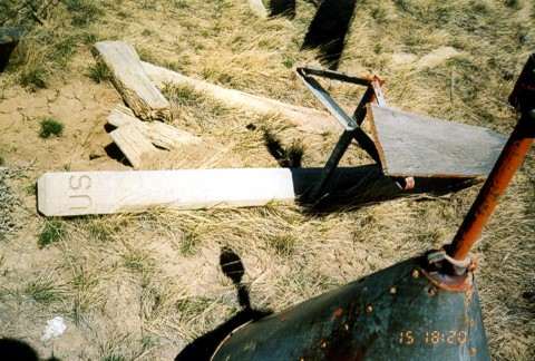
This boundary cone is located in the south east corner of the site. A U.S. concrete property marker can be seen laying on the ground along with the triangular stanchion for supporting 1×16 red and white wood runway markers.
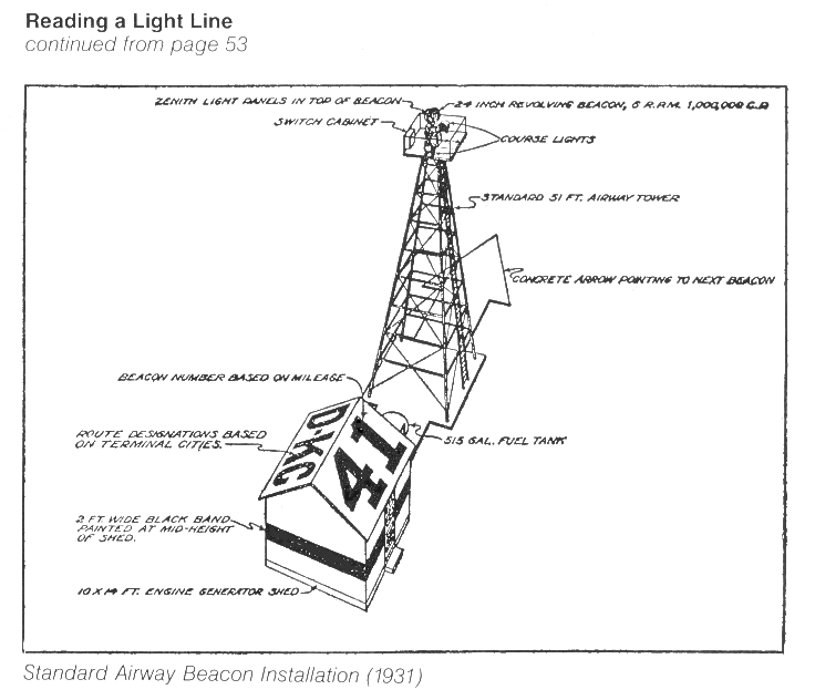
Kohler Equipped Beacon, 1932

Kohler Equipped Beacon, in the desert near Columbus, New Mexico, 1932


Kohler electric plant equipped with thermostatic control and oil and carburetor heater to operate on high isolated beacon sites where freezing temperatures endanger performance.

Indian Mounds Park, Minnesota Airway Beacon

An early (circa 1939) black and white photo of the beacon. Photo by Joe Cosimini

Its beam flashes across the sky every five seconds, 720 times an hour.  The light is visible for miles and has been guiding planes to safety  for 70 years.  The Mounds Park beacon, or as it is formally named,  the Indian Mounds Park “Airway” Beacon, has been a landmark in Dayton’s Bluff since 1929.
At one time over 600 of these beacons defined nighttime airway corridors across America. The Mounds Park beacon was part of the system that defined the route between St. Paul and Chicago. But electronic guidance equipment eventually made the beacons obsolete and, just like their lighthouse counterparts,  most of them eventually went dark.  Our beacon is the last of its kind.
It was a marvel in its time and is still impressive by today’s standards.  The tower is 110 feet tall.  The beacon itself is 24 inches in diameter.

The beacon’s red and white colors against the  blue sky made for a nice Bicentennial display in this photograph  taken on July 11, 1976. Photo by Joe Cosimini

It was designed by the City of St. Paul’s Bureau of Bridges and built by the St. Paul Structural Steel Co.  During a refurbishing in 1994-95, the tower’s  original black and chrome-yellow color scheme was restored, replacing the red and white colors that had graced the tower in modern times. The mid-90s restoration was accomplished through a coalition of groups including the Metropolitan Airports Commission,  the FAA, the State Historic Preservation Office, the Indian Affairs Council, the State Archeologist and the City of St. Paul.
The beacon  has been an attraction ever since it was built.  At least three postcards, probably issued in the 1930s,  featured the beacon, showing Indian burial mounds in the foreground with the St. Paul skyline in the background.
Besides guiding airplanes, our beacon also welcomes trains, boats and, of course, weary automobile commuters as they return to Dayton’s Bluff from the far reaches of the Twin Cities in the dark of night.

The beacon had been restored to its original black and chrome-yellow color scheme  by the time this picture was taken on April 13, 1997.  People are looking at the flooded Mississippi River down below the Bluffs. Photo by Greg Cosimin

Observing the  beacon is also a very good way to determine prevailing weather conditions.   As the beacon sweeps clockwise through the atmosphere,  its beam can appear nearly invisible, extremely bright or anything in between, depending  on what is in the atmosphere that night.
The beacon’s most spectacular  display can only be seen a couple of times a year.  Watch its beam when the temperature is near zero and there is an ice fog  in the air.  As the beacon rotates a hazy glow will be seen in the sky until the beam is pointing directly towards your position. Suddenly, a  brilliant shaft of light will appear to shoot straight up into the sky and disappear just as quickly, only to appear five seconds later when the beacon swings around again.
No matter what the sky conditions, Dayton’s Bluff ‘s own Old Faithful will be there, lighting up the sky every five seconds for years to come just as it has for the past 70 years.
And just to make sure the beacon looks its best, it received a new coat of paint in June 1999.

Here are three postcards from the 1930s that featured the beacon

This page was last updated in 1999, courtesy of the University of Minnesota

Radio Beacon Site 39

Harrington Ranch Airway Radio Beacon Site 39, New Mexico
This beacon was located at Harrington Ranch Field between El Paso and Columbus, New Mexico, on the Los Angeles-El Paso Airway. A Fan marker was also installed here.

Buffalo Valley Radio and Radio Beacon, Nevada, 1942

Submitted by Barbara Davidson

Buffalo Valley Radio and Radio Beacon, Nevada, 1942

The left side of the building consisted of living quarters. The radio station was located in the center and the right side was temporary housing or bachelor quarters.  The building on the left was moved to Battle Mountain and still in use today (2007) as an FAA office.

COMPARE PHOTOS:  Below is the same photo perspective taken by Robert Pearce in August 2007.  The sidewalk leading up to the entrance is still there but the old buildings are no longer there. The short vertical pipe in the lower right corner is the stub of the flagpole in the above photo, far right side.

Buffalo Valley Radio Lat/Long:  40°23’55.36″N 117°19’23.79″W

______________

Submitted by Robert E. Pearce

Buffalo Valley Radio and Radio Beacon, Nevada, 1942

This is the location where the Buffalo Valley Radio Station was located in the 1940’s.

Oso Ridge, Site 61, Fire Lookout and LA-A Airway Beacon Light Tower, New Mexico, 1948

Submitted by Steve Owen

Oso Ridge Fire Lookout and LA-A Airway Beacon Light Tower, Site 61, New Mexico, 1948.
1948
Submitted by Steve Owen

Oso Ridge Fire Lookout and LA-A Airway Beacon Light
Tower Intermediate, Site 61, New Mexico, 1944.
Coordinates are:  35° 2’17.30″N 108° 6’59.70″W
Wintertime, date unknown

Crouse-Hinds DCB-10 Beacon Light


Submitted by Paul Domeier

Crouse-Hinds DCB-10 Beacon Light
Comments by Paul Domeier.
This particular unit was at KVCB Nut Tree in Vacaville, CA, and the local lore is that it was originally installed at Travis AFB (formerly Fairfield-Suisun Army Air Base) in Fairfield, CA… but as this is not a white/white/green flash unit, I’m not so sure of that.

There’s a real Buck Rogers type feature that doesn’t show up well in the photos: The unit has two bulbs, but only fires one at a time. The second bulb is spring-loaded in an auto-switchover mechanism that would slam it into the primary position if the first bulb failed… or maybe it’s supposed to be triggered by a remote switch?

San Rafael Beacon Generator Hut 62, Restored


Submitted by Steve Owen

San Rafael Mesa Airway Beacon Generator, Hut LA-A-62, Site 62, 2011

The US Forest Service, Passport in Time volunteers, plan to begin restoration of this generator hut in the fall of 2011, which supplied power to the San Rafael Mesa Airway Beacon, which was part of the Midcontinent Airway system.


Submitted by Steve Owen

San Rafael Mesa Airway Beacon, Generator Hut, LA-A-62, Site 62, 2011

Backside view of the same building at top of page


Submitted by Steve Owen

(Above) In 2011, Site 62 building was moved to Grants Airport and placed next to the Grants Flight Service Station for restoration.  In this photo the base structure has been repaired and is almost ready for painting.


Submitted by Steve Owen

Site 62 Restored
The above and below photos are site 62 after a restoration project by “Cibola County Historical Society.” Completed in June 2012.


Submitted by Steve Owen


Submitted by Steve Owen

Submitted by Steve Owen

Submitted by Steve Owen

View several great historical videos from Cibola County Historical Society at Grants, New Mexico

Oso Ridge, Site 61, Fire Lookout and LA-A Airway Beacon Light Tower, New Mexico, 2011

Submitted by Steve Owen

Restored Oso Ridge LA-A Airway Beacon Light Tower Generator Site 61, 2011
The renovated exterior of the Oso Ridge generator hut, LA-A Site 61, completed on June 16, 2011. The cement slab in foreground is where the fire lookout tower stood in the previous images.
Submitted by Steve Owen

Oso Ridge Fire Lookout and LA-A Airway Beacon Light Tower, Site 61, New Mexico, 2010
In 2011, the above generator site began undergoing restoration by the USDA-Forest Service “Passport In Time” program.
Submitted by Steve Owen

Oso Ridge Fire Lookout and LA-A Airway Beacon Light Tower Intermediate, Site 61, New Mexico, 1944
Restoration volunteers are with the USDA-Forest Service “Passport In Time” program.
Coordinates are:  35° 2’17.30″N 108° 6’59.70″W
Photo by Craig Fuller

Looking uphill towards the beacon generator site with the fire lookout tower in the background.
Photo by Craig Fuller

Beacon generator site number 61 prior to start of restoration
Cibola National Forest, Oso Ridge Fire Lookout tower
Elevation 9,098 feet with the old Oso Ridge generator shack to the right prior to restoration.
Submitted by Steve Owen

Oso Ridge, New Mexico, fire lookout tower, elevation 9,098 feet, 
2011
Oso Ridge, New Mexico, fire lookout tower, 2012
Photo by Craig Fuller

“Passport In Time” volunteers working on site Oso Ridge, site 61 restoration.
Photo by Craig Fuller

Looking towards beacon generator site number 61 with the fire lookout tower in the foreground.
Photo by Craig Fuller

Thanks to the US Forest Service, “Passport In Time” volunteers who were involved with the restoration of generator hut, LA-A Site 61, completed June 16, 2011.
Photo by Craig Fuller

Restored Oso Ridge LA-A Airway Beacon Light Tower Generator Site 61, 2011

The renovated  exterior of the Oso Ridge generator hut, LA-A Site 61, completed on June 16, 2011.  
Photo by Craig Fuller

“Passport In Time” volunteers working on site Oso Ridge, site 61 restoration

Cibola National Forest, Oso Ridge Fire Lookout, elevation 9,098 feet

Above restoration was accomplished by the dedicated members of the Cibola County, New Mexico Historical Society

Submitted by Steve Owen

Oso Ridge Fire Lookout and LA-A Airway Beacon Light Tower, Site 61, New Mexico.
Satellite view, 2012.
Forest Service fire lookout tower sign

Oso Ridge, New Mexico, beacon generator site entry door, 2012

Oso Ridge, New Mexico, beacon generator site entry door sign, 2012