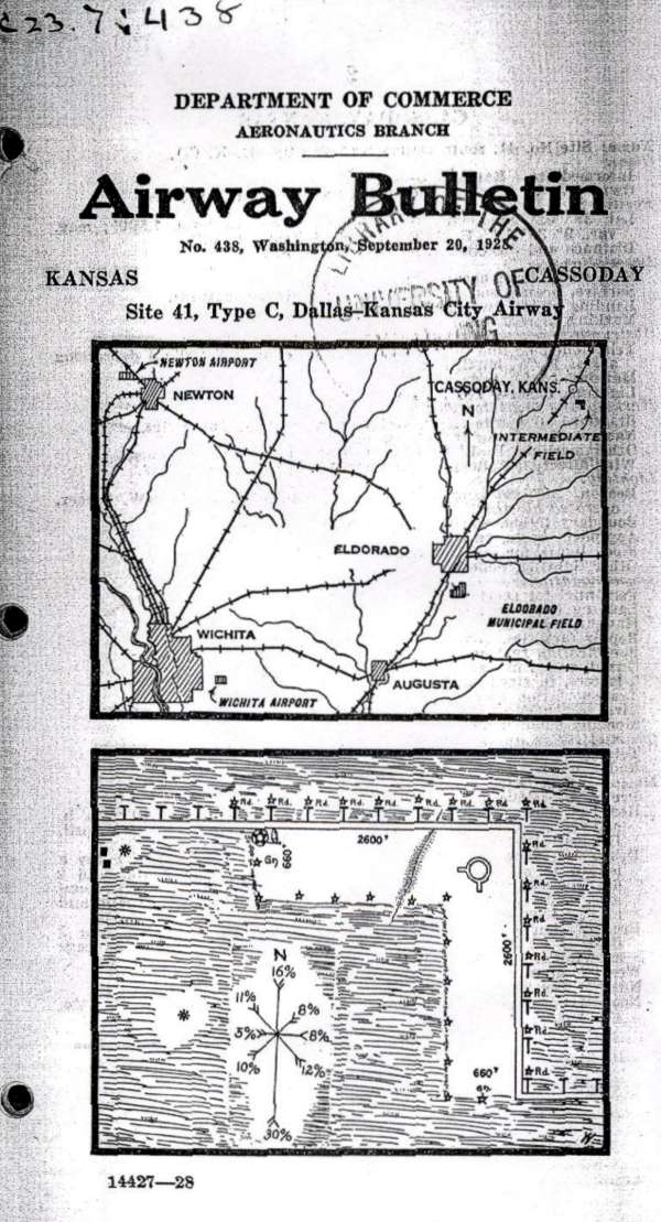
Cassoday, Kansas, Site #41, Dallas to Kansas City Airway Map, Sep 20, 1928
Department of Commerce Airway Bulletin no. 428, Washington DC, depicting the airway and the Cassoday Intermediate Field layout (lower diagram). The field was operated by the Department of Commerce using two grass runways in an ‘L’ formation, 2,600 feet long.
In the northwest corner of the airfield was a 2-million candlepower 24 inch rotating beacon which rotated at 6 RPM. The newly-built field had few amenities (no fuel, repairs, or telegraph) but did have nighttime lights around the boundary of the airfield.
By 1931, the starting point of the airway had been changed from Dallas to Amarillo, and this resulted in a renumbering of the airfields & beacons. Cassoday was changed from Site #41 to Site #34 and, according to the 1931 Bulletin #2, this beacon site was upgraded to a Flight Service Station (FSS), commissioned February 1931, and included course lights and a weather teletype.